NWS Albany - Marginal Risk For Severe Thunderstorms Through Saturday - Friday, August 16, 2019 440 PM

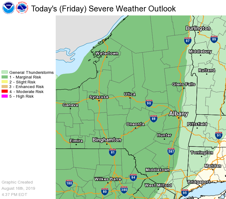
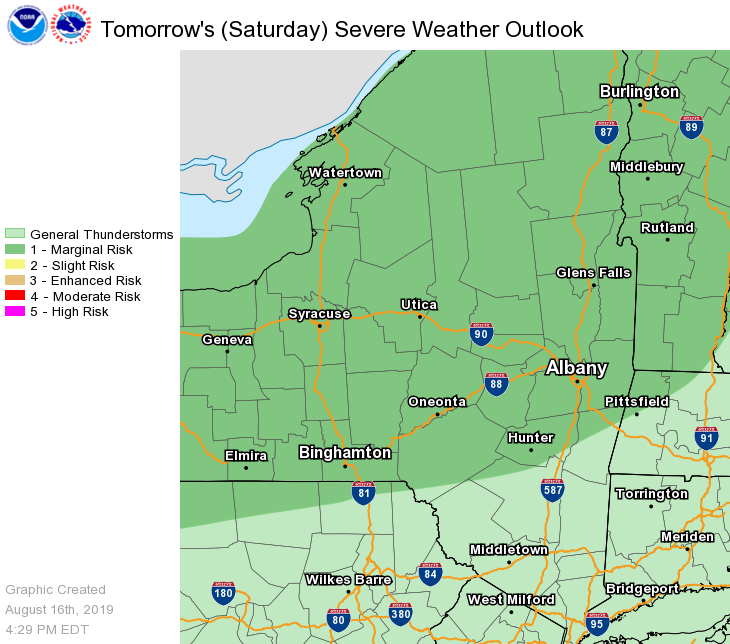
**** The information in this email pertains to the following areas only:**** *- In Connecticut: Litchfield County* *- In Massachusetts: Berkshire County* *- In Vermont: Bennington & Windham Counties* *- In New York: Albany, Columbia, Dutchess, Fulton, Hamilton, Herkimer, Montgomery, Greene, Rensselaer, Saratoga, Schenectady, Schoharie, Ulster, Warren and Washington Counties* Dear Emergency Managers and other partners, Isolated to scattered thunderstorms are expected for this evening into tonight. There is a marginal risk that storms may be severe, mainly for areas west of the Hudson Valley. The main threat with any storms will be damaging wind gusts. In addition, storms may produce locally heavy downpours, which may cause flooding of urban, poor drainage and low lying areas. There is a chance of thunderstorms each day Saturday through Wednesday, mainly during the afternoon and evening hours. A few of the thunderstorms may produce damaging winds and hail on Saturday and most of the area is in a marginal risk for severe thunderstorms. Any thunderstorm will also be capable of locally heavy rainfall which may lead to water ponding on roadways and poor drainage flooding in low lying areas. Please see the attached severe weather outlook graphics for the rest of today and tomorrow. If you have any questions, please feel free to contact us via: 1. Email: alb.stormreport@noaa.gov 2. NWSChat at https://nwschat.weather.gov/live/ 3. Social Media: Facebook <https://www.facebook.com/NWSAlbany> and Twitter <https://twitter.com/NWSAlbany> 4. Telephone: (518) 435-9575 <518-435-9575> Sincerely, NWS Albany www.weather.gov/albany
participants (1)
-
 ALB Stormreport - NOAA Service Account