NWS Albany - Wintry Mix Possible Saturday night, Strong Winds Likely Sunday night into Monday - Thursday, February 21st, 2019 - 430 PM

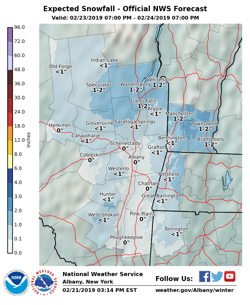
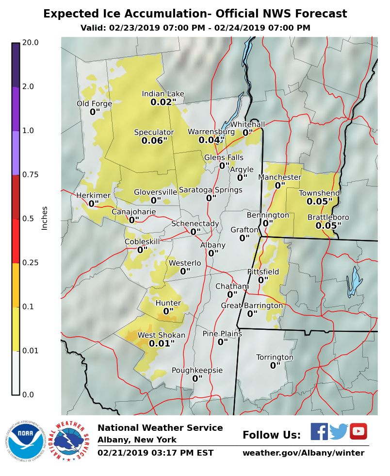
**** The information in this email pertains to the following areas only:**** *- In Connecticut: Litchfield County* *- In Massachusetts: Berkshire County* *- In Vermont: Bennington & Windham Counties* *- In New York: Albany, Columbia, Dutchess, Fulton, Hamilton, Herkimer, Montgomery, Greene, Rensselaer, Saratoga, Schenectady, Schoharie, Ulster, Warren and Washington Counties* Dear Emergency Managers and other partners, A low pressure system will approach the area on Saturday. This system will bring a wintry mix of snow, sleet and freezing rain Saturday night into early Sunday morning before changing over to all rain. Please see attached graphics for snowfall and ice accumulation forecasts. Additionally, strong winds will be possible Sunday night into Monday. The strongest winds are expected over the Mohawk Valley, Catskills, southern Capital Region, Taconics, southern Vermont and western Massachusetts, with strong to damaging wind gusts possible at times. Wind headlines will likely be needed. If you have any questions, please feel free to contact us via: 1. Email: alb.stormreport@noaa.gov 2. NWSChat at https://nwschat.weather.gov/live/ 3. Social Media: Facebook <https://www.facebook.com/NWSAlbany> and Twitter <https://twitter.com/NWSAlbany> 4. Telephone: (518) 435-9575 <518-435-9575> Sincerely, NWS Albany www.weather.gov/albany
participants (1)
-
 ALB Stormreport - NOAA Service Account