NWS Albany - Active weather through the upcoming weekend - Friday, November 22, 2019 600 PM

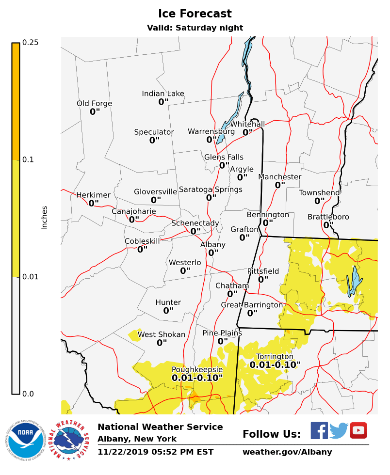
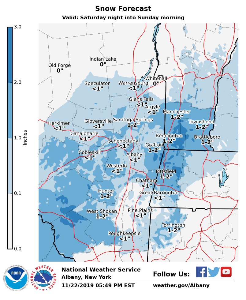
**** The information in this email pertains to the following areas only:**** *- In Connecticut: Litchfield County* *- In Massachusetts: Berkshire County* *- In Vermont: Bennington & Windham Counties* *- In New York: Albany, Columbia, Dutchess, Fulton, Hamilton, Herkimer, Montgomery, Greene, Rensselaer, Saratoga, Schenectady, Schoharie, Ulster, Warren and Washington Counties* Dear Emergency Managers and other partners, A storm system is forecast to impact the area late Saturday night into Sunday. A light wintry mix and or light snow accumulations are possible, mainly southeast of the Adirondacks. Expected snow and ice amounts are attached, that will be adjusted periodically through Saturday as new data and guidance are available. If confidence increases for higher snow and ice amounts, then winter weather advisories may be needed for some locations. See attached images for ice and snow accumulations over the weekend. If you have any questions, please feel free to contact us via: 1. Email: alb.stormreport@noaa.gov 2. NWSChat at https://nwschat.weather.gov/live/ 3. Social Media: Facebook <https://www.facebook.com/NWSAlbany> and Twitter <https://twitter.com/NWSAlbany> 4. Telephone: (518) 435-9575 <518-435-9575>
participants (1)
-
 ALB Stormreport - NOAA Service Account