NWS Albany - Heavy Rain and Flood Potential Thursday into Thursday Night - Issued 410 AM Tuesday, October 29th, 2019

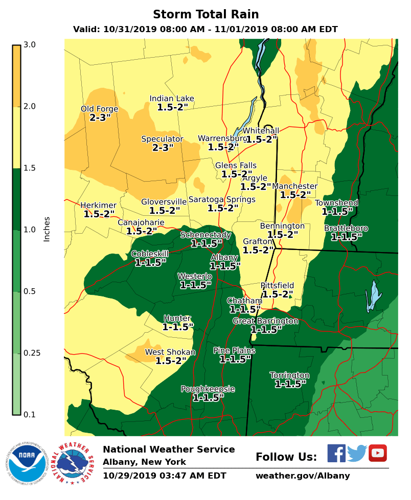
**** The information in this email pertains to the following areas only:**** *- In Connecticut: Litchfield County* *- In Massachusetts: Berkshire County* *- In Vermont: Bennington & Windham Counties* *- In New York: Albany, Columbia, Dutchess, Fulton, Hamilton, Herkimer, Montgomery, Greene, Rensselaer, Saratoga, Schenectady, Schoharie, Ulster, Warren and Washington Counties* Dear Emergency Managers and other partners, A strong low pressure system will bring a period of moderate to locally heavy rainfall to the region late Thursday into Thursday night. Total forecast rainfall for this storm is 1 - 3 inches (see attached graphic). The rainfall will result in rises on area waterways, with river flooding a possibility. Some minor flooding of urban and poor drainage areas is also possible. A Flood Watch may be needed. If you have any questions, please feel free to contact us via: 1. Email: alb.stormreport@noaa.gov 2. NWSChat at https://nwschat.weather.gov/live/ 3. Social Media: Facebook <https://www.facebook.com/NWSAlbany> and Twitter <https://twitter.com/NWSAlbany> 4. Telephone: (518) 435-9575 <518-435-9575> Sincerely, NWS Albany www.weather.gov/albany
participants (1)
-
 ALB Stormreport - NOAA Service Account