NWS Albany - Thunderstorms with very heavy rain with isolated flooding possible Tuesday - Sent at 547 PM EDT Monday, August 12, 2019

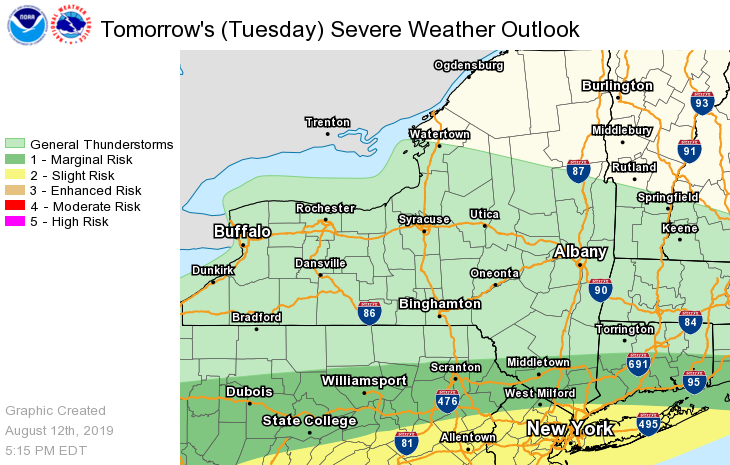
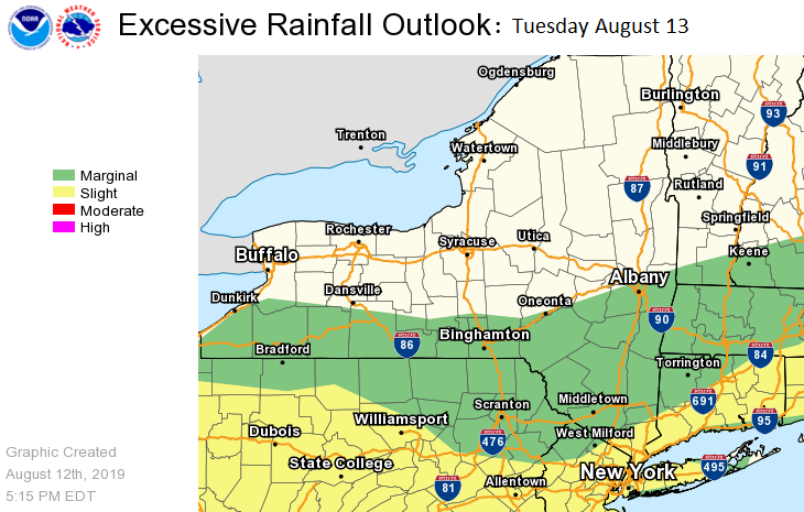
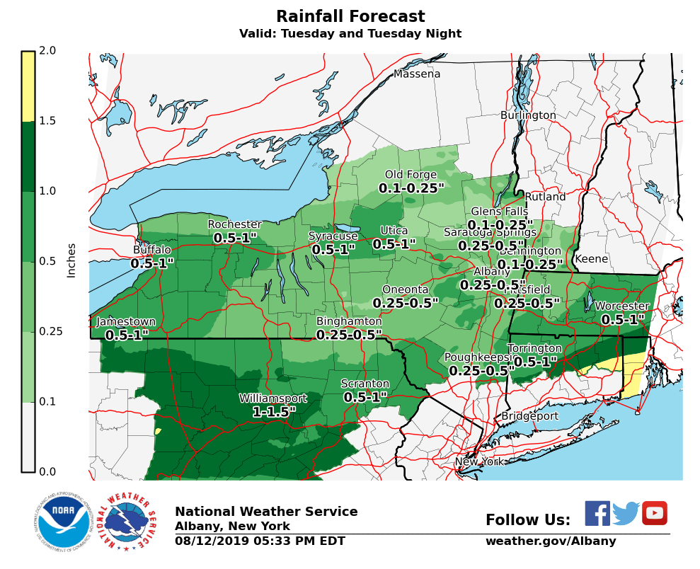
**** The information in this email pertains to the following areas only:**** *- In Connecticut: Litchfield County* *- In Massachusetts: Berkshire County* *- In Vermont: Bennington & Windham Counties* *- In New York: Albany, Columbia, Dutchess, Fulton, Hamilton, Herkimer, Montgomery, Greene, Rensselaer, Saratoga, Schenectady, Schoharie, Ulster, Warren and Washington Counties* Dear Emergency Managers and other partners, It will turn more humid for Tuesday with numerous showers and scattered thunderstorms. Thunderstorms will be capable of producing locally heavy rainfall which could lead to urban and poor drainage flooding along with isolated flash flooding a possibility across the southeast part of the Albany Forecast Area. The threat for severe thunderstorms is expected to be across southern Ulster, Dutchess and Litchfield Counties. Please refer to the attached graphics for Tuesday's Severe Weather Outlook, Tuesday's Excessive Rainfall Outlook and Rain Forecast for Tuesday and Tuesday night. If you have any questions, please feel free to contact us via: 1. Email: alb.stormreport@noaa.gov 2. NWSChat at https://nwschat.weather.gov/live/ 3. Social Media: Facebook <https://www.facebook.com/NWSAlbany> and Twitter <https://twitter.com/NWSAlbany> 4. Telephone: (518) 435-9575 <518-435-9575> Sincerely, NWS Albany www.weather.gov/albany
participants (1)
-
 ALB Stormreport - NOAA Service Account