NWS Albany - Dangerous Heat Conditions Today to Saturday and Heavy Rainfall Potential - issued 5:30 AM July 4, 2019

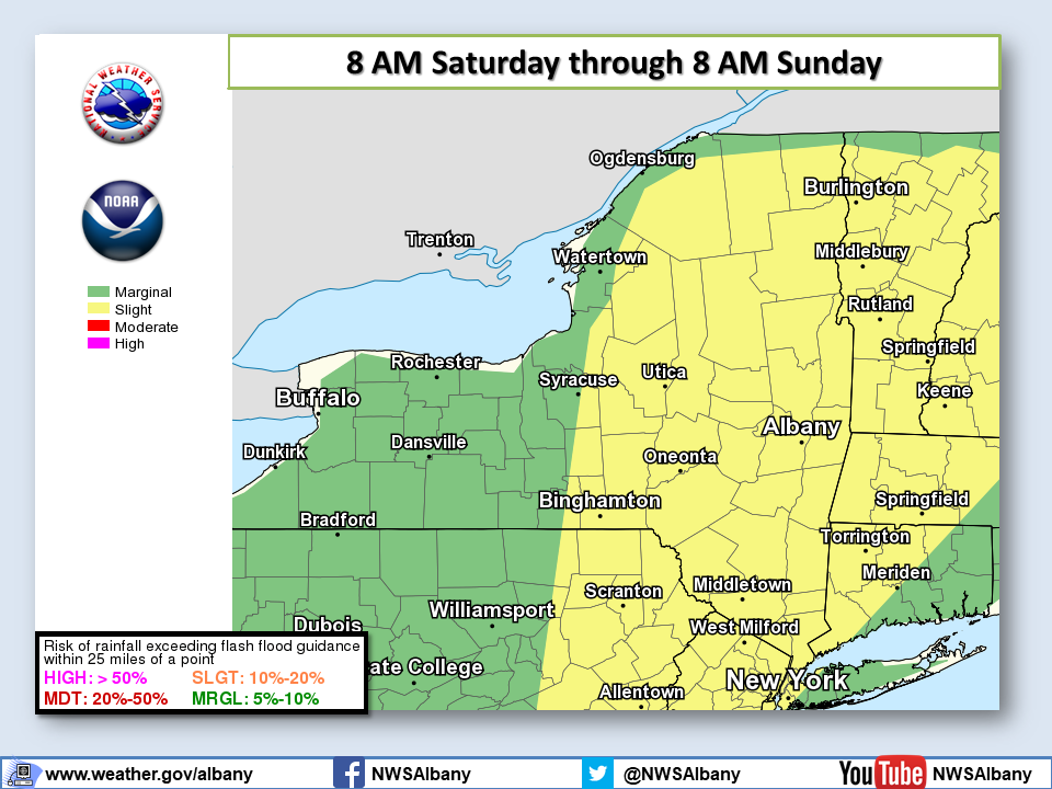
**** The information in this email pertains to the following areas only:**** *- In Connecticut: Litchfield County* *- In Massachusetts: Berkshire County* *- In Vermont: Bennington & Windham Counties* *- In New York: Albany, Columbia, Dutchess, Fulton, Hamilton, Herkimer, Montgomery, Greene, Rensselaer, Saratoga, Schenectady, Schoharie, Ulster, Warren and Washington Counties* Dear Emergency Managers and other partners, Happy Independence Day! *Heat and Heavy Rainfall Potential the next several days.* Our confidence in a three day period of hot temperatures and humid conditions extending from today July 4 to Saturday July 6 remains unchanged. Such conditions may produce dangerous heat conditions with heat index values reaching into the mid-90s in portions of the Hudson and Mohawk Valley. Humidity values are expected to be the highest on Saturday which means areas from the mid-Hudson Valley into the Greater Capital Region could see heat index values near 95F. Should confidence continue to increase, heat advisories will need to be issued. Heat safety tips and resources are available at: https://www.weather.gov/safety/heat (also linked from our web page) In addition to the heat, the chance for thunderstorms increases Friday into Saturday. Some thunderstorms may produce very heavy rainfall as our region has been highlighted within a 'Slight Risk' of excessive rainfall. See attached graphic for details. If you have any questions, please feel free to contact us via: 1. Email: alb.stormreport@noaa.gov 2. NWSChat at https://nwschat.weather.gov/live/ 3. Social Media: Facebook <https://www.facebook.com/NWSAlbany> and Twitter <https://twitter.com/NWSAlbany> 4. Telephone: (518) 435-9575 <518-435-9575> Sincerely, NWS Albany www.weather.gov/albany
participants (1)
-
 ALB Stormreport - NOAA Service Account