NWS Albany - Freezing Rain Possible Late Sunday Night into Monday - Saturday November 16, 2019 430 AM

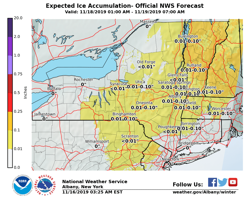
**** The information in this email pertains to the following areas only:**** *- In Connecticut: Litchfield County* *- In Massachusetts: Berkshire County* *- In Vermont: Bennington & Windham Counties* *- In New York: Albany, Columbia, Dutchess, Fulton, Hamilton, Herkimer, Montgomery, Greene, Rensselaer, Saratoga, Schenectady, Schoharie, Ulster, Warren and Washington Counties* Dear Emergency Managers and other partners, A coastal storm has the potential to bring freezing rain resulting in light ice accretion late Sunday night into Monday morning. This may result in slippery conditions for the Monday morning commute. Temperatures slowly warming above freezing should put an end to the freezing rain by Monday afternoon over lower elevations, but light freezing rain may linger at higher elevations through Monday into Monday night. There is uncertainty regarding the track and timing of this system and resulting precipitation amounts. Please see the attached graphic for forecast ice accretion. If you have any questions, please feel free to contact us via: 1. Email: alb.stormreport@noaa.gov 2. NWSChat at https://nwschat.weather.gov/live/ 3. Social Media: Facebook <https://www.facebook.com/NWSAlbany> and Twitter <https://twitter.com/NWSAlbany> 4. Telephone: (518) 435-9575 <518-435-9575> Sincerely, NWS Albany www.weather.gov/albany
participants (1)
-
 ALB Stormreport - NOAA Service Account