NWS Albany - Light Snowfall Thu night-Fri & Potential for Significant Storm this Weekend - Tuesday, January 15th, 2019 - 500 PM

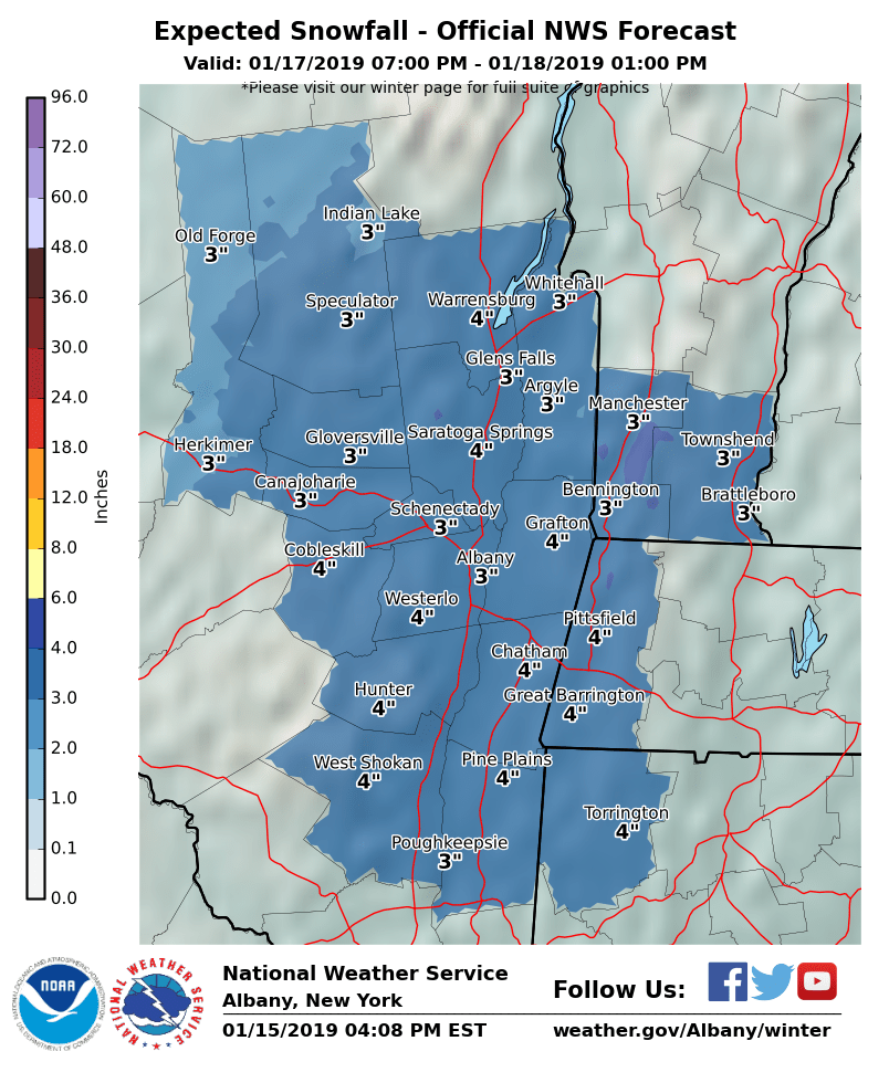
**** The information in this email pertains to the following areas only:**** *- In Connecticut: Litchfield County* *- In Massachusetts: Berkshire County* *- In Vermont: Bennington & Windham Counties* *- In New York: Albany, Columbia, Dutchess, Fulton, Hamilton, Herkimer, Montgomery, Greene, Rensselaer, Saratoga, Schenectady, Schoharie, Ulster, Warren and Washington Counties* Dear Emergency Managers and other partners, A *light snowfall is still expected Thursday night into Friday morning *which may impact the Friday morning commute. Expected snowfall map is attached. A *significant storm is expected impact the region this weekend* with a moderate to possibly heavy snowfall. There is still much uncertainty in the forecast, however at this time the time frame for impacts is Saturday afternoon into Sunday evening with the potential for a wintry mix of precipitation for areas south and east of the Capital District. A *dangerously cold air mass and well below zero wind chills* are possible Sunday into Monday in the wake of this storm. If you have any questions, please feel free to contact us via: 1. Email: alb.stormreport@noaa.gov 2. NWSChat at https://nwschat.weather.gov/live/ 3. Social Media: Facebook <https://www.facebook.com/NWSAlbany> and Twitter <https://twitter.com/NWSAlbany> 4. Telephone: (518) 435-9575 <518-435-9575> Sincerely, NWS Albany www.weather.gov/albany
participants (1)
-
 ALB Stormreport - NOAA Service Account