NWS Albany - Severe Thunderstorms possible Thursday afternoon and night - Tuesday May 21, 2019 - 530 PM

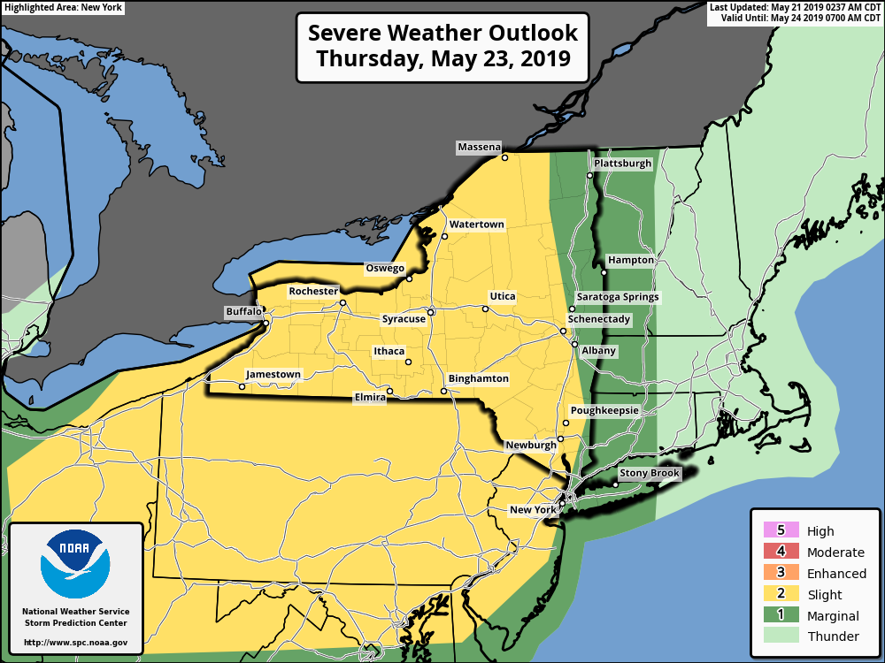
**** The information in this email pertains to the following areas only:**** *- In Connecticut: Litchfield County* *- In Massachusetts: Berkshire County* *- In Vermont: Bennington & Windham Counties* *- In New York: Albany, Columbia, Dutchess, Fulton, Hamilton, Herkimer, Montgomery, Greene, Rensselaer, Saratoga, Schenectady, Schoharie, Ulster, Warren and Washington Counties* Dear Emergency Managers and other partners, We continue to monitor the potential for severe thunderstorms Thursday afternoon into Thursday night. The main impact from any severe thunderstorm would be damaging winds and large hail. Currently, there is greater confidence for severe thunderstorms west of the Hudson River which is why the Storm Prediction Center has outlined that region in a "Slight Risk" with only a "Marginal Risk" for areas east of the Hudson into western New England. We will provide updates as needed over the coming days. If you have any questions, please feel free to contact us via: 1. Email: alb.stormreport@noaa.gov 2. NWSChat at https://nwschat.weather.gov/live/ 3. Social Media: Facebook <https://www.facebook.com/NWSAlbany> and Twitter <https://twitter.com/NWSAlbany> 4. Telephone: (518) 435-9575 <518-435-9575> Sincerely, NWS Albany www.weather.gov/albany
participants (1)
-
 ALB Stormreport - NOAA Service Account