NWS Albany - Wintry Mix Late in the Wednesday into Thursday - Monday, February 18, 2019 - 3:30 PM

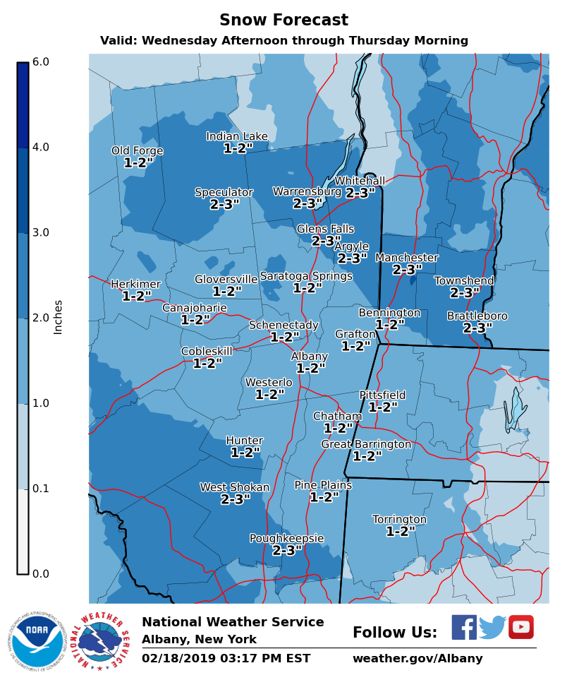
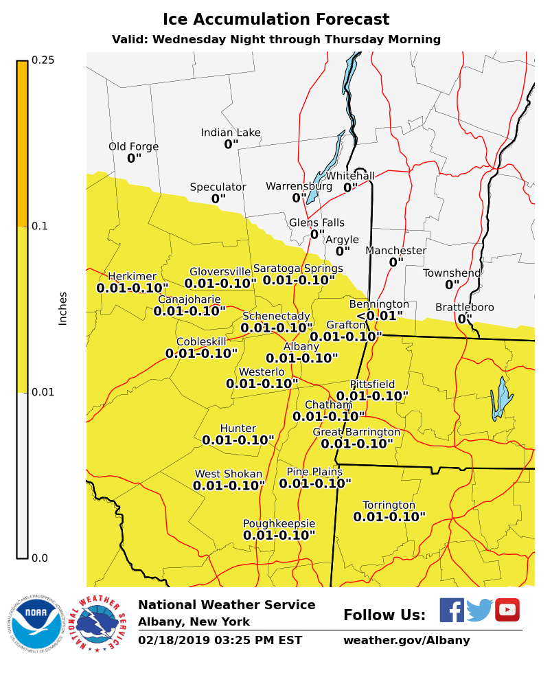
**** The information in this email pertains to the following areas only:**** *- In Connecticut: Litchfield County* *- In Massachusetts: Berkshire County* *- In Vermont: Bennington & Windham Counties* *- In New York: Albany, Columbia, Dutchess, Fulton, Hamilton, Herkimer, Montgomery, Greene, Rensselaer, Saratoga, Schenectady, Schoharie, Ulster, Warren and Washington Counties* Dear Emergency Managers and other partners, *TONIGHT: *As temperatures drop untreated slushy and wet surfaces will freeze creating icy spots *NEXT SYSTEM* *WHAT & WHEN: * A light snowfall is expected late in the day Wednesday through the evening hours with a transition to sleet and freezing rain expected late at night into early Thursday morning. *WHERE: * East central New York and adjacent western New England *POTENTIAL IMPACTS:* Hazardous travel conditions especially on untreated surfaces potentially impacting the Thursday morning commute Attached: Current snowfall and ice accumulation forecasts for the system If you have any questions, please feel free to contact us via: 1. Email: alb.stormreport@noaa.gov 2. NWSChat at https://nwschat.weather.gov/live/ 3. Social Media: Facebook <https://www.facebook.com/NWSAlbany> and Twitter <https://twitter.com/NWSAlbany> 4. Telephone: (518) 435-9575 <518-435-9575> Sincerely, NWS Albany www.weather.gov/albany
participants (1)
-
 ALB Stormreport - NOAA Service Account