NWS Albany - A mix of precipitation expected Monday into Tuesday morning - Saturday, November 9, 2019 500 AM

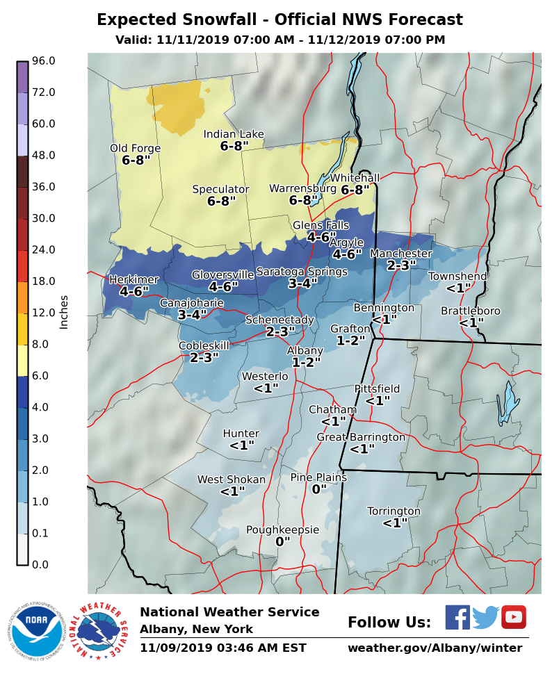
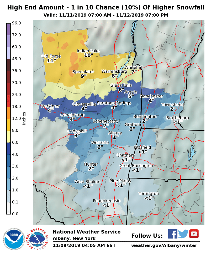
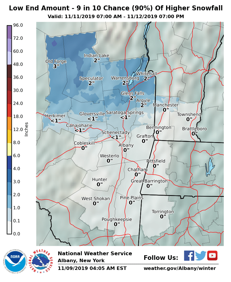
Dear Emergency Managers and other partners, A storm system Monday into Tuesday morning will bring a mix of precipitation to the area. Temperatures will be above freezing for most of the area during the day Monday as light precipitation overspreads parts of the area, however temperatures will fall Monday night as heavier, steadier precipitation develops. Several inches of snow are possible from the southern Adirondacks to the Green Mountains of Vermont. A wintry mix including a light snowfall is possible from the Capital District southward to the mid-Hudson Valley, the Berkshires, and northwest Connecticut. Temperatures will fall late Monday night and Tuesday, so that moisture on area roadways could freeze, causing slippery conditions regardless of snowfall amounts. A small shift in the track of this storm will shift the rain, snow and ice areas, so stay tuned for further updates. Please see the attached slide for more details on expected and possible snowfall amounts. If you have any questions, please feel free to contact us via: 1. Email: alb.stormreport@noaa.gov 2. NWSChat at https://nwschat.weather.gov/live/ 3. Social Media: Facebook and Twitter 4. Telephone: (518) 435-9575 Sincerely, NWS Albany www.weather.gov/albany
participants (1)
-
 ALB Stormreport - NOAA Service Account