NWS Albany - Rain Changing to Snow for Thursday into Thursday Night - Wednesday, November 6, 2019 445 PM

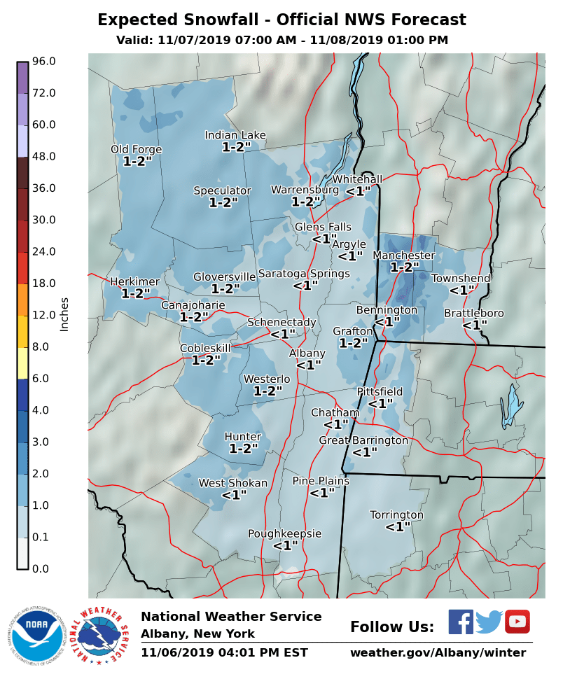
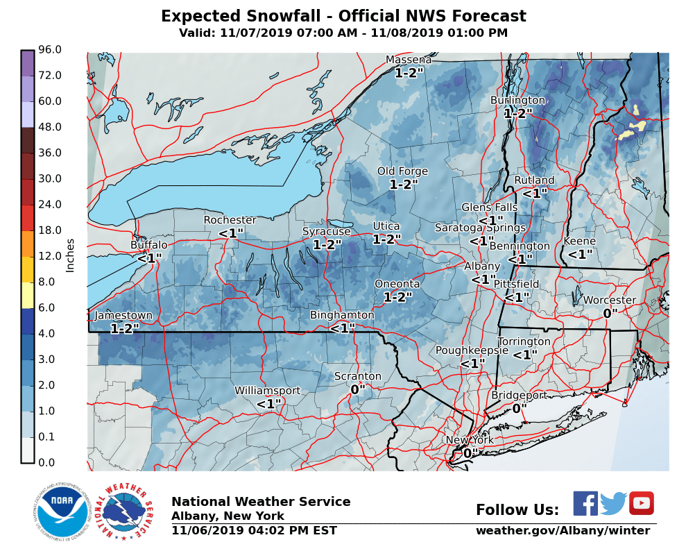
Dear Emergency Managers and other partners, A storm system is still expected to impact the region for Thursday into Thursday night. Initially, temperatures should be warm enough for the precipitation to fall as rain during the day on Thursday, although the Adirondacks may be cold enough for precipitation to begin as snow. Temperatures should cool quickly after sunset and allow rain to mix with and transition to wet snow for Thursday evening into Thursday night throughout all of eastern New York and western New England. Temperatures overnight are expected to cool below freezing across the entire region and therefore some wet snow accumulations are possible. Low temperatures are forecast to range from the upper teens over the high elevations to the mid to upper 20s in the valleys, so any residual moisture has the potential to freeze on surfaces. Precipitation will taper off by midnight for most of the area, with a cold and windy day likely for Friday. Storm total snow amounts are expected to be an inch or less for areas below 1500 foot elevation, with mainly 1-3" possible above 1500' in the southern Adirondacks, eastern Catskills, northern Taconics, southern Greens, and Berkshires. Please see the attached graphics for the latest forecast snowfall totals. If you have any questions, please feel free to contact us via: 1. Email: alb.stormreport@noaa.gov 2. NWSChat at https://nwschat.weather.gov/live/ 3. Social Media: Facebook <https://www.facebook.com/NWSAlbany> and Twitter <https://twitter.com/NWSAlbany> 4. Telephone: (518) 435-9575 <518-435-9575> Sincerely, NWS Albany www.weather.gov/albany
participants (1)
-
 ALB Stormreport - NOAA Service Account