NWS Albany - Strong winds tonight into Thanksgiving & Storm Sunday/Monday - Issued Wednesday November 27, 2019 5 AM

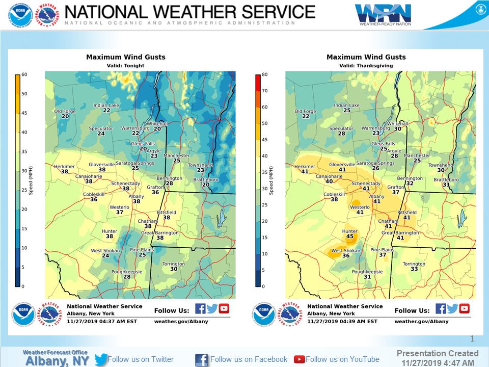
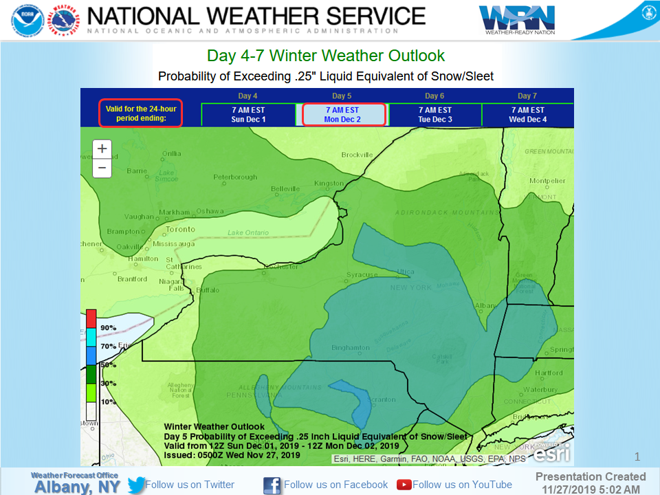
**** The information in this email pertains to the following areas only:**** *- In Connecticut: Litchfield County* *- In Massachusetts: Berkshire County* *- In Vermont: Bennington & Windham Counties* *- In New York: Albany, Columbia, Dutchess, Fulton, Hamilton, Herkimer, Montgomery, Greene, Rensselaer, Saratoga, Schenectady, Schoharie, Ulster, Warren and Washington Counties* Dear Emergency Managers and other partners, Strong west to northwest winds gusting up to 35-45mph are expected tonight into Thanksgiving Day. The strongest winds are expected to occur from the Mohawk Valley into the Greater Capital District, Taconics and Berkshires as well as in the Catskills and southern Greens. If wind gusts in excess of 45 mph are expected then a wind advisory <https://www.weather.gov/media/aly/FactSheets/NYSWind.pdf> will be issued. Please refer to the attached slide "Tonight and Thanksgiving Wind Gusts" for details. Our next chance for a wintry mix of precipitation arrives Sunday into Monday. Uncertainty regarding the overall track/evolution and start time continues. Please refer to the attached slide "Sunday-Monday Snow" for the possibility for a plowable snowfall. If you have any questions, please feel free to contact us via: 1. Email: alb.stormreport@noaa.gov 2. NWSChat at https://nwschat.weather.gov/live/ 3. Social Media: Facebook <https://www.facebook.com/NWSAlbany> and Twitter <https://twitter.com/NWSAlbany> 4. Telephone: (518) 435-9575 <518-435-9575> Sincerely, NWS Albany www.weather.gov/albany
participants (1)
-
 ALB Stormreport - NOAA Service Account