NWS Albany - Update on Possible Winter Weather Sunday into Monday - Issued Thursday November 28, 2019 5 AM

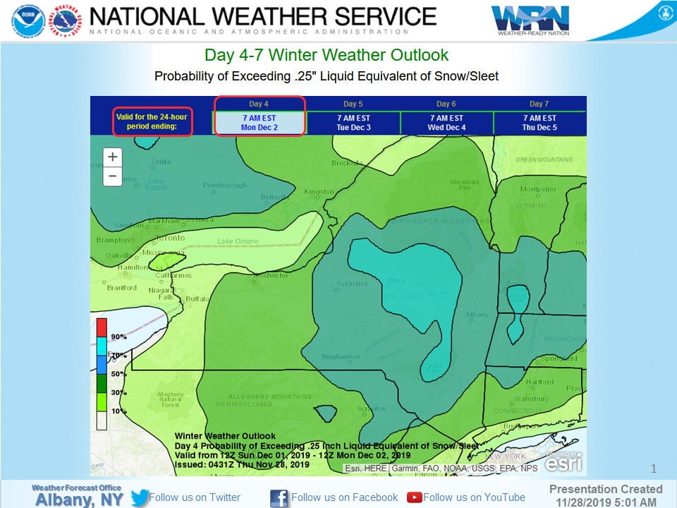
**** The information in this email pertains to the following areas only:**** *- In Connecticut: Litchfield County* *- In Massachusetts: Berkshire County* *- In Vermont: Bennington & Windham Counties* *- In New York: Albany, Columbia, Dutchess, Fulton, Hamilton, Herkimer, Montgomery, Greene, Rensselaer, Saratoga, Schenectady, Schoharie, Ulster, Warren and Washington Counties* Dear Emergency Managers and other partners, Confidence is growing that a low pressure system will impact eastern NY and western New England starting Sunday and continuing into Monday. Initially, temperatures should be cold enough to support mainly snow but depending on the exact storm track, snow could transition to a wintry mix for some areas. The exact storm track will also affect precipitation intensity and total snow amounts. Given the prolonged nature of this event, travel will likely be impacted. Please refer to the attached slide for the probability that this event produces plowable (greater than 2 inches) snow/sleet accumulations. Notice that the probabilities have increased across the region. If you have any questions, please feel free to contact us via: 1. Email: alb.stormreport@noaa.gov 2. NWSChat at https://nwschat.weather.gov/live/ 3. Social Media: Facebook <https://www.facebook.com/NWSAlbany> and Twitter <https://twitter.com/NWSAlbany> 4. Telephone: (518) 435-9575 <518-435-9575> Sincerely, NWS Albany www.weather.gov/albany
participants (1)
-
 ALB Stormreport - NOAA Service Account