[2019.01.21 PM NWS Boston Weather Briefing]

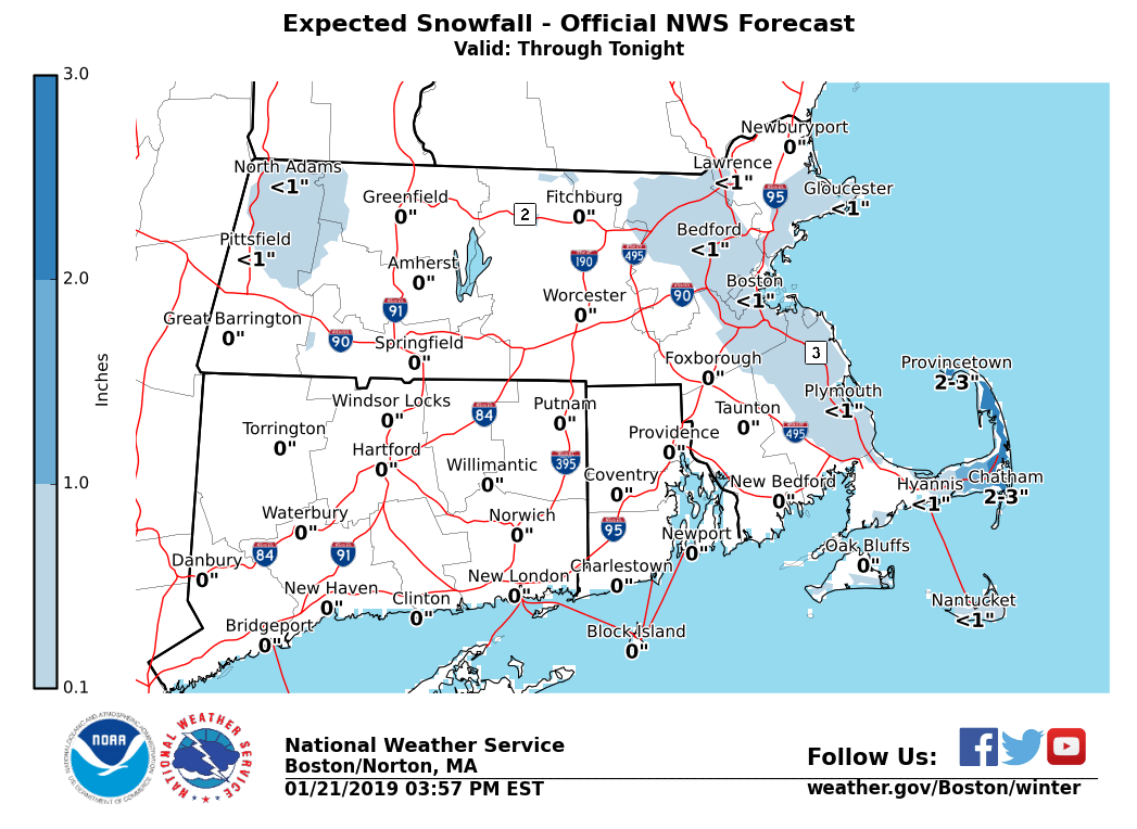
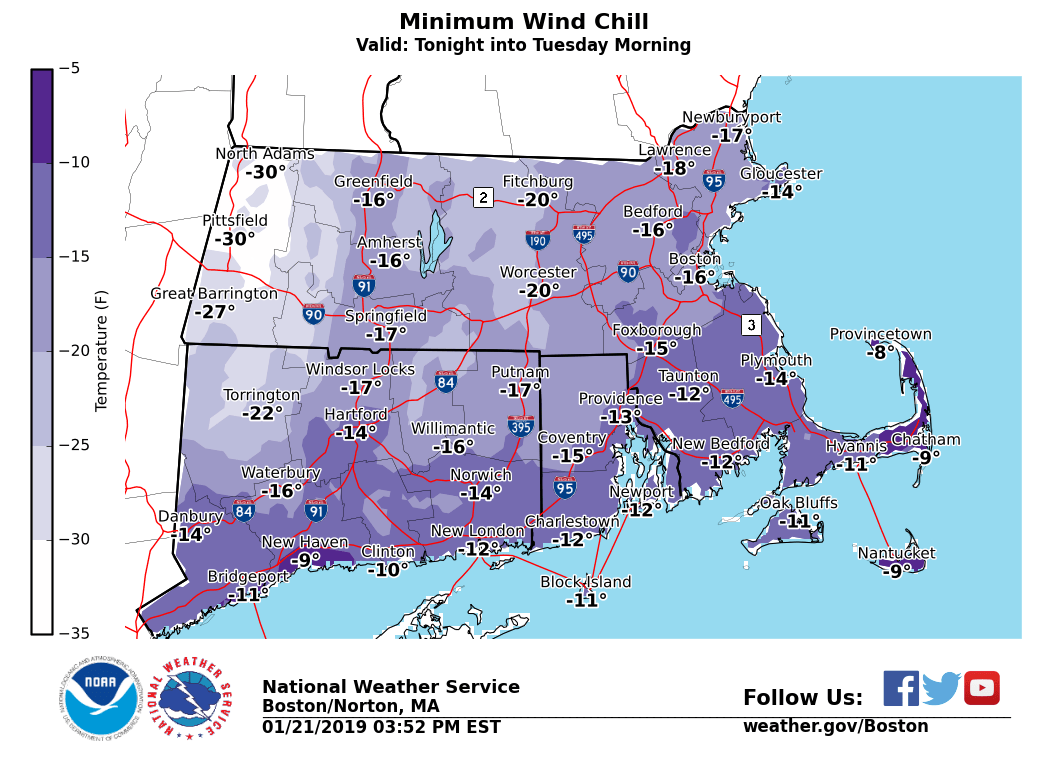
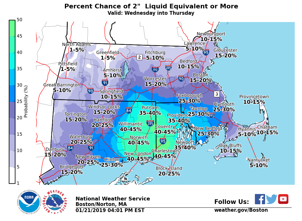
Good afternoon everyone, Ocean effect snow showers and dangerously cold wind chills will continue into tonight. Looking ahead, the potential exists for a heavy rainfall event Wednesday night into Thursday. Details are provided below. *What / Where / When ...* - Ocean Effect Snow - Mainly across the outer Cape from Provincetown to Chatham through tonight - Total accumulations of 1 to 2 inches with locally up to 3 inches in spots - Dangerously Cold Wind Chills all Southern New England - Wind chill advisories continue tonight with warnings for the Berkshires - Wind chills -10 to -20°F tonight into early Tuesday, -20 to -30°F for the Berkshires - Gales and Moderate to Heavy Freezing Spray - Gale Warnings on all waters tonight into Tuesday morning for gusts to 40+ knots - Moderate to locally heavy freezing spray into Tuesday morning - Freezing spray advisories and heavy freezing spray warnings continue - Heavy Rainfall and Possible Flooding - Greatest risk across eastern Connecticut, Rhode Island and southeast Massachusetts for late Wednesday night into Thursday - Rainfall of 1-2 inches across southern New England with locally up to 3 inches for RI and SE Massachusetts - Areas of urban and poor drainage flooding possible If you have any questions or would like more information, don't hesitate to contact us via this email address, on NWSChat <https://nwschat.weather.gov/>, or at the following: National Weather Service Boston/Norton, MA 46 Commerce Way Norton, MA 02766 508.622.3280 Website <http://www.weather.gov/boston> | Facebook <http://www.facebook.com/NWSBoston> | Twitter <http://www.twitter.com/NWSBoston>
participants (1)
-
 BOX Operations - NOAA Service Account