[2021.12.11 AM] NWS Boston EM Briefing - Winter Weather Advisory this Morning/Strong Winds Today and Tonight

Good Morning, There will be a chance for freezing rain this morning across the northern portions of Worcester and Middlesex counties. This has prompted a winter weather advisory in effect from 5am to 9am for these areas. Impacts will be limited to slippery roads resulting in hazardous travel conditions. A graphic highlighting the area covered by the advisory is attached. Separate from the winter weather advisory this morning, we want to provide you with the latest update on the potential for strong winds today and tonight. Since the last update we have expanded the wind advisory to include all of southern New England. Still expecting wind gusts to top out around 50 mph with the strongest winds expected over The Berkshires, Cape, and Islands. More details can be found in the attached one page briefing. This will be the final briefing for this event. Thank you, Rob Megnia and Bill Babcock If you have any questions or would like more information, don't hesitate to contact us via this email address, on NWSChat <https://nwschat.weather.gov/>, or at the following: National Weather Service Boston/Norton, MA 46 Commerce Way Norton, MA 02766 508.622.3280 Website <http://www.weather.gov/boston> | Facebook <http://www.facebook.com/NWSBoston> | Twitter <http://www.twitter.com/NWSBoston>
Good morning, Attached is a corrected wind advisory graphic that reflects the fact that Litchfield county in CT is included in the wind advisory for today. We apologize for any confusion. Have a great weekend. If you have any questions or would like more information, don't hesitate to contact us via this email address, on NWSChat <https://nwschat.weather.gov/>, or at the following: National Weather Service Boston/Norton, MA 46 Commerce Way Norton, MA 02766 508.622.3280 Website <http://www.weather.gov/boston> | Facebook <http://www.facebook.com/NWSBoston> | Twitter <http://www.twitter.com/NWSBoston> On Sat, Dec 11, 2021 at 3:45 AM BOX Operations - NOAA Service Account < box.operations@noaa.gov> wrote:
Good Morning,
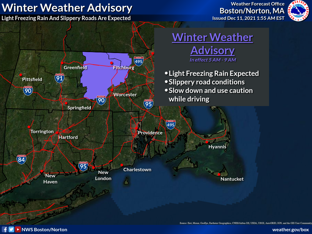
There will be a chance for freezing rain this morning across the northern portions of Worcester and Middlesex counties. This has prompted a winter weather advisory in effect from 5am to 9am for these areas. Impacts will be limited to slippery roads resulting in hazardous travel conditions. A graphic highlighting the area covered by the advisory is attached.
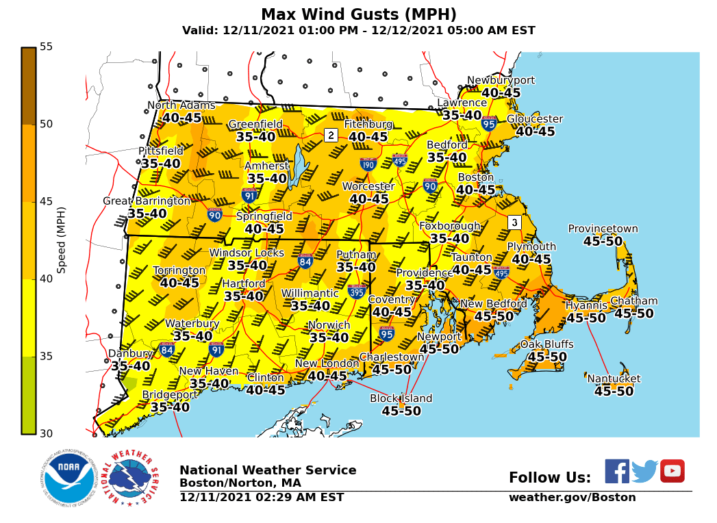
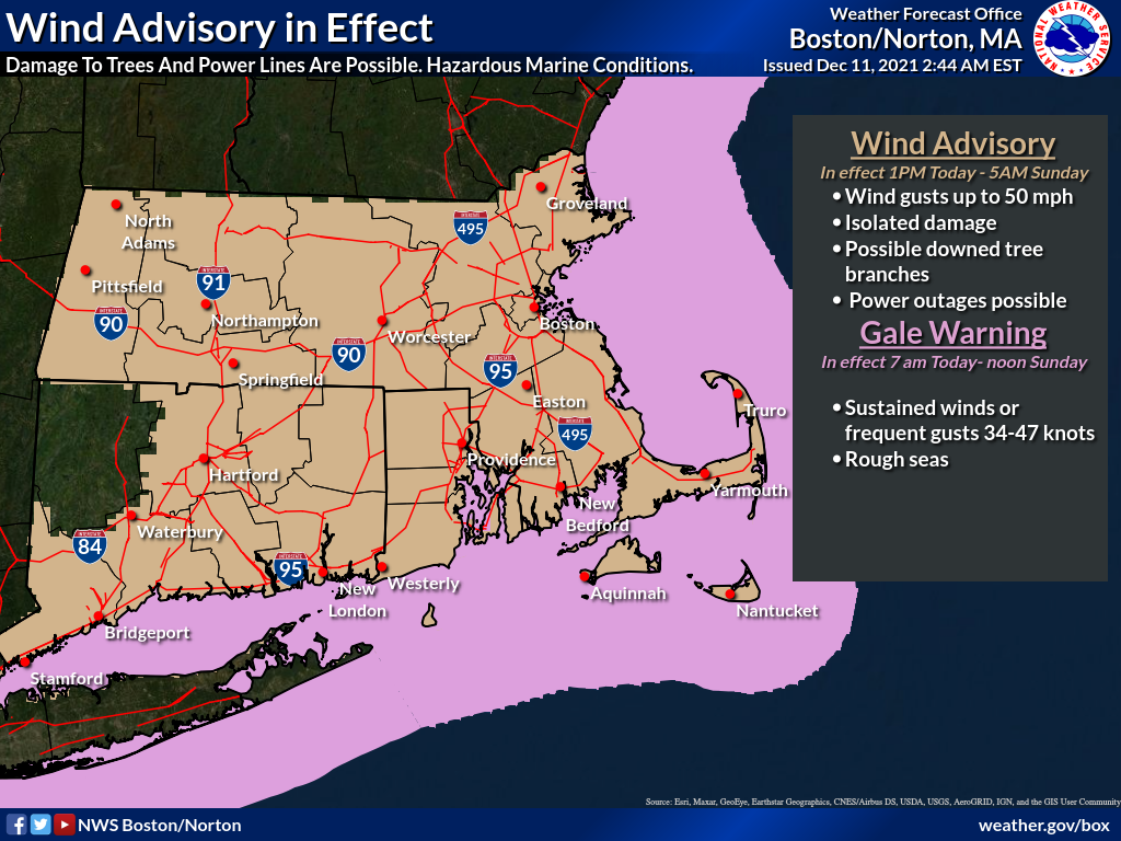
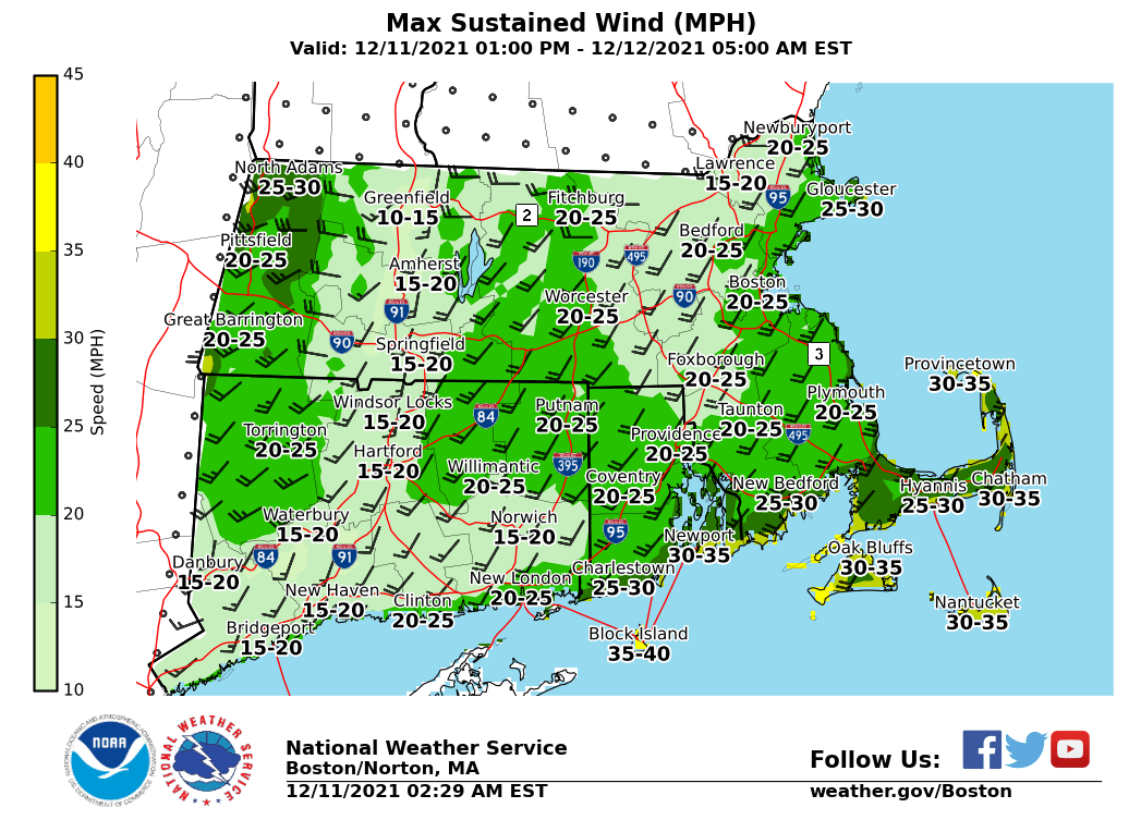
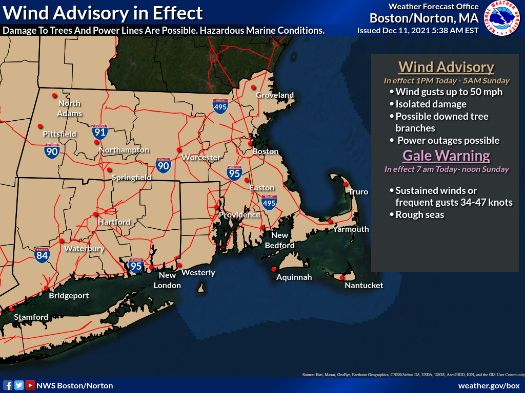
Separate from the winter weather advisory this morning, we want to provide you with the latest update on the potential for strong winds today and tonight. Since the last update we have expanded the wind advisory to include all of southern New England. Still expecting wind gusts to top out around 50 mph with the strongest winds expected over The Berkshires, Cape, and Islands. More details can be found in the attached one page briefing. This will be the final briefing for this event.
Thank you,
Rob Megnia and Bill Babcock
If you have any questions or would like more information, don't hesitate to contact us via this email address, on NWSChat <https://nwschat.weather.gov/>, or at the following:
National Weather Service Boston/Norton, MA 46 Commerce Way Norton, MA 02766 508.622.3280 Website <http://www.weather.gov/boston> | Facebook <http://www.facebook.com/NWSBoston> | Twitter <http://www.twitter.com/NWSBoston>
participants (1)
-
 BOX Operations - NOAA Service Account