[02.06.2026 AM] NWS Boston/Norton EM Briefing for Dangerous Cold and Accumulating Snow

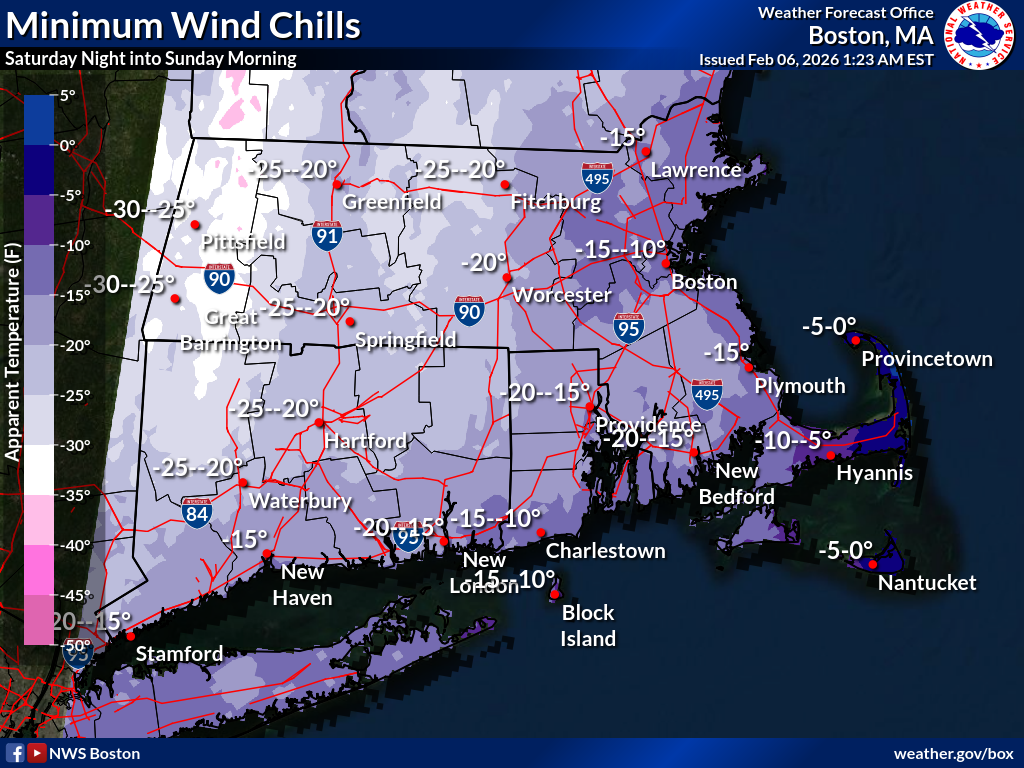
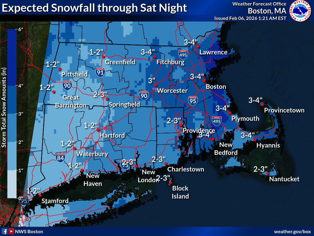
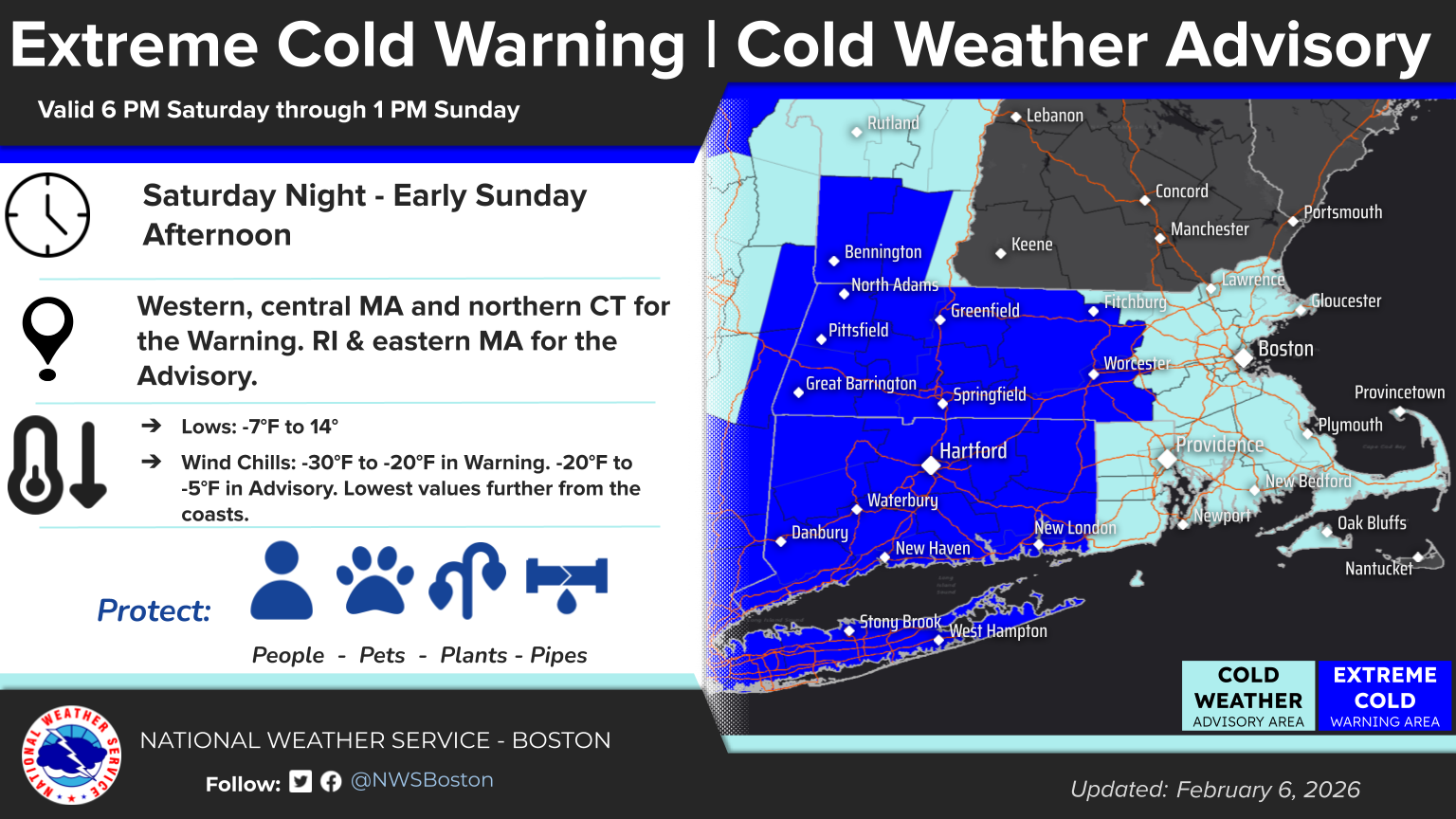
Good morning, Here is an updated briefing for the dangerously cold conditions Saturday night into Sunday, and the expected snowfall from Friday night into Saturday. Changes since the last briefing. - Extreme Cold Watches were upgraded to Extreme Cold Warnings for Central and western MA and northern CT - Cold Weather Advisories were issued for the rest of southern New England - Snowfall was increased across southern New England for Saturday with the highest snow accumulation across eastern MA We expect locally heavy snow bands to develop Saturday, especially across eastern MA in the afternoon but the exact placement of these bands is uncertain. Snow accumulation of 1 to 4 inches is expected across southern New England, with the heaviest amounts in eastern MA where localized accumulations up to 6 inches are possible. However, the axis of heaviest snowfall is uncertain and may shift. Winter Weather Advisories will likely be issued this afternoon for portions of southern New England. Thank you. Kevin Cadima and Candice Hrencecin If you have any questions or would like more information, please don't hesitate to contact us. You can reach us via: email: box.operations@noaa.gov phone: 508.622.3280 Slack/NWSChat 2.0 <https://nwschatws.slack.com/> (for approved partners) social media: Website <http://www.weather.gov/boston> | Facebook <http://www.facebook.com/NWSBoston> | Twitter <http://www.twitter.com/NWSBoston>
participants (1)
-
 BOX Operations - NOAA Service Account