[2018.12.26 AM NWS Briefing] Wintry Mix Across The Interior Friday Morning

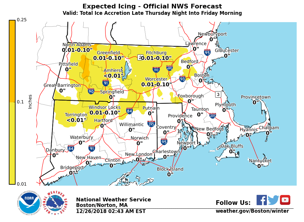
Good morning everyone, This email aims to give you a heads-up on the potential for a period of sleet and freezing rain on the front end of our next wet weather system across portions of interior southern New England, particularly the higher terrain of Massachusetts including the Berkshires and Worcester Hills. This system arrives in the early hours of Friday morning and may impact the Friday morning commute before it transitions to an all rain event. *What:* - A mix of freezing rain and sleet, changing to rain. - Light ice accumulations possible, with slippery conditions on area roadways. - Risk for some impact to Friday morning commute. *Where:* - Especially the higher terrain of western and central Massachusetts and Connecticut *When:* - Precipitation begins early Friday morning. - Gradual change to rain through early-mid morning. *When We Will Know More:* We will continue to resolve the precipitation type issues over the next 24 hours. Some Winter Weather Advisories are possible where ice is expected. If you have any questions or would like more information, don't hesitate to contact us via this email address, on NWSChat <https://nwschat.weather.gov/>, or at the following: National Weather Service Boston/Norton, MA 46 Commerce Way Norton, MA 02766 508.622.3280 Website <http://www.weather.gov/boston> | Facebook <http://www.facebook.com/NWSBoston> | Twitter <http://www.twitter.com/NWSBoston>
participants (1)
-
 BOX Operations - NOAA Service Account