[08.10.2023 AM] NWS Boston EM Briefing - Heavy Rain & Strong Storms Possible Tonight into Fri AM

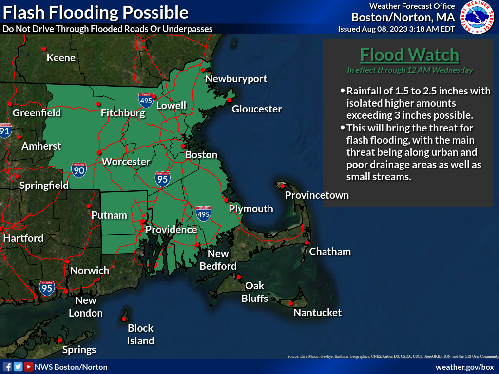
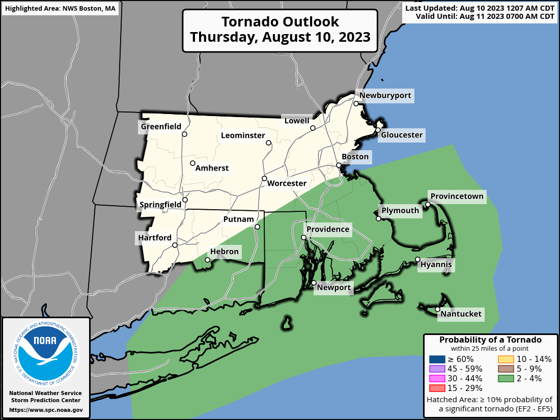
Good morning, There have been no significant changes to the forecast for tonight into Friday. Please find some key messages below. - There remains the potential for heavy rainfall, strong thunderstorms, and an isolated tornado this evening into early Friday. - The greatest risk for heavy rainfall remains across eastern MA and RI. Flood Watch remains in effect through early Friday. - The greatest risk for an isolated tornado will be over The Cape and Islands. One small change to note is that The Storm Prediction Center has expanded the 2% tornado probability a bit further west into CT (see attached graphic). We'll likely provide one final briefing this afternoon before the event to notify you of any potential changes to the forecast. Thank you and have a great day, Rob Megnia and Glenn Field If you have any questions or would like more information, please don't hesitate to contact us. You can reach us via: email: box.operations@noaa.gov phone: 508.622.3280 Slack/NWSChat 2.0 <https://nwschatws.slack.com/> (for approved partners) social media: Website <http://www.weather.gov/boston> | Facebook <http://www.facebook.com/NWSBoston> | Twitter <http://www.twitter.com/NWSBoston>
participants (1)
-
 BOX Operations - NOAA Service Account