[01.20.2023 PM] NWS Boston EM Briefing: Rain/Snow, Wind, and Coastal Flooding Sunday night into Monday

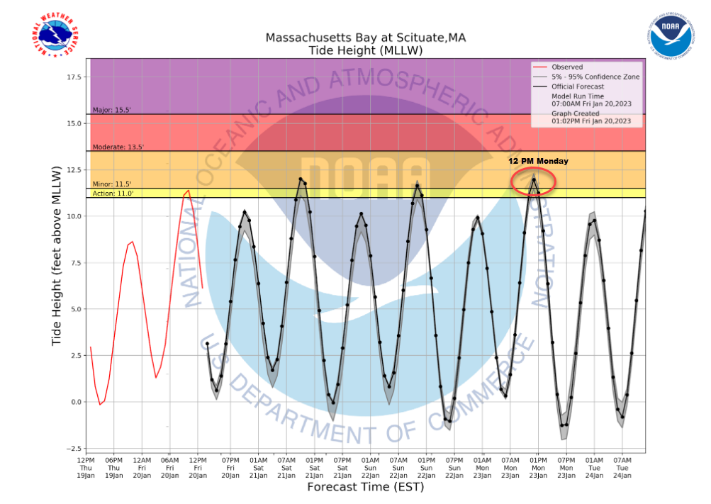
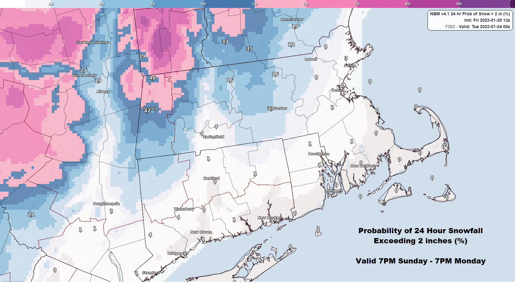
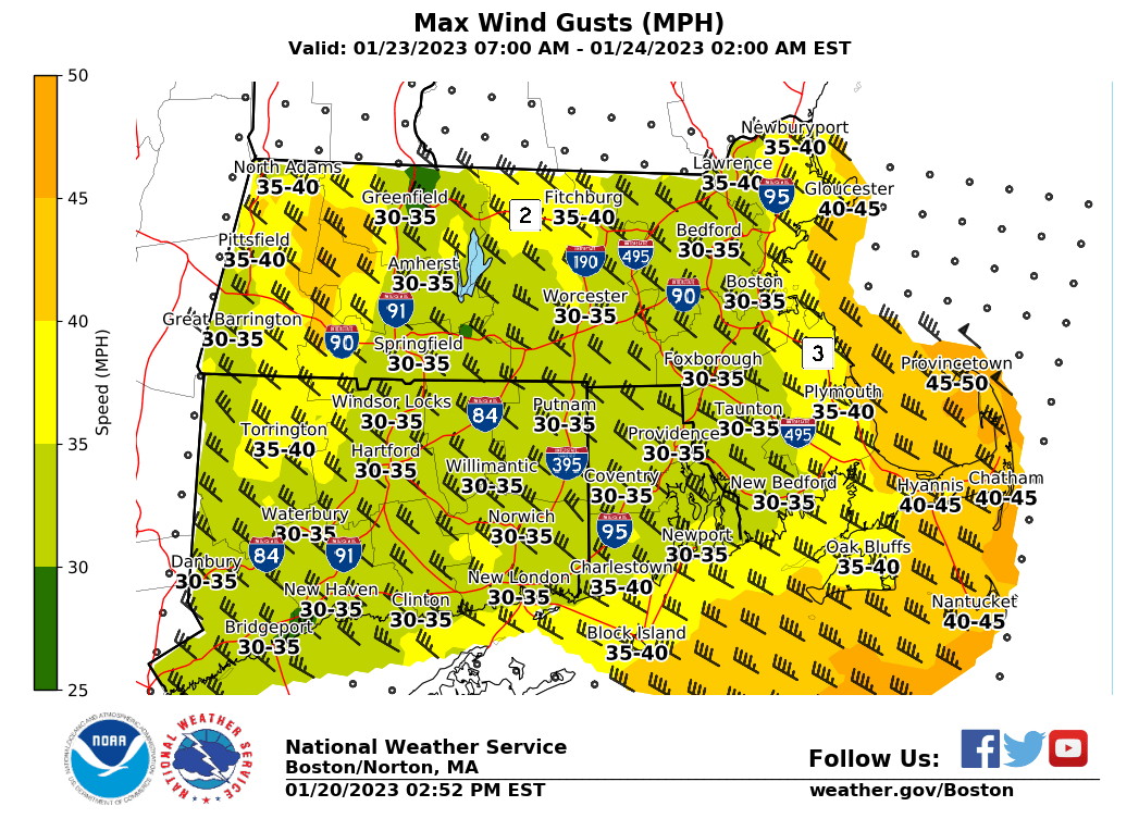
Good afternoon, We wanted to send this email as an early heads up for another potentially impactful storm for southern New England Sunday night into Monday. Details are still vague at this time, but some of the potential hazards are listed below along with our current confidence. *Snowfall* - Advisory level snowfall (3+ inches) possible for the northern Worcester Hills (low confidence) - Advisory to warning level snowfall (3 to 6+ inches) possible for the northern Berkshires. (medium confidence for advisory level snowfall, lower confidence for warning level snowfall). - Rain elsewhere (high confidence) *Winds* - Wind gusts up to 45 mph for southeastern MA, The Cape, and Islands Monday afternoon and evening. (medium confidence) *Coastal Flooding* - Minor to low end moderate coastal flooding possible along the east coast during the late Monday morning high tide (moderate to high confidence in minor coastal flooding, lower confidence in moderate coastal flooding) We've attached a few graphics that support our thinking for the hazards listed above. We'll likely begin our traditional one page briefings tonight or tomorrow. Thank you and have a great weekend! -Rob Megnia, Hayden Frank, and Kristie Smith If you have any questions or would like more information, don't hesitate to contact us via this email address, on NWSChat <https://nwschat.weather.gov/>, or at the following: National Weather Service Boston/Norton, MA 46 Commerce Way Norton, MA 02766 508.622.3280 Website <http://www.weather.gov/boston> | Facebook <http://www.facebook.com/NWSBoston> | Twitter <http://www.twitter.com/NWSBoston>
participants (1)
-
 BOX Operations - NOAA Service Account