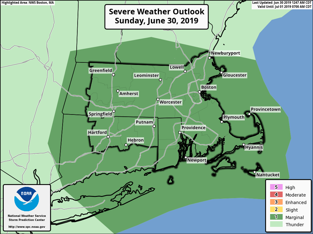
[2019.06.30 AM] Strong To Perhaps Severe Thunderstorms Expected Today

Good morning, There are no changes since yesterday's briefing. The threat for strong to severe thunderstorms continues today. *WHAT/WHEN:* - Scattered strong to perhaps severe thunderstorms expected from mid to late morning into the afternoon. *WHERE:* - All of southern New England is at risk, but the greatest risk is across central and eastern MA as well as Rhode Island. *POTENTIAL IMPACTS:* - Hail is the main threat. Some large hail exceeding the size of a quarter is possible. - Locally strong to perhaps damaging wind gusts are a secondary concern which may bring down tree limbs/branches and small trees. - Localized heavy rainfall producing 1-2 inches in a short time will bring the risk of localized street flooding. - Dangerous cloud to ground lightning will pose a risk to those with outdoor activities, including mariners and beach goers. If you have any questions or concerns, please reach out to us any time. Kevin Cadima NWS Boston/Norton If you have any questions or would like more information, don't hesitate to contact us via this email address, on NWSChat <https://nwschat.weather.gov/>, or at the following: National Weather Service Boston/Norton, MA 46 Commerce Way Norton, MA 02766 508.622.3280 Website <http://www.weather.gov/boston> | Facebook <http://www.facebook.com/NWSBoston> | Twitter <http://www.twitter.com/NWSBoston>
participants (1)
-
 BOX Operations - NOAA Service Account