[2020-03-19 PM] NWS Boston EM Briefing for Severe Storms Friday Afternoon & Evening

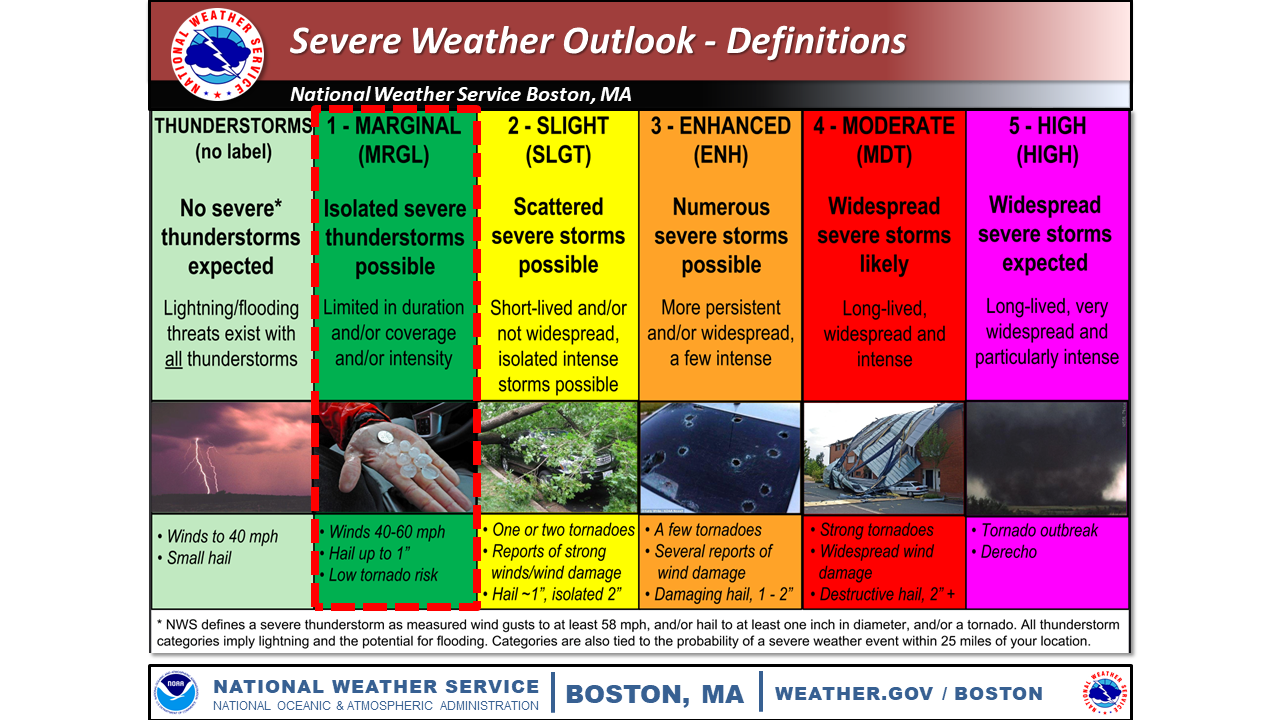
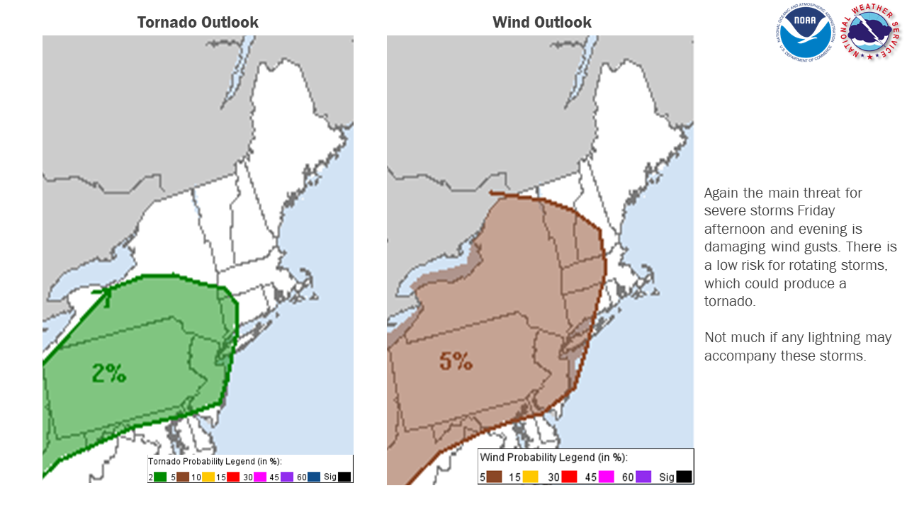
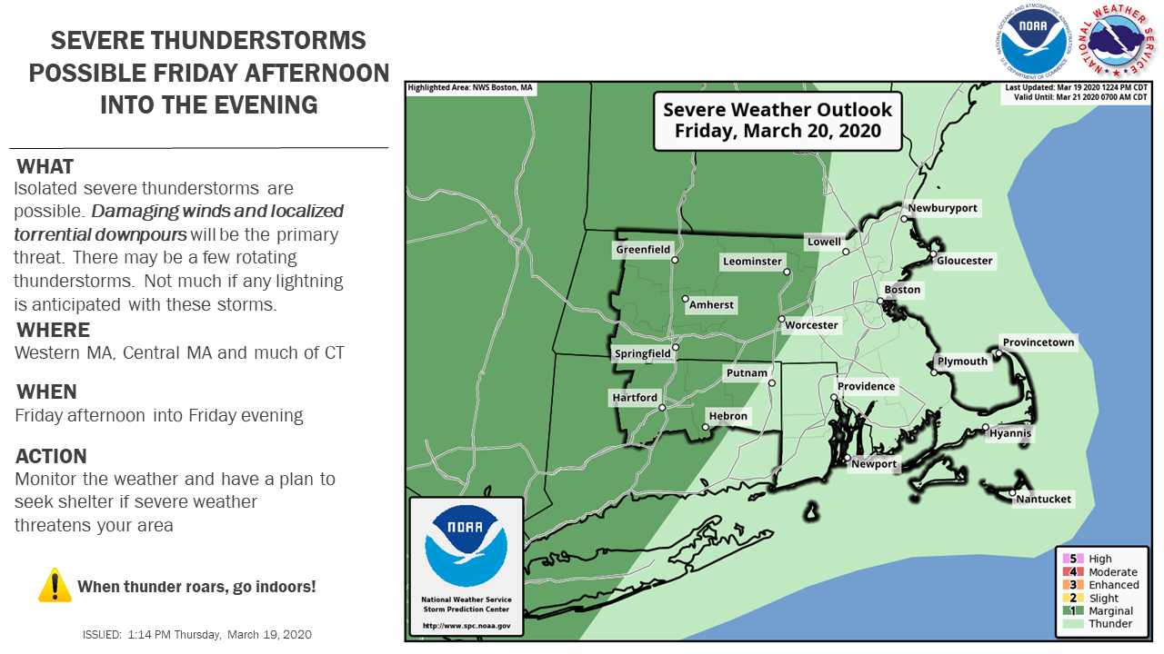
Good afternoon, A cold front will slide in from the west Friday afternoon and into the evening. Ahead of the front, a few severe thunderstorms may develop. The graphics attached are the severe thunderstorm outlook for southern New England for March 20, 2020, hazards expected and a reminder of the SPC Severe Weather Outlook definitions. There is potential for a coastal storm to impact southern New England Monday into Tuesday with accumulating snow possible. Folks should stay tuned to the forecast over the weekend. *What:* - A few severe thunderstorms are possible with the main threats of: - Damaging Wind Gusts - Heavy Downpours - Low risk of rotating storms *When and Where:* - During Friday afternoon and into the evening. Roughly between 4-8 PM. - Between 4-6 PM western MA and CT - Between 6-8 PM RI and eastern MA *Uncertainty:* - Showers may develop during the morning into the early afternoon, which could inhibit storms from becoming strong Expect an updated weather briefing no later than 6 AM Friday. Thanks, Meteorologists Frank Nocera and Bill Leatham If you have any questions or would like more information, don't hesitate to contact us via this email address, on NWSChat <https://nwschat.weather.gov/>, or at the following: National Weather Service Boston/Norton, MA 46 Commerce Way Norton, MA 02766 508.622.3280 Website <http://www.weather.gov/boston> | Facebook <http://www.facebook.com/NWSBoston> | Twitter <http://www.twitter.com/NWSBoston>
participants (1)
-
 BOX Operations - NOAA Service Account