[2020-03-20 AM] NWS Boston EM Briefing for Severe Storm Potential Friday Afternoon & Evening

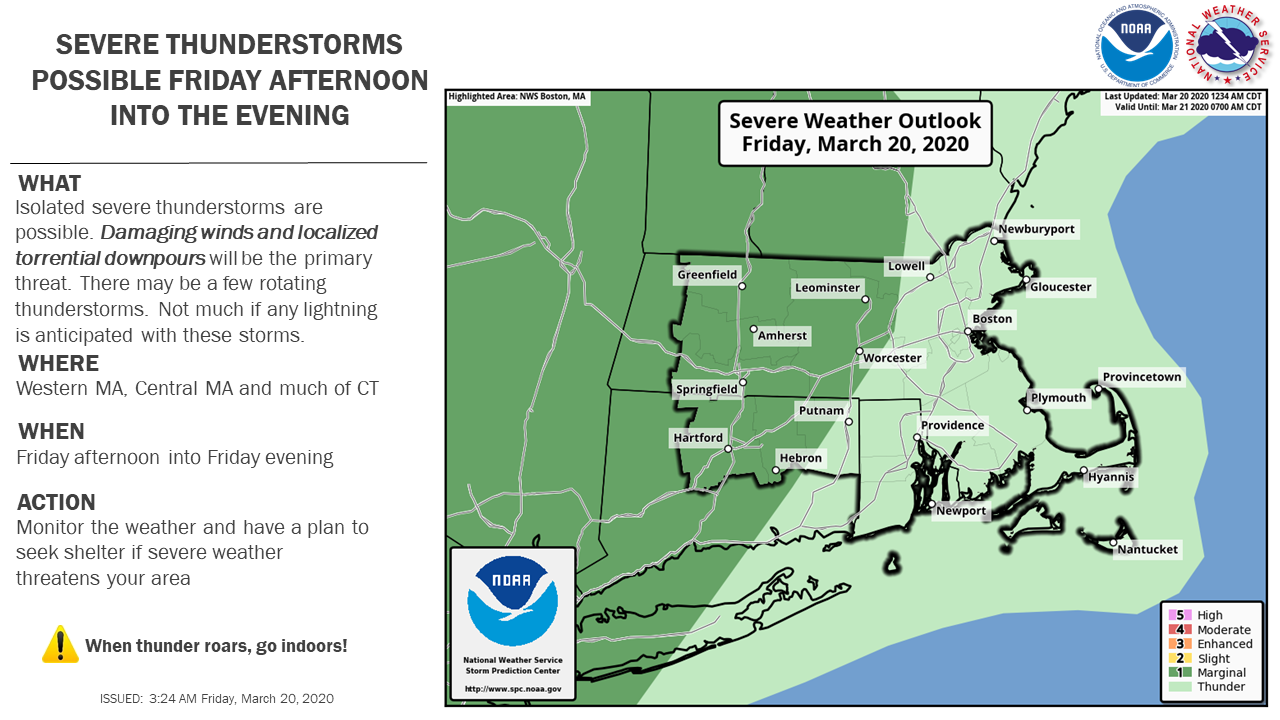
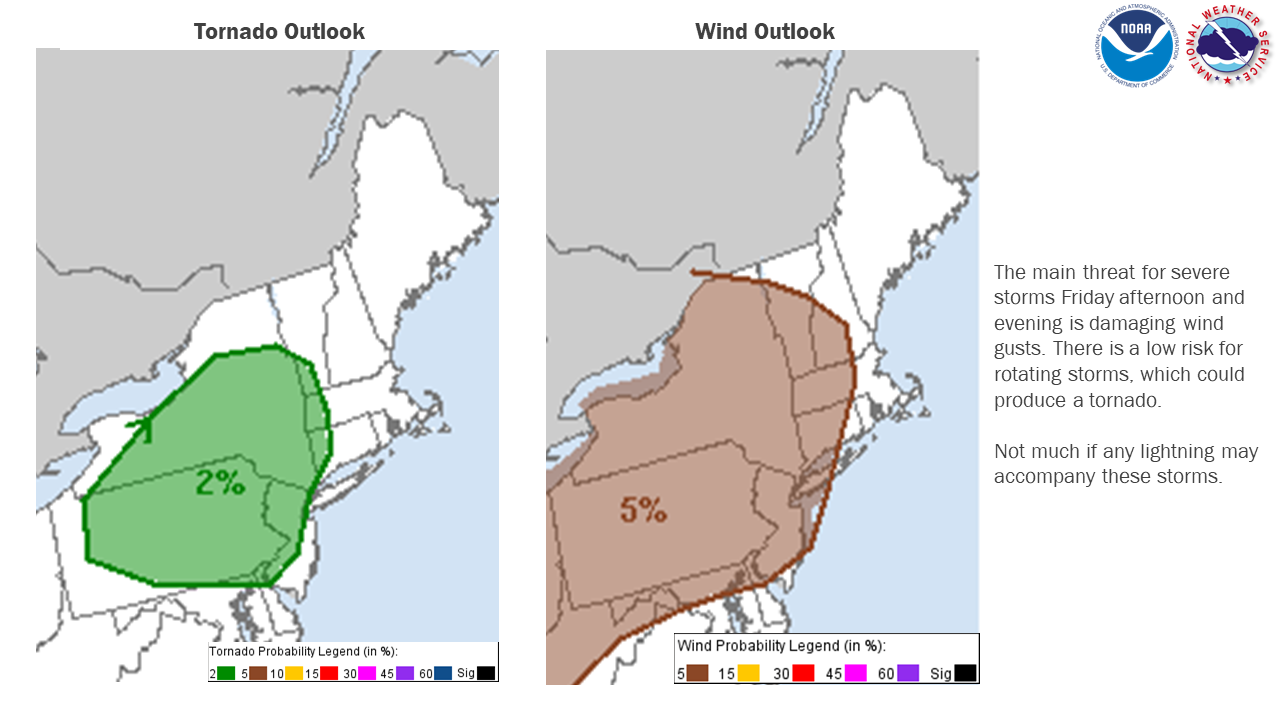
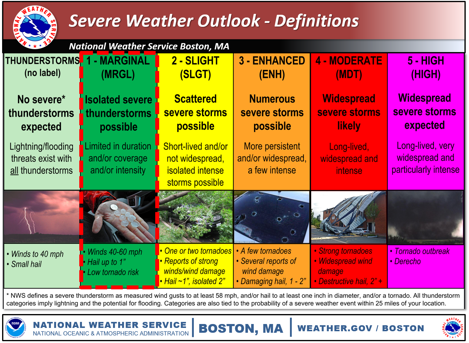
Good morning everyone, The forecast remains largely the same. A cold front will slide in from the west this afternoon and into the evening. Ahead of the front, a few severe thunderstorms may develop. Little if any lightning is expected with these storms. The biggest threat would be from damaging winds. There is also potential for a coastal storm to impact southern New England Monday into Tuesday with accumulating snow possible. Details on that will come into focus over the weekend. *What:* - A few severe thunderstorms are possible with the main threats of: - Damaging Wind Gusts - Heavy Downpours - Low risk of a tornado *When and Where:* - Friday afternoon and into the evening. Roughly between 4-8 PM. - Between 4-6 PM western MA and CT - Between 6-8 PM RI and eastern MA if storms hold together *Uncertainty:* - Showers may develop during the morning into the early afternoon, which could inhibit storms from becoming strong The graphics attached are the severe thunderstorm outlook for southern New England for March 20, 2020, hazards expected, and a reminder of the SPC Severe Weather Outlook definitions. Thank you Meteorologist: Bryce Williams If you have any questions or would like more information, don't hesitate to contact us via this email address, on NWSChat <https://nwschat.weather.gov/>, or at the following: National Weather Service Boston/Norton, MA 46 Commerce Way Norton, MA 02766 508.622.3280 Website <http://www.weather.gov/boston> | Facebook <http://www.facebook.com/NWSBoston> | Twitter <http://www.twitter.com/NWSBoston>
participants (1)
-
 BOX Operations - NOAA Service Account