[2018.12.27 AM NWS Briefing] Wintry Mix Comprising of Freezing Rain across N/W MA Friday Morning

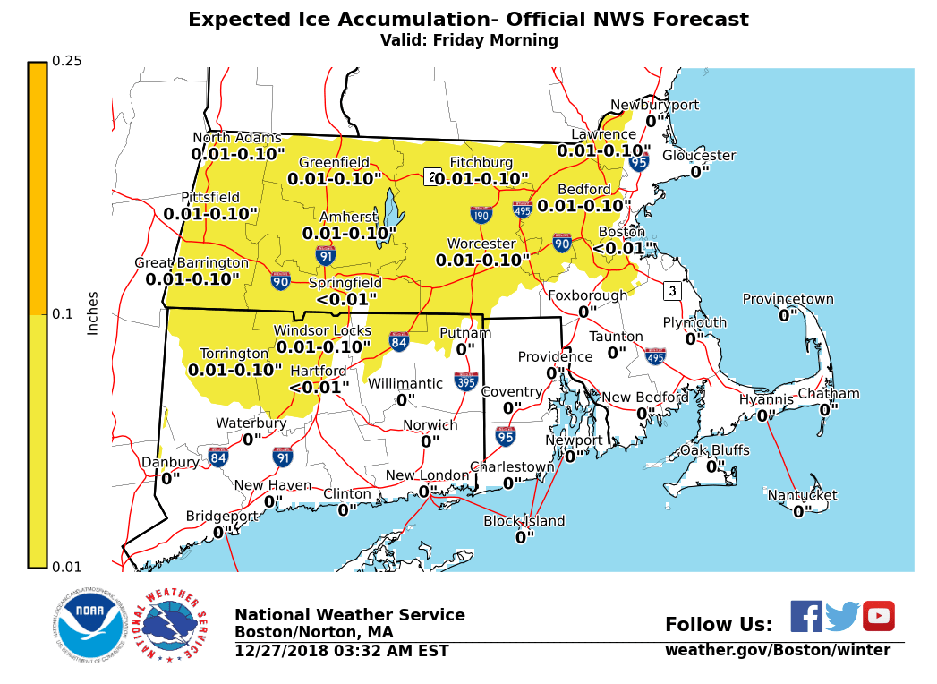
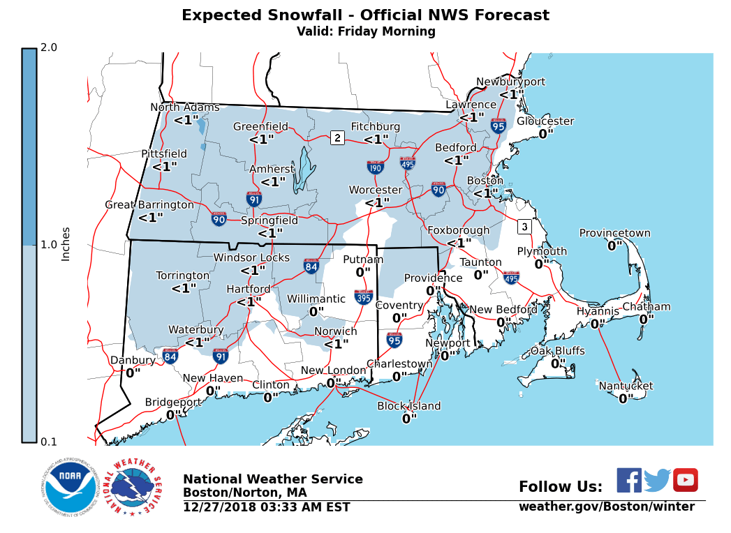
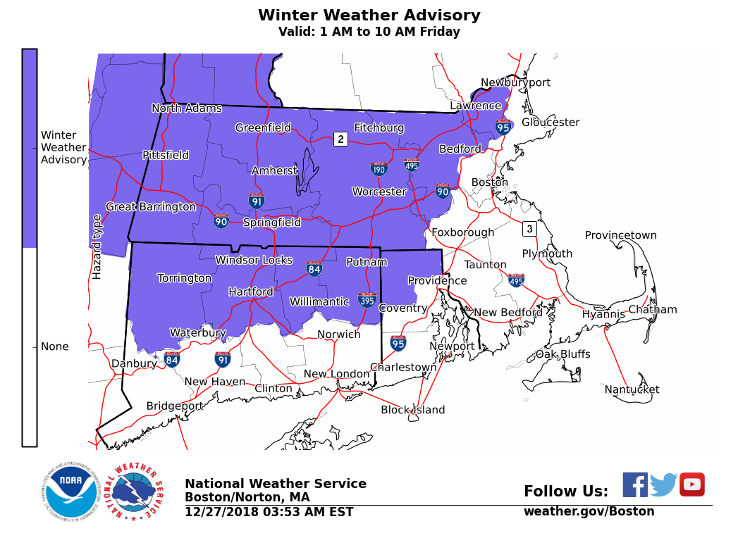
Good morning, We continue to forecast a wintry mix of snow, sleet and freezing rain tomorrow (Friday) morning. The Winter Weather Advisory has been expanded to include northern Connecticut, central/eastern Massachusetts, and northern Rhode Island. Highest confidence of ice accumulation continues to be focused on the Berkshires and Worcester Hills, but all of these areas could see a period of icy conditions. This system will impact the Friday morning commute and transition to an all rain event. *What:* - A mix of snow, sleet, and freezing rain changing to rain. - Light snow accumulations w/ a glaze of ice causing slippery conditions on area roadways. - Risk for impact to the Friday morning commute. *Where:* - Interior MA, CT, and RI, especially the higher terrain of western and central Massachusetts and Connecticut *When:* - 1 am to 10 am Friday. If you have any questions or would like more information, don't hesitate to contact us via this email address, on NWSChat <https://nwschat.weather.gov/>, or at the following: National Weather Service Boston/Norton, MA 46 Commerce Way Norton, MA 02766 508.622.3280 Website <http://www.weather.gov/boston> | Facebook <http://www.facebook.com/NWSBoston> | Twitter <http://www.twitter.com/NWSBoston>
participants (1)
-
 BOX Operations - NOAA Service Account