[2025.02.02 PM] NWS Boston EM Briefing - Quick Hitting Snow Sunday PM thru Monday AM

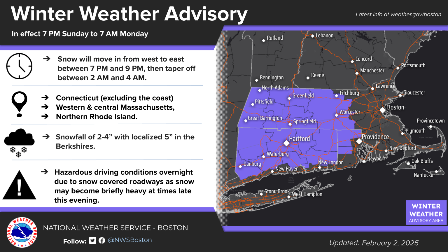
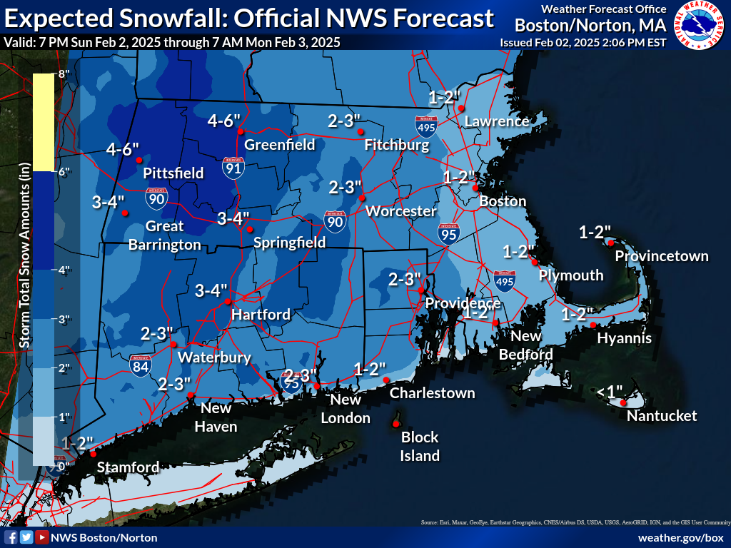
Good afternoon, We wanted to provide an update on a fast-moving system that will bring widespread snow to the region this evening, prompting a Winter Weather Advisory for most of Connecticut (excluding the coast), western and central Massachusetts, and northern Rhode Island. In these areas, we expect 2-4 inches of snow, with locally higher amounts near 5 inches in the Berkshires. Coastal areas and eastern Massachusetts will see 1-2 inches of snow. The Winter Weather Advisory is in effect from 7 PM Sunday to 7 AM Monday. Snow will move in from west to east between 7 PM and 9 PM, then taper off between 2 AM and 4 AM. Attached are the one-page briefing, a forecast snowfall map, and the current Winter Weather Advisory map. We are only expecting minor impacts to the Monday morning commute. This will be the final briefing. - Kevin Cadima and Torry Dooley If you have any questions or would like more information, please don't hesitate to contact us. You can reach us via: email: box.operations@noaa.gov phone: 508.622.3280 Slack/NWSChat 2.0 <https://nwschatws.slack.com/> (for approved partners) social media: Website <http://www.weather.gov/boston> | Facebook <http://www.facebook.com/NWSBoston> | Twitter <http://www.twitter.com/NWSBoston>
participants (1)
-
 BOX Operations - NOAA Service Account