[2018.12.15 PM NWS Briefing #2] Freezing Rain & Sleet Sunday Inland Changing to Mainly Snow Sunday Night Inland

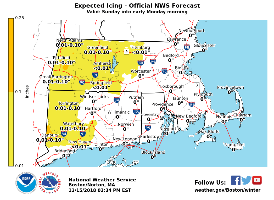
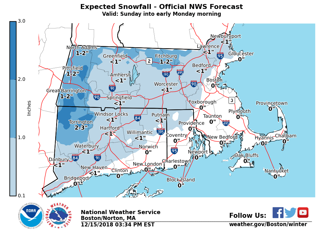
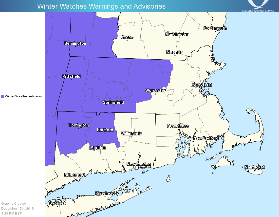
Good afternoon, A wintry mix of sleet and freezing rain for the interior is still forecast Sunday then changing to mainly snow Sunday night into early Monday. Please see the attached images that highlight the latest forecast thinking and possible trends. *What / Where / When ...* - Wintry mix of sleet / freezing rain across northwest CT into central-western MA - Onset early Sunday morning for northwest CT but likely not until afternoon for central-western MA - Low risk for spotty light freezing drizzle across northern CT into Worcester county Sunday morning - Minor snow / sleet accumulations of a coating up to 2 inches are forecast, as well as ice accretion of a trace up to a tenth of an inch - Greatest travel impacts in regards to slick roadways will be across the higher terrain especially elevations above 1000 ft - Sleet and Freezing rain changes to snow Sunday night from western CT/MA eastward - Greatest impact Sunday night into the Monday morning commute will likely be across the higher elevations where temperatures are at or below freezing - Therefore not expecting much if any snow accumulations into the Hartford-Providence-Boston corridor with roads possibly just wet *Uncertainty ...* Given a mixed precipitation event, there remains uncertainty with respect to precip-types at specific times over particular areas, as well as associated outcomes and impacts. As of now the greatest impact appears across the higher elevations of northwest CT into western-central MA. Thus little if any impact to the Hartford-Providence-Boston corridor. However if the storms intensifies more rapidly than expected wintry precipitation may occur farther south and east. There will likely be adjustments to later forecasts so stay tuned to further emails. Should you have any questions, comments and/or concerns, please don't hesitate to reach out to us at any time. Frank Nocera If you have any questions or would like more information, don't hesitate to contact us via this email address, on NWSChat <https://nwschat.weather.gov/>, or at the following: National Weather Service Boston/Norton, MA 46 Commerce Way Norton, MA 02766 508.622.3280 Website <http://www.weather.gov/boston> | Facebook <http://www.facebook.com/NWSBoston> | Twitter <http://www.twitter.com/NWSBoston>
participants (1)
-
 BOX Operations - NOAA Service Account