[2023.03.02 PM] NWS Boston EM Briefing: Potential for Impactful Winter Weather Friday evening and Saturday

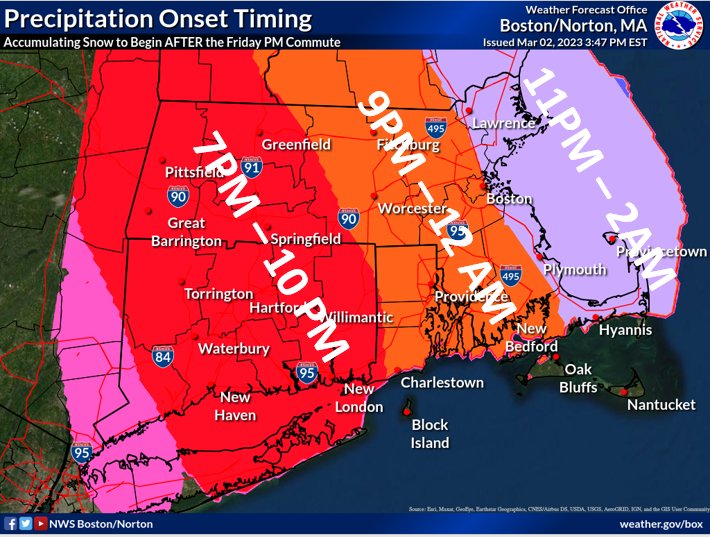
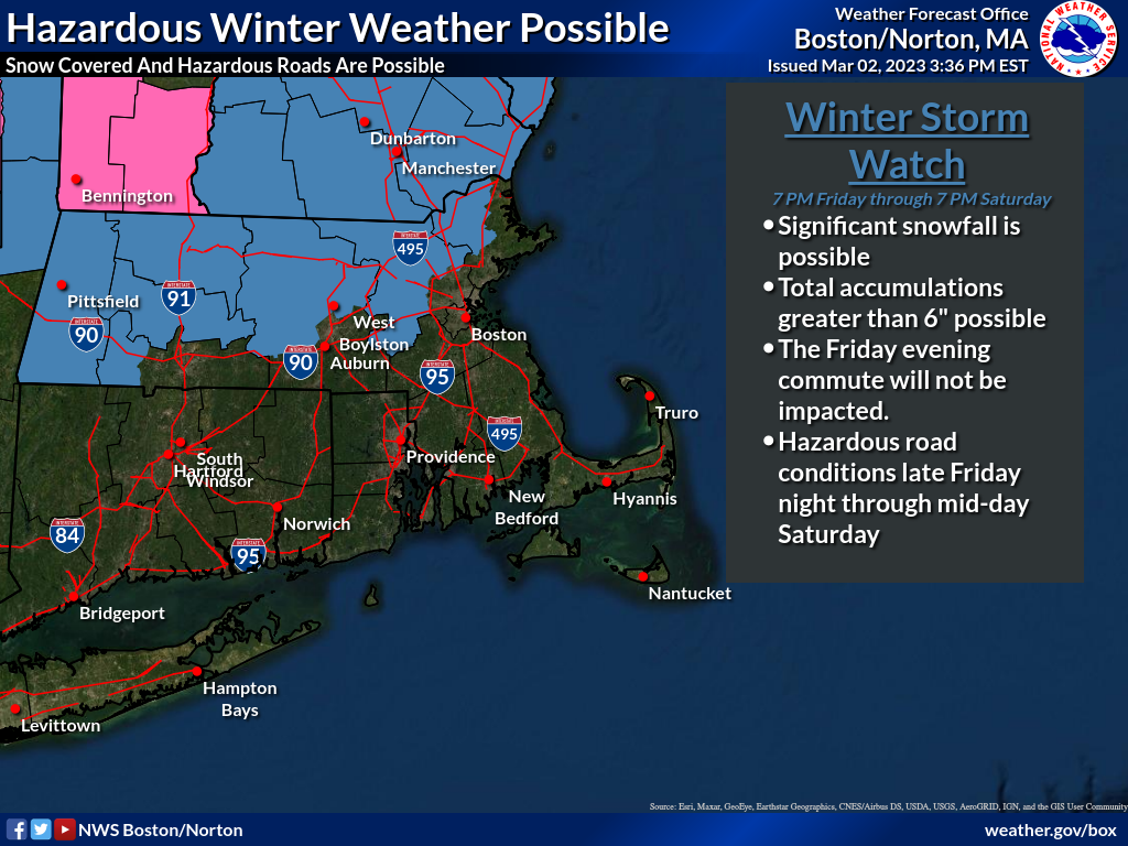
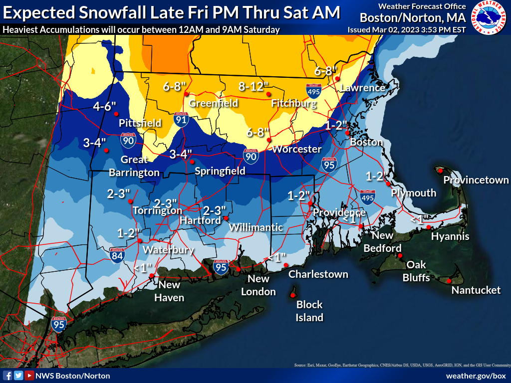
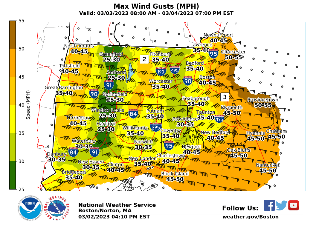
Good Afternoon All, Please find the latest briefing, regarding the potential for accumulating snow Friday night into Saturday, attached. Note that confidence has increased regarding impacts north of the I-90 corridor, with the highest confidence in impactful accumulations of snow north of Route 2 where more than 6" of snow is forecast to fall. A Winter Storm Watch has been issued for portions of Massachusetts north of I-90 and west of the I-495 corridors. Wind will also be of concern along the eastern MA coastline, where winds gusting between 40-50mph are likely on Saturday. While easterly winds will be strong, coastal flooding is not a concern as we will have low astronomical tides this weekend. Confidence in snow totals is lowest across the eastern MA coastline and south of I-90 as mixed precipitation such as sleet and rain will mix in after sunrise on Saturday. We would like to emphasize that the general timing of this system has not changed, with all impacts expected AFTER the Friday PM commute. Please let us know if you have additional questions. Kevin Cadima, Torry Gaucher, and Kristie Smith If you have any questions or would like more information, don't hesitate to contact us via this email address, on NWSChat <https://nwschat.weather.gov/>, or at the following: National Weather Service Boston/Norton, MA 46 Commerce Way Norton, MA 02766 508.622.3280 Website <http://www.weather.gov/boston> | Facebook <http://www.facebook.com/NWSBoston> | Twitter <http://www.twitter.com/NWSBoston>
participants (1)
-
 BOX Operations - NOAA Service Account