[2024.06.13 AM] NWS Boston EM Briefing: Severe T-Storms Possible Fri with Excessive Heat/Humidity Potential Next Week

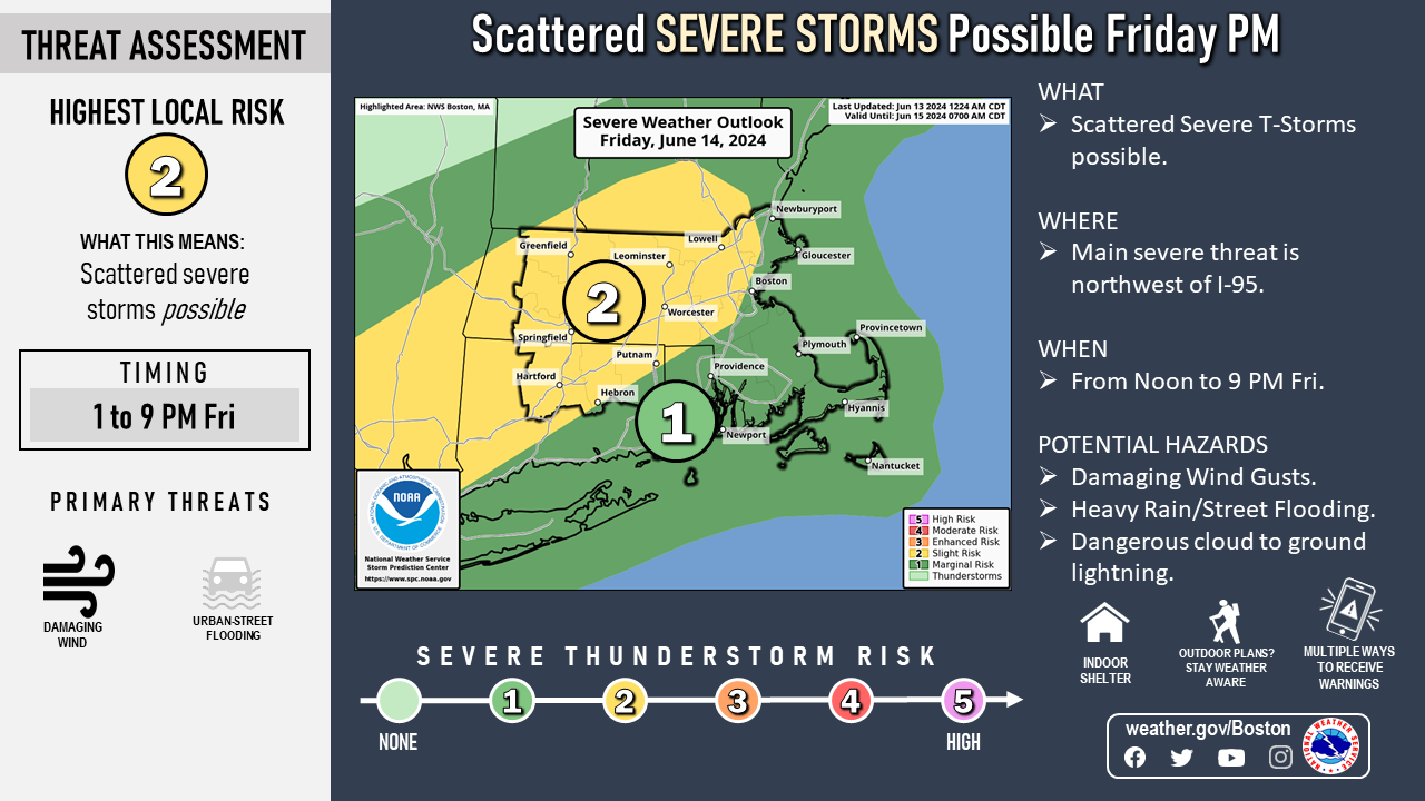
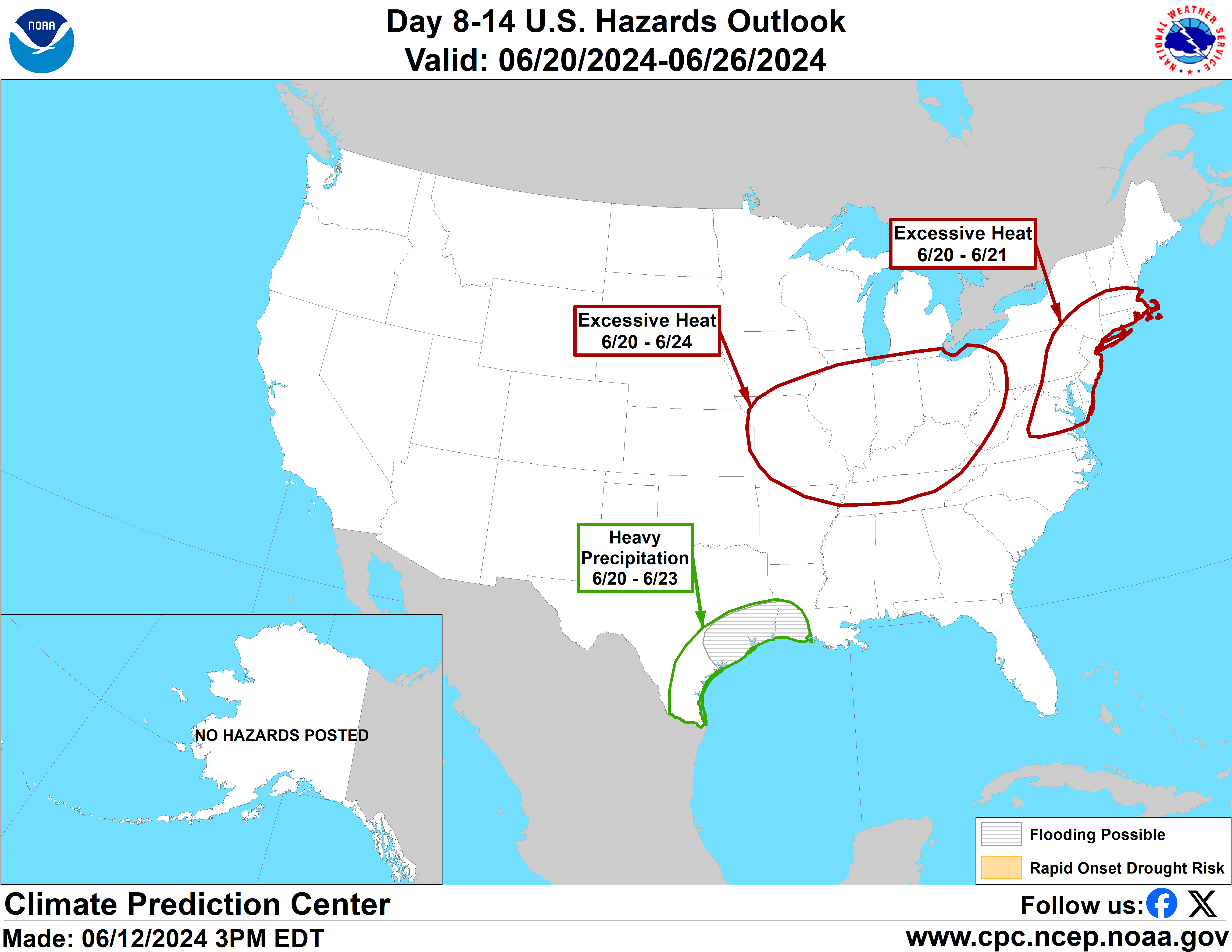
Good morning everyone Attached is the latest one-pager on the potential for scattered severe thunderstorms Friday afternoon and evening with the main risk northwest of the I-95 corridor. The main severe weather threat will be locally damaging wind gusts. In addition, torrential rain with any thunderstorms may result in urban street flooding...which may impact part of the Friday PM commute. Also, the potential for excessive heat and humidity continues next week. This begins next Tuesday and may continue through Thursday or Friday of next week. While it is a long way off...the potential for heat indices of 95-104 degrees are possible at times. It will also remain quite muggy at night...so that will also be a concern. Attached is the one-pager and also enlarged images of the Severe Weather Outlook for Friday and potential for excessive heat and humidity next week. We plan to issue an updated email by 6 pm this evening. Please let us know if you have any questions or concerns! Thank You Meteorologists: Hayden Frank and Kyle Pederson If you have any questions or would like more information, please don't hesitate to contact us. You can reach us via: email: box.operations@noaa.gov phone: 508.622.3280 Slack/NWSChat 2.0 <https://nwschatws.slack.com/> (for approved partners) social media: Website <http://www.weather.gov/boston> | Facebook <http://www.facebook.com/NWSBoston> | Twitter <http://www.twitter.com/NWSBoston>
participants (1)
-
 BOX Operations - NOAA Service Account