[2019.12.12 PM] NWS Boston EM Briefing: Heavy rain on Saturday

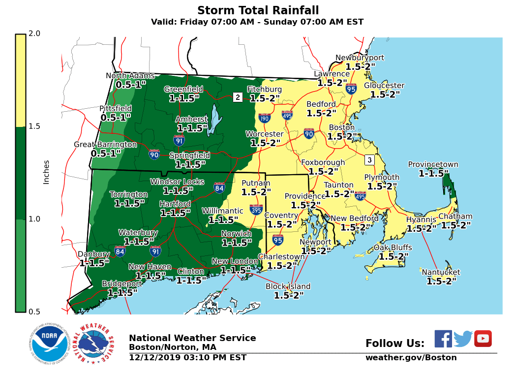
Good afternoon, We are expecting a heavy rain event to impact the region late Friday night into Saturday. Precipitation might start off as a bit of freezing rain in the interior high elevations and parts of the CT River valley, but any icing impact will be transient as temperatures warm well above freezing overnight on Friday. *Interior Light Icing:* *Locations*: East slopes of the Berkshires and CT River valley in MA. *Timing:* Spotty freezing drizzle and/or very light freezing rain developing during precipitation onset. Changeover to rain by midnight. *Amounts*: Trace amounts to a couple hundredths of an inch resulting in a light, thin glaze of ice. *Impact*: Slick roads impacting Friday night's travel. *Confidence:* Low. Coverage of freezing drizzle and light freezing rain will be spotty/patchy. *Heavy Rain:* *Locations*: All locations. *Timing:* Late Friday night into Saturday evening. Heaviest between Saturday morning and afternoon. *Amounts*: 0.75 to 1.5 inches in Western MA and CT. 1 to 2 inches in Eastern MA and RI. *Impact*: Combination of snowmelt and heavy rain could result in localized flooding, especially in areas with poor drainage. *Confidence:* High. A storm total rainfall graphic is attached. Please let us know if you have any questions or concerns. This email will be updated as needed. Meteorologist: Rodney Chai and Bryce Williams If you have any questions or would like more information, don't hesitate to contact us via this email address, on NWSChat <https://nwschat.weather.gov/>, or at the following: National Weather Service Boston/Norton, MA 46 Commerce Way Norton, MA 02766 508.622.3280 Website <http://www.weather.gov/boston> | Facebook <http://www.facebook.com/NWSBoston> | Twitter <http://www.twitter.com/NWSBoston>
participants (1)
-
 BOX Operations - NOAA Service Account