[2024.02.12 PM] NWS Boston EM Briefing: Winter Storm Tuesday

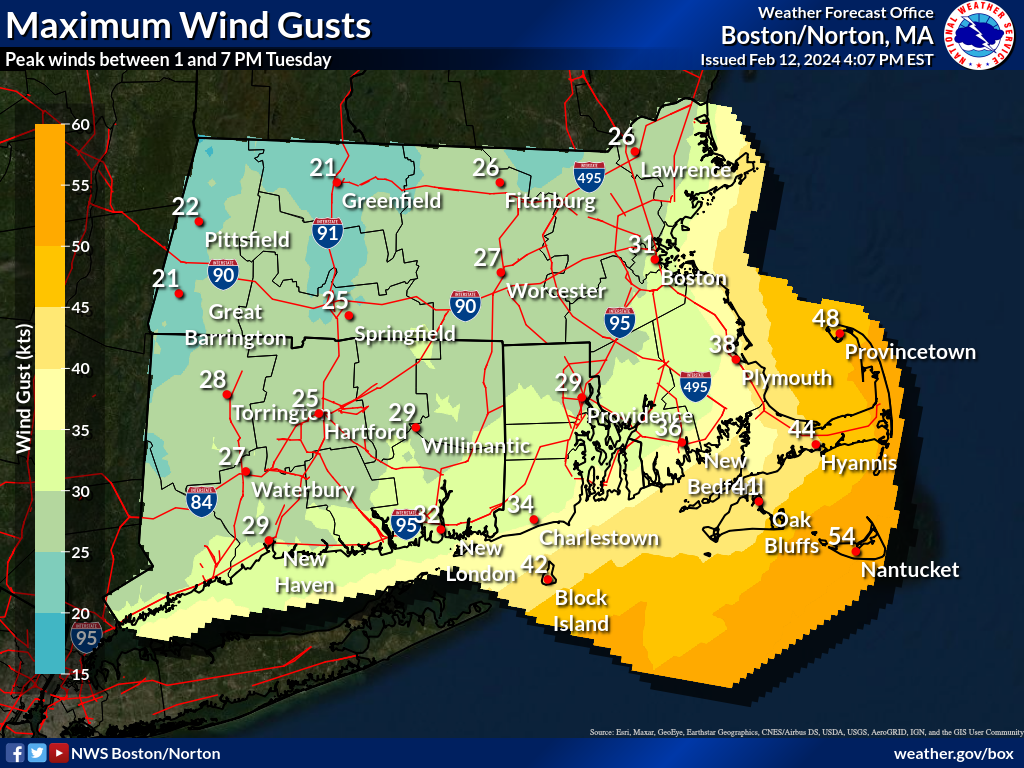
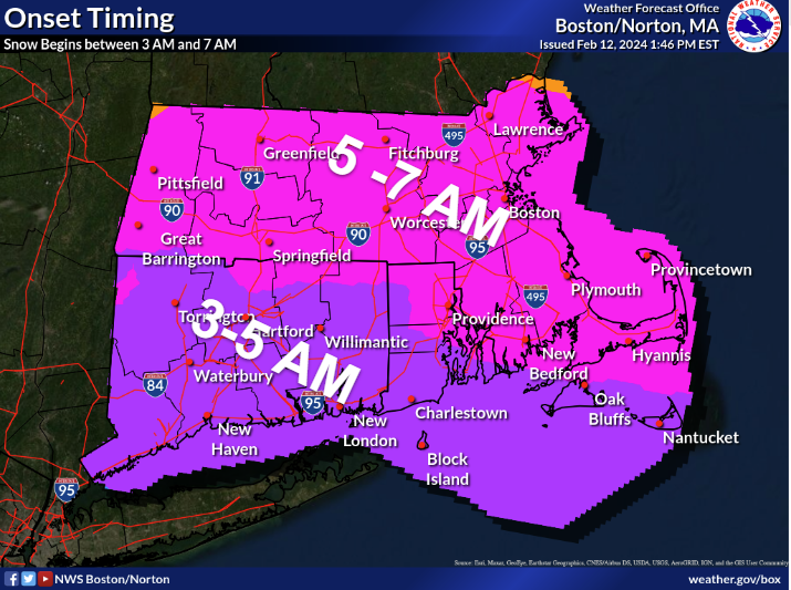
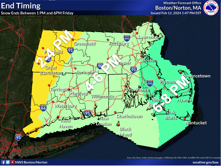
Good Afternoon All, We appreciate your patience as we worked to get the newest information incorporated into our forecast. There has been a rather significant shift in the axis of heaviest snow southward with accumulations of 6"+ suppressed south of the I-90 corridor. Heavy snowfall rates in excess of 2"+ per hour are still possible across SE MA and RI between 9 am and 3pm tomorrow. Travel impacts are expected to be significantly less north of the Mass Pike. We will continue to monitor trends this evening and overnight and will make adjustments to the forecast as needed. Another briefing will be provided by 6 AM Tuesday morning. Kind Regards, Bryce Williams, Kristie Smith, Joe Delli Carpini, Andy Nash, Matthew Belk, and Kyle Pederson If you have any questions or would like more information, please don't hesitate to contact us. You can reach us via: email: box.operations@noaa.gov phone: 508.622.3280 Slack/NWSChat 2.0 <https://nwschatws.slack.com/> (for approved partners) social media: Website <http://www.weather.gov/boston> | Facebook <http://www.facebook.com/NWSBoston> | Twitter <http://www.twitter.com/NWSBoston>
participants (1)
-
 BOX Operations - NOAA Service Account