[2019.03.22 AM NWS Brief] Coastal Flooding, Accumulating Snow, and Strong Winds Into Saturday

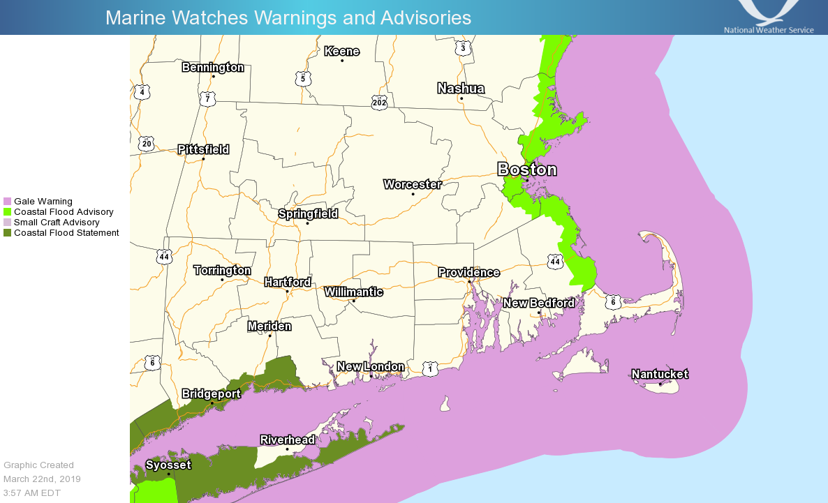
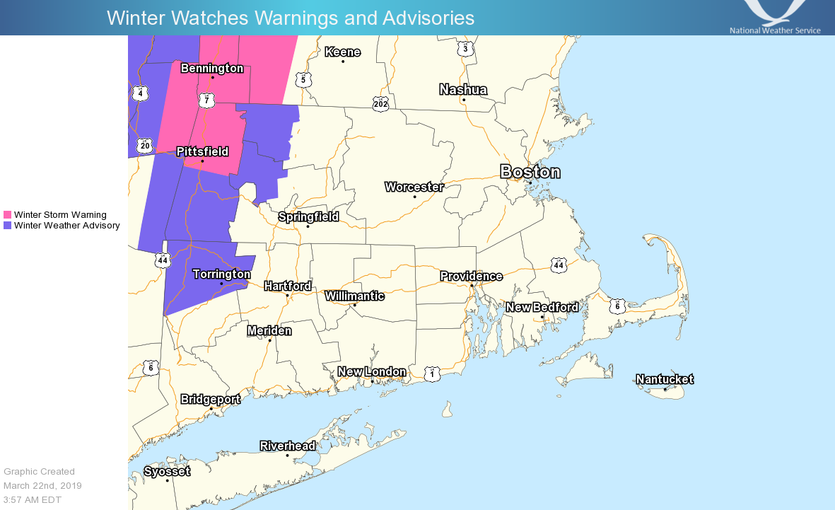
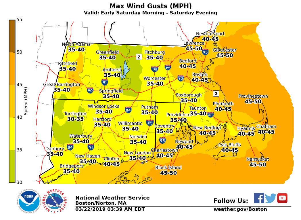
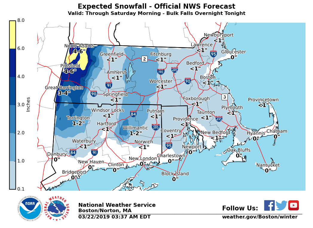
Good morning everyone, A transition from heavier rain to light snow across the high terrain and damp conditions elsewhere is expected this morning. There is no change to headlines with this morning's update. *Winter Weather:* - Light snow will linger across the higher elevations of western MA and CT through the day. - Accumulations of a coating to 2 inches across the lower elevations, with the potential of 4 to 8 inches over the highest terrain especially across northwest Franklin county, tonight. - The bulk of the accumulations occur during the overnight hours tonight. - Potential for localized power outages where snowfall exceeds 5 inches *Coastal Flooding:* - Minor coastal flooding along the eastern Massachusetts coast during high tide early this afternoon. - Some vulnerable shore roads may experience minor flooding around high tide. *Winds:* - Winds will increase late tonight into Saturday. - Sustained westerly winds 15-25 mph with gusts 35-45mph are possible during the day Saturday. - Some isolated tree damage and power outages are possible. *Marine:* - Strong West wind gusts to 40 knots develop late Friday and continue through midday Saturday - Seas will build to 10 to 15 feet offshore If you have any questions or would like more information, don't hesitate to contact us via this email address, on NWSChat <https://nwschat.weather.gov/>, or at the following: National Weather Service Boston/Norton, MA 46 Commerce Way Norton, MA 02766 508.622.3280 Website <http://www.weather.gov/boston> | Facebook <http://www.facebook.com/NWSBoston> | Twitter <http://www.twitter.com/NWSBoston>
participants (1)
-
 BOX Operations - NOAA Service Account