NWS Boston: EM Briefing - Wintry Mix Tomorrow

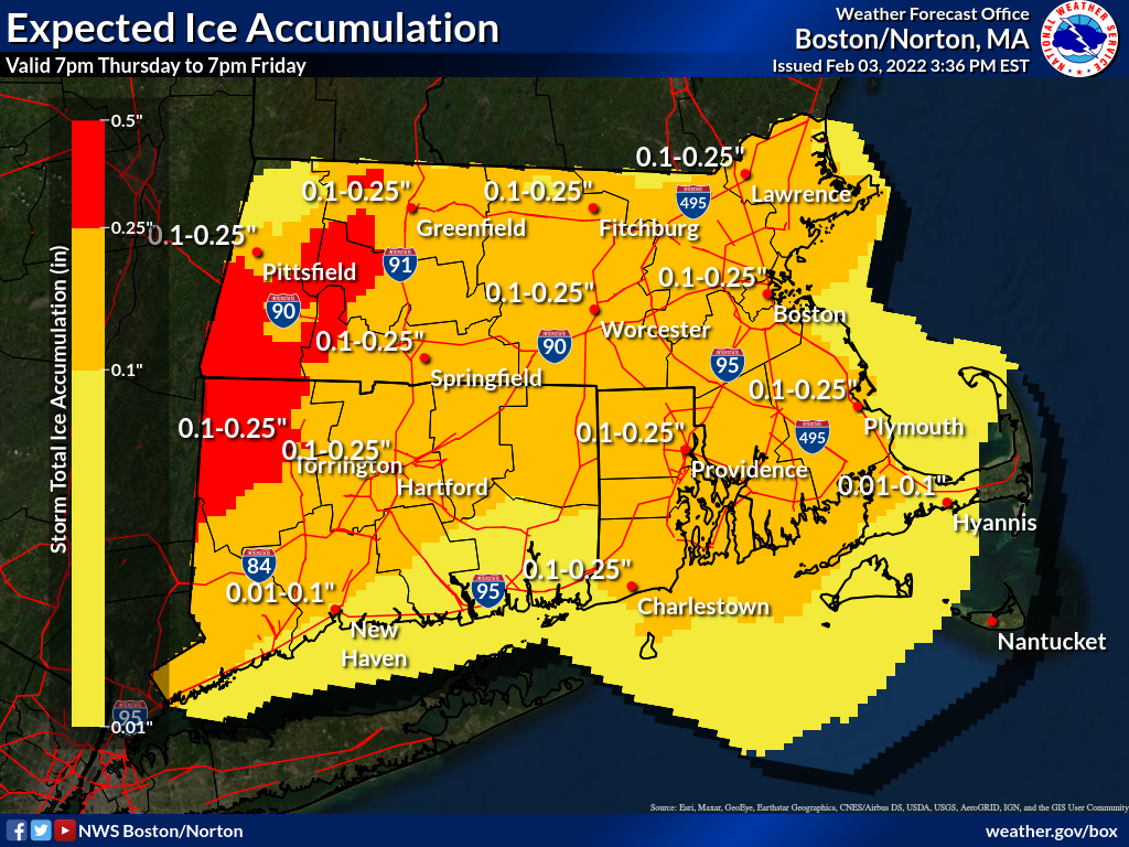
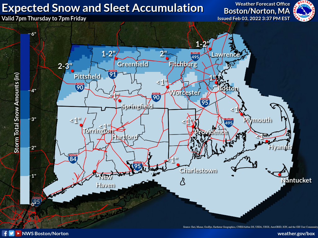
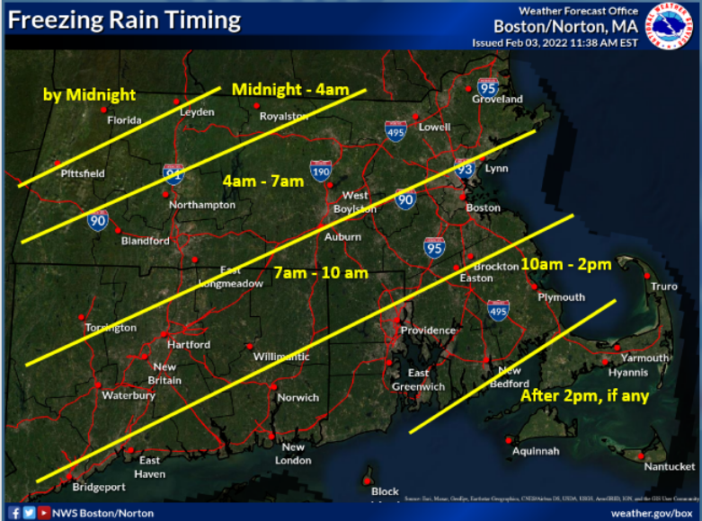
All, Attached is our latest briefing, and a few related images, for the weather system that will bring widespread wintry mix across the region beginning late tonight and through the day Friday. *What has changed:* - No significant changes to the forecast. - Moderate confidence in the overall timing of the transitions from rain to freezing rain and then to sleet. *Winter Weather Headlines:* - Winter Storm Warnings remain for northern Berkshire County into north central Massachusetts where there is the highest chance for the highest sleet accumulations along with minor ice accumulations - Winter Weather Advisory for the rest of southern New England (except for Block Island, Martha's Vineyard, and Nantucket) where the combination of freezing rain and sleet will result in travel difficulties. Thanks, Andy Nash, Hayden Frank and Andrew Loconto If you have any questions or would like more information, don't hesitate to contact us via this email address, on NWSChat <https://nwschat.weather.gov/>, or at the following: National Weather Service Boston/Norton, MA 46 Commerce Way Norton, MA 02766 508.622.3280 Website <http://www.weather.gov/boston> | Facebook <http://www.facebook.com/NWSBoston> | Twitter <http://www.twitter.com/NWSBoston>
participants (1)
-
 BOX Operations - NOAA Service Account