[07.22.2024 PM] NWS Boston EM Briefing - Heavy Rainfall and Low Tornado Risk Tuesday Morning

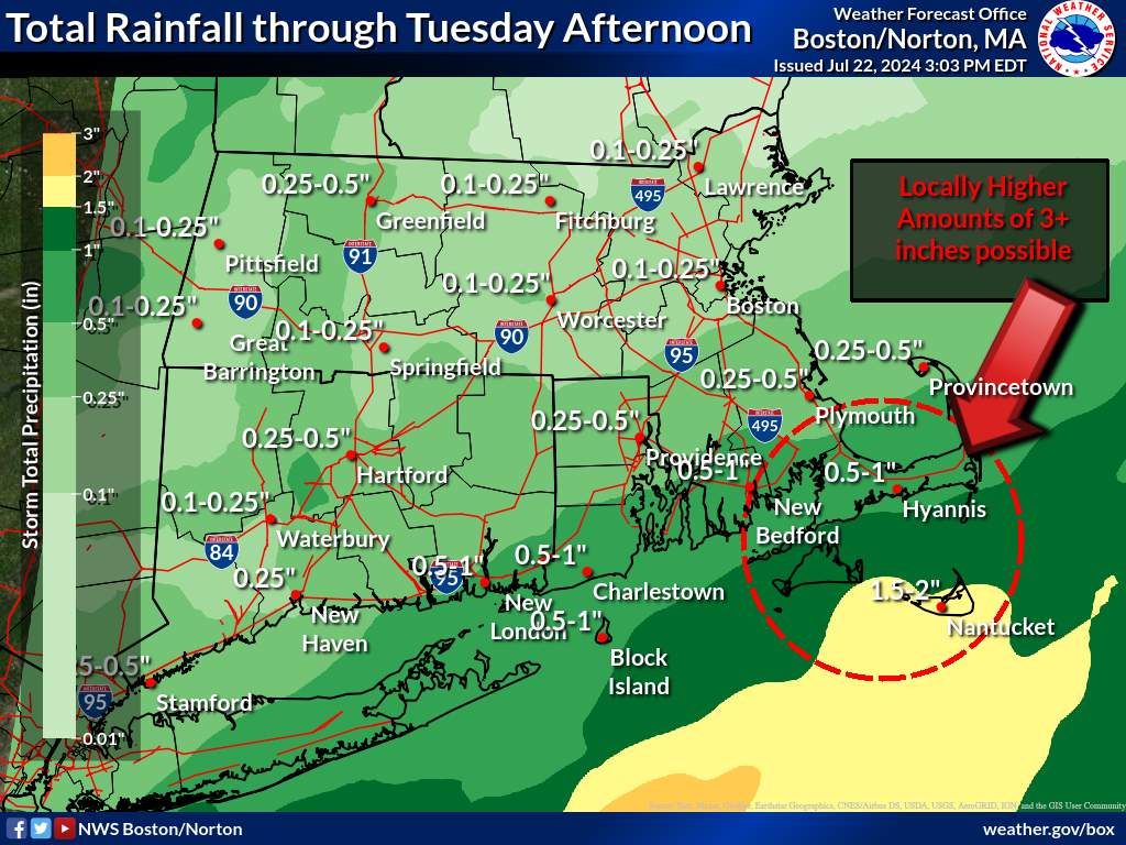
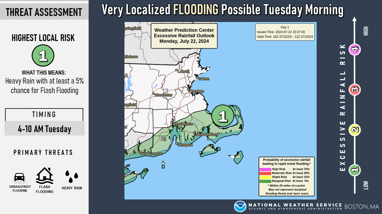
Good afternoon, We wanted to let everyone know that there is a low risk for heavy rainfall and flash flooding over the South Coast, Cape, and Islands tomorrow morning. Please find key details below along with an attached one page briefing and supporting graphics - Tropical downpours may produce as much as 3 inches of rain in under 3 hours over the south coast, Cape, and Islands tomorrow morning (4AM to 10AM time frame) - The Island of Nantucket is forecast to receive the highest rainfall amounts at this time (1 to 2 inches with locally higher amounts of 3+ inches) - A shift in the heaviest rainfall to the north and west could result in higher rainfall amounts over The Cape and South Coast including the urban areas of New Bedford and Providence where poor drainage street flooding may be an issue during the morning commute. - There is a low risk for a brief weak tornado or waterspout as these heavy downpours move over the areas at risk We may provide an updated briefing overnight if there are any significant changes to the forecast. Thanks and have a great afternoon. Meteorologists Rob Megnia and Torry Dooley If you have any questions or would like more information, please don't hesitate to contact us. You can reach us via: email: box.operations@noaa.gov phone: 508.622.3280 Slack/NWSChat 2.0 <https://nwschatws.slack.com/> (for approved partners) social media: Website <http://www.weather.gov/boston> | Facebook <http://www.facebook.com/NWSBoston> | Twitter <http://www.twitter.com/NWSBoston>
participants (1)
-
 BOX Operations - NOAA Service Account