[2020-04-11 PM] NWS Boston EM Briefing for Damaging Winds/Thunderstorms on Monday

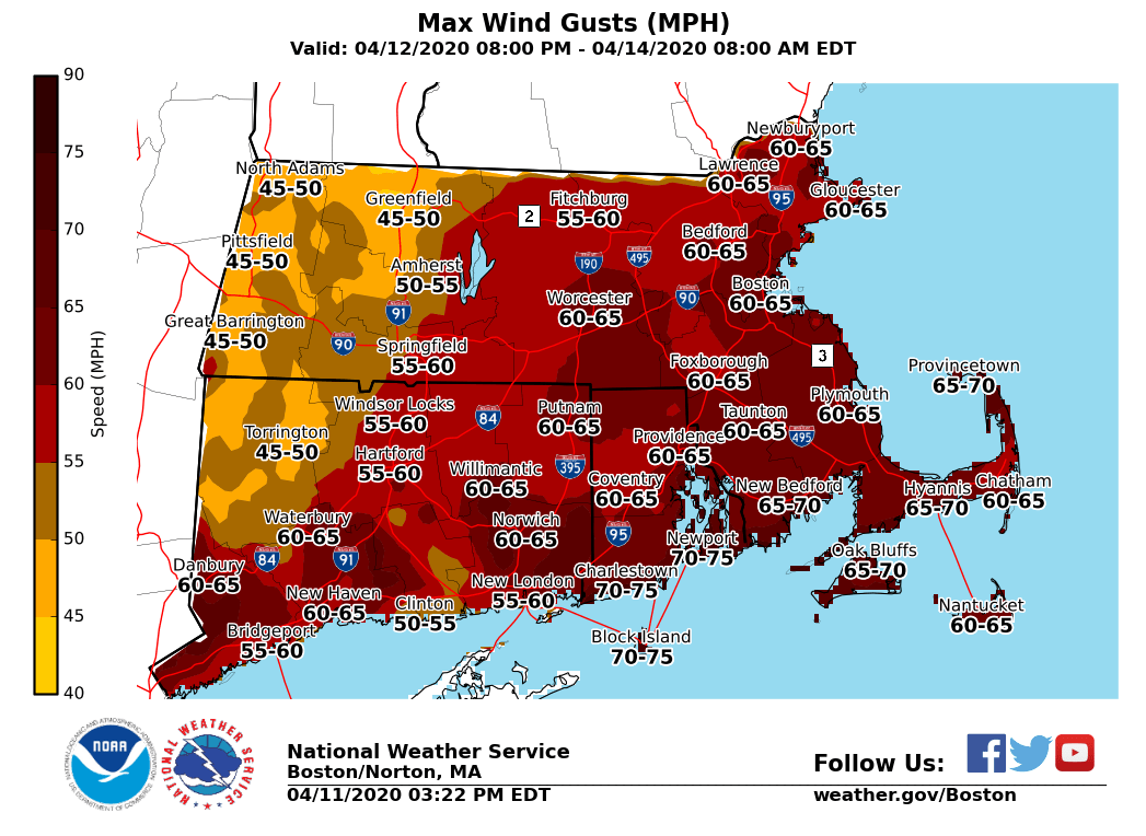
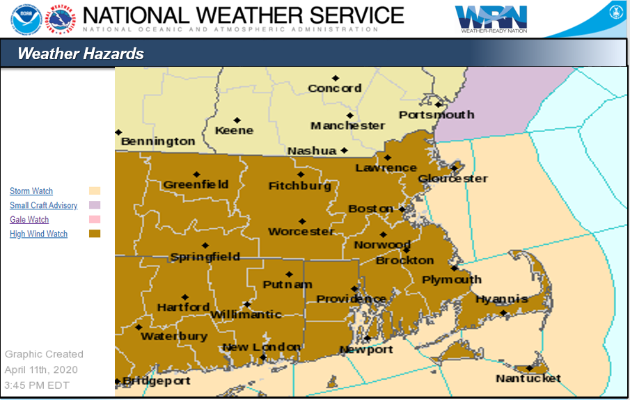
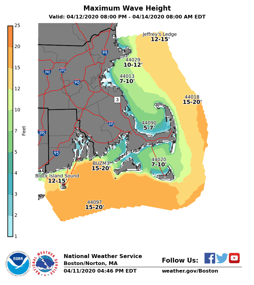
Good afternoon, Confidence has increased this afternoon in the potential for damaging wind gusts and power outages on Monday. Greatest time of concern is late Monday morning into early Monday evening. Attached are graphics of the watches that have been issued, the maximum wind gusts and maximum wave heights expected on Monday. *Changes since the last update:* - High WInd Watches Issues for all of southern New England. - Concern increasing in the potential for damaging wind gusts and power outages. *Headlines:* - High Wind Watch for all of southern New England from Monday morning until Monday evening - Storm Watch in effect for the ocean waters from Monday morning into Monday evening *Details:* *Damaging Winds:* South wind gusts of 55 to 75 mph are possible late Monday morning through Monday evening. Greatest time of concern is late Monday morning into early Monday evening. The highest gusts are expected along the south coast, including Cape Cod and the Islands, but damaging wind gusts are possible across all of southern New England. *Heavy Rain:* Rainfall amounts of 1 to 2 inches are possible from late Sunday night through Monday. Locally higher amounts are possible where any thunderstorms move through. *Thunderstorms:* Thunderstorms will be possible ahead of a cold front Monday afternoon and early Monday night. Some of these storms could become severe bringing damaging winds, lightning and heavy rain. *Wave Heights:* Expect waves to build across the ocean waters to 10 to 15 feet across the eastern waters and 15 to 20 feet across the southern waters. The highest waves are anticipated further offshore. No coastal flooding is anticipated due to low astronomical tides. *Impacts:* - Scattered to perhaps even widespread power outages due to downed trees, tree limbs and power lines. Difficult travel for high profile vehicles. - Any thunderstorms may bring an increased risk for damaging wind gusts along with cloud to ground lightning. - Heavy rain may cause brief localized urban and poor drainage flooding. *Uncertainty:* - We are confident in strong to damaging wind gusts Monday, but the magnitude of the wind gusts is more uncertain. If we end up on the lower end with mainly 50 to 60 mph wind gusts, we will have scattered power outages. On the other hand, if wind gusts end up in the 65 to 75 mph range, widespread power outages would be possible. - How widespread thunderstorm coverage will be is also uncertain. Thanks Rodney Chai, Hayden Frank and Bill Leatham If you have any questions or would like more information, don't hesitate to contact us via this email address, on NWSChat <https://nwschat.weather.gov/>, or at the following: National Weather Service Boston/Norton, MA 46 Commerce Way Norton, MA 02766 508.622.3280 Website <http://www.weather.gov/boston> | Facebook <http://www.facebook.com/NWSBoston> | Twitter <http://www.twitter.com/NWSBoston>
participants (1)
-
 BOX Operations - NOAA Service Account