[01.14.2023 PM] NWS Boston EM Briefing: Potential for light snow Tonight into Monday

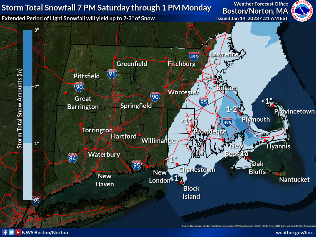
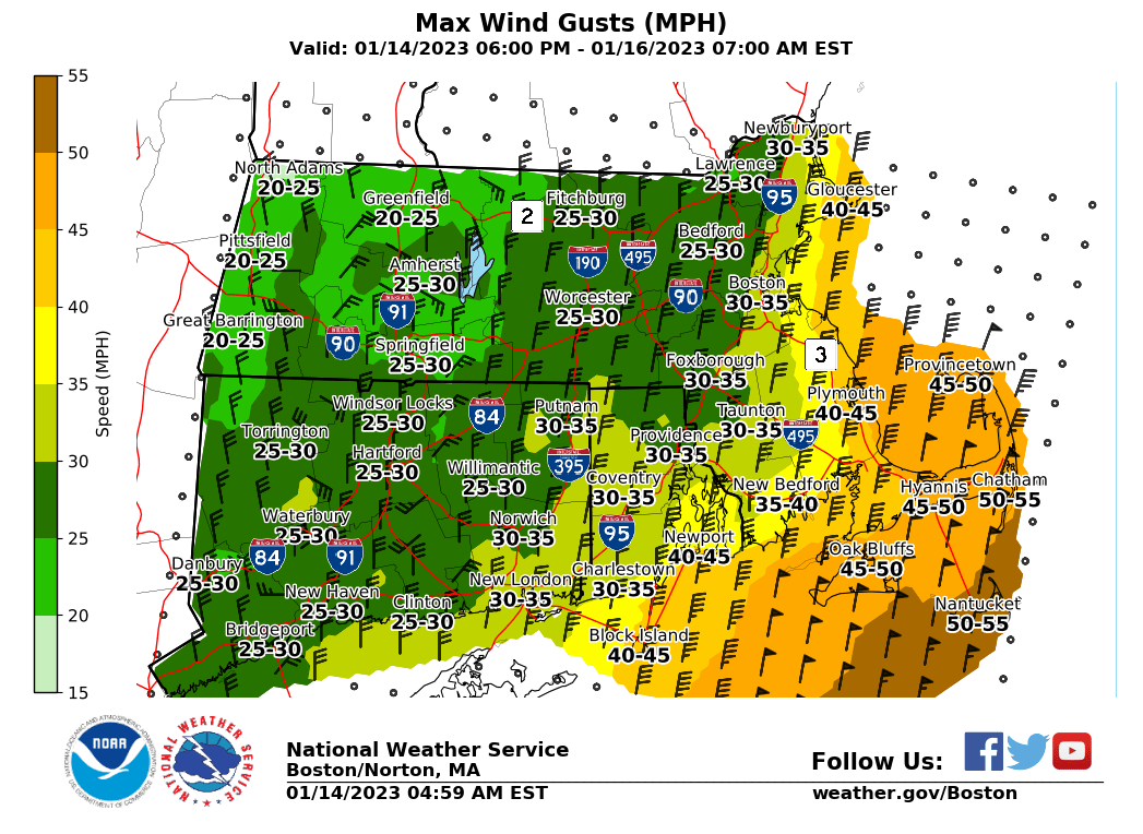
Good morning, all: Attached is the latest briefing regarding accumulating snowfall between tonight and Monday. No winter weather headlines are in effect at this time, but Wind Advisories have been posted for portions of southeast MA. Individual maps of snow accumulations and max wind gusts are also attached. Some risk for some sleet or rain to mix in with the snow, which will reduce snow accumulation. Because it's a longer duration light snow event, impacts will be reduced. However, we cannot rule out some ocean-effect enhancement, which would raise the possibilities of a Winter Weather Advisory eventually being needed. Please keep an eye on the weather this weekend. Matthew Belk and Kristie Smith If you have any questions or would like more information, don't hesitate to contact us via this email address, on NWSChat <https://nwschat.weather.gov/>, or at the following: National Weather Service Boston/Norton, MA 46 Commerce Way Norton, MA 02766 508.622.3280 Website <http://www.weather.gov/boston> | Facebook <http://www.facebook.com/NWSBoston> | Twitter <http://www.twitter.com/NWSBoston>
participants (1)
-
 BOX Operations - NOAA Service Account