[09.08.2021 AM] NWS Boston EM Briefing - Heavy Rain & a few Severe Thunderstorms possible Tonight & Thu

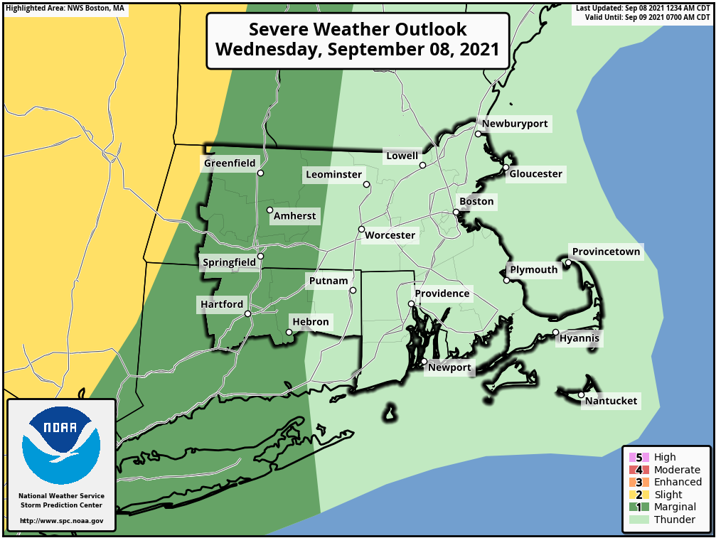
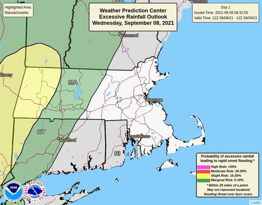
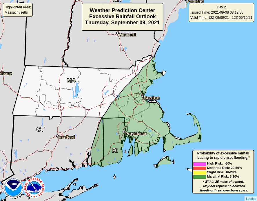
Good morning everyone, Attached is our latest briefing regarding the potential for heavy rainfall along with a few strong to severe thunderstorms tonight into Thursday. The main concern is heavy rainfall, which may lead to localized flooding along with a few storms potentially producing strong to damaging wind gusts. *What has changed - * *1) Higher confidence in heavy rain threat, but lower in severe weather threat* An additional concern we have late this week and into the weekend, when large swells from Hurricane Larry arrive into the MA and RI waters Thursday, peak Friday and then linger into Saturday. These large swells will result in very rough surf and dangerous rip currents, especially at southeast facing ocean beaches for the entire coastline of MA and RI. Now that most beaches are unguarded, these conditions become even more dangerous. In addition, we discourage people from viewing the large surf on rocks and jetties, which can be very dangerous with large breaking waves. Thanks, Bill Leatham and Kevin Cadima If you have any questions or would like more information, don't hesitate to contact us via this email address, on NWSChat <https://nwschat.weather.gov/>, or at the following: National Weather Service Boston/Norton, MA 46 Commerce Way Norton, MA 02766 508.622.3280 Website <http://www.weather.gov/boston> | Facebook <http://www.facebook.com/NWSBoston> | Twitter <http://www.twitter.com/NWSBoston>
participants (1)
-
 BOX Operations - NOAA Service Account