NWS Boston Severe Weather Briefing

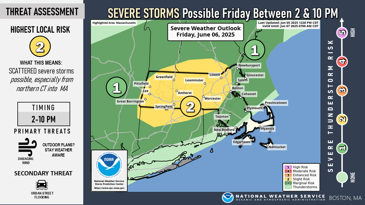
Good Afternoon, Attached is a one-pager and a supporting image showing the potential for severe thunderstorms and urban flash flooding Friday afternoon and evening, between 2 PM and 8 PM. Our confidence in severe thunderstorms is highest near and north of the Mass Pike (I-90) where storms should be more numerous, but we can't rule out severe storms across northern Connecticut and the northwest corner of Rhode Island. The next briefing will be emailed Friday morning by 8 AM. Thanks, Joe Dellicarpini and Francis Tarasiewicz If you have any questions or would like more information, please don't hesitate to contact us. You can reach us via: email: box.operations@noaa.gov phone: 508.622.3280 Slack/NWSChat 2.0 <https://nwschatws.slack.com/> (for approved partners) social media: Website <http://www.weather.gov/boston> | Facebook <http://www.facebook.com/NWSBoston> | Twitter <http://www.twitter.com/NWSBoston>
participants (1)
-
 BOX Operations - NOAA Service Account