[2020-03-23] Changes to Winter Weather Headlines - NWS Boston EM Briefing Monday into Tue Morning

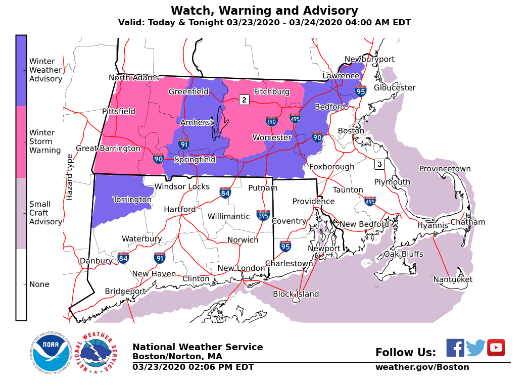
Good afternoon everyone, Just a quick update to let you know of one change to previous forecast ... *NEW: * - Winter Weather Advisory expanded to include northern Middlesex county into northern Essex county (see map below) for 2-4" of snow likely, mainly along and near the Massachusetts-New Hampshire border. The bulk of the accumulation will be on non paved surfaces however secondary roads and untreated surfaces may become snow covered and slippery - Special Weather Statement issued for northern Connecticut (Hartford - Tolland - Windham) for moderate to heavy snow this afternoon accumulating 1-3 inches, highest totals across elevations above 500 ft and on non paved surfaces. Snow will mix with sleet and then change to rain between 4 pm and 6 pm. The remainder of the forecast is unchanged. Frank Nocera If you have any questions or would like more information, don't hesitate to contact us via this email address, on NWSChat <https://nwschat.weather.gov/>, or at the following: National Weather Service Boston/Norton, MA 46 Commerce Way Norton, MA 02766 508.622.3280 Website <http://www.weather.gov/boston> | Facebook <http://www.facebook.com/NWSBoston> | Twitter <http://www.twitter.com/NWSBoston>
participants (1)
-
 BOX Operations - NOAA Service Account