[2022.02.15 PM] NWS Boston EM Briefing - High Winds Thursday Night into Friday Morning

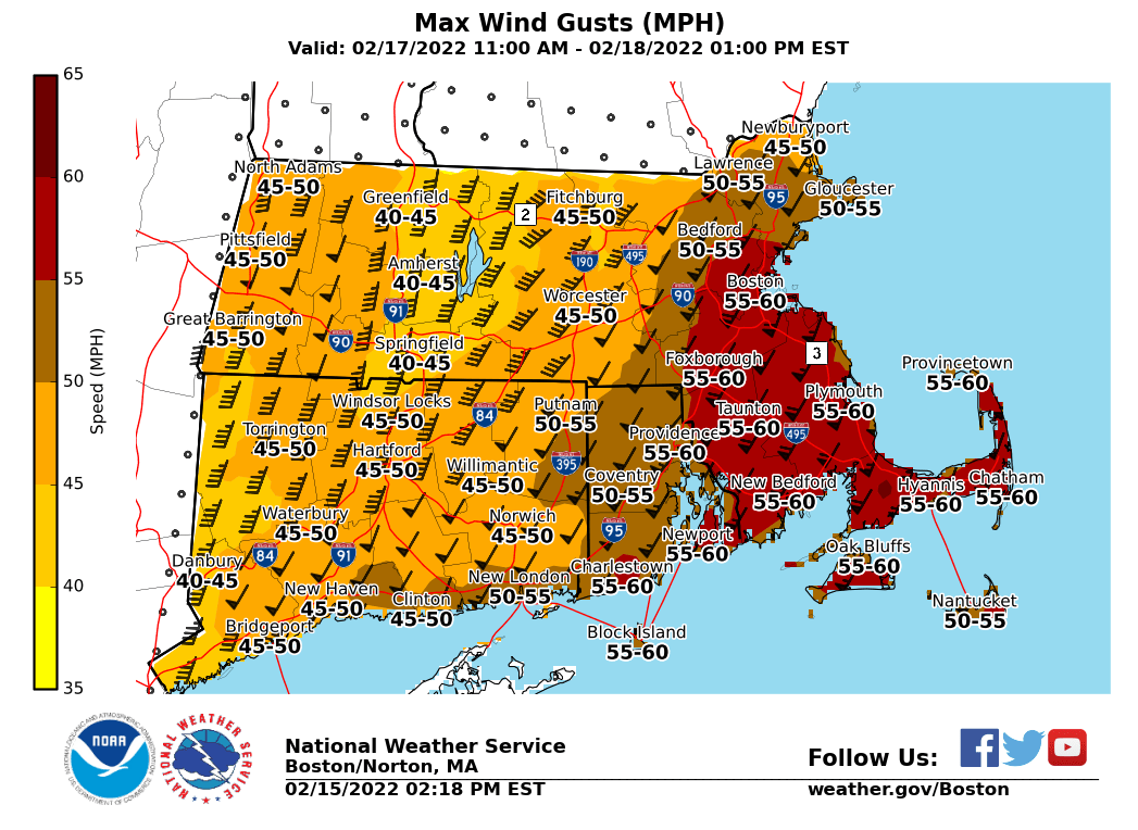
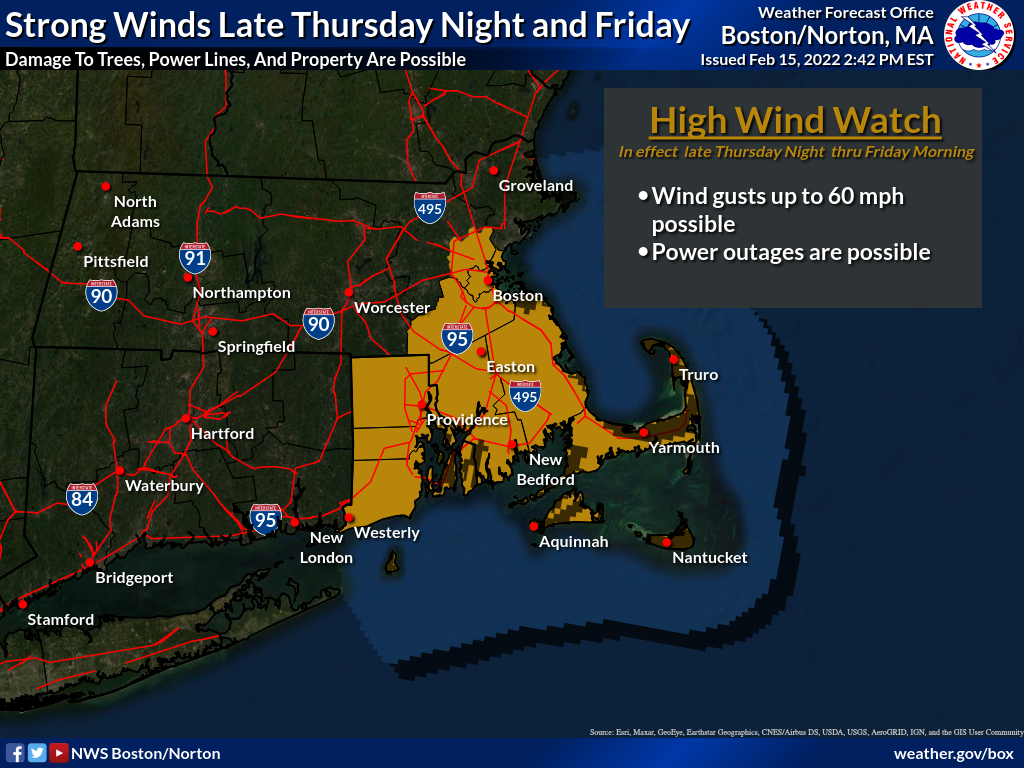
Good Afternoon, Attached is a briefing regarding potential high winds across southern New England late Thursday night into Friday morning. At this time, there is increasing confidence that widespread southerly/southwesterly gusts of 40-50 mph are will occur across interior southern New England, with gusts between 50-60 mph likely south and east of the I-95 corridor. A High Wind Watch is in effect for SE MA and RI from late Thursday night into Friday morning. Unseasonably warm temperatures and about one inch of rain will accompany this system. Nuisance poor drainage and urban flooding is possible in flood-prone areas, especially across southeast MA and RI due to rapid snowmelt. Meteorologists Hayden Frank, Kevin Kadima, and Kristie Smith If you have any questions or would like more information, don't hesitate to contact us via this email address, on NWSChat <https://nwschat.weather.gov/>, or at the following: National Weather Service Boston/Norton, MA 46 Commerce Way Norton, MA 02766 508.622.3280 Website <http://www.weather.gov/boston> | Facebook <http://www.facebook.com/NWSBoston> | Twitter <http://www.twitter.com/NWSBoston>
participants (1)
-
 BOX Operations - NOAA Service Account