[2020-06-27 AM] NWS Boston EM Briefing - Scattered Strong to Severe Storms Possible This Weekend

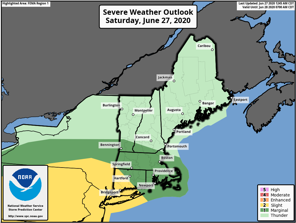
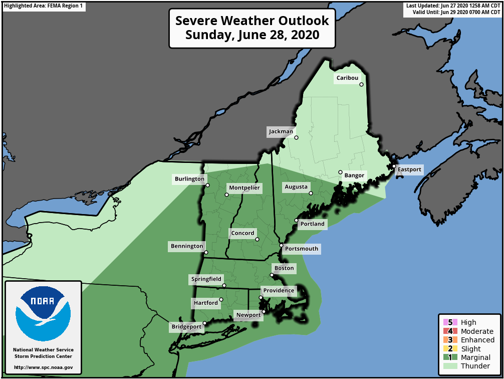
Good morning everyone, Severe thunderstorms are possible today and Sunday across portions of Southern New England. There are no changes to the outlook graphics from the previous email, but they have been attached. *Changes since the previous update* Best risk of severe weather is southwest of the region. If the instability can increase a bit then the severe storm risk will be higher today. No changes at this point in time for Sunday. The timing, locations and threat information is the same for both days. To see that information please see the text below: *Saturday* *Timing*: Mid-afternoon to early Saturday evening. *Locations*: Possible anywhere, but the best chance is near and south of the Massachusetts Turnpike/I-90 *Severe Thunderstorm Threats:* Primarily damaging straight-line winds and hail up to 1" in diameter. While the overall risk is very low, an isolated tornado is possible. *Sunday* *Timing*: Late-afternoon to mid-evening Sunday; isolated storms possible earlier in the day *Locations*: Possible anywhere, but the best chance is across the interior *Severe Thunderstorm Threats:* Damaging straight-line winds and hail up to 1" in diameter. *Confidence: *Moderate. Isolated strong/severe storms could be possible before late in the day but the best chance is with the cold front arriving later in the day into mid-evening. Thank you, Meteorologist Bill Leatham If you have any questions or would like more information, don't hesitate to contact us via this email address, on NWSChat <https://nwschat.weather.gov/>, or at the following: National Weather Service Boston/Norton, MA 46 Commerce Way Norton, MA 02766 508.622.3280 Website <http://www.weather.gov/boston> | Facebook <http://www.facebook.com/NWSBoston> | Twitter <http://www.twitter.com/NWSBoston>
participants (1)
-
 BOX Operations - NOAA Service Account