[2021.09.15 930 AM] NWS Boston EM Briefing - Severe Weather Possible Late This Afternoon into Tonight

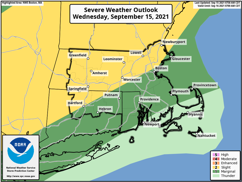
Hi everyone, The Storm Prediction Center's "Slight Risk" area has expanded slightly farther east, to include northeast MA, the city of Worcester, and the city of Hartford. The tornado risk has also slightly expanded, to include more of interior MA, with greatest risk from the northern Berkshires to the northern Worcester hills. Not much has changed in terms of the overall scenario or timing. Expect a line of storms to develop around 3-4 PM and move eastward across western and central portions of the region during the early evening, weakening as it heads east. We will also be keeping an eye out for isolated flash flooding, due to any storms traversing the same areas. There is a chance that a portion of the region could be upgraded to an Enhanced Risk by SPC on the 1230 PM update. Stay tuned. -- Glenn Field Warning Coordination Meteorologist NWS - Boston/Norton If you have any questions or would like more information, don't hesitate to contact us via this email address, on NWSChat <https://nwschat.weather.gov/>, or at the following: National Weather Service Boston/Norton, MA 46 Commerce Way Norton, MA 02766 508.622.3280 Website <http://www.weather.gov/boston> | Facebook <http://www.facebook.com/NWSBoston> | Twitter <http://www.twitter.com/NWSBoston>
participants (1)
-
 BOX Operations - NOAA Service Account