[2023.03.10 PM] NWS Boston EM Briefing: Snow tonight and Potential Winter Storm early next week

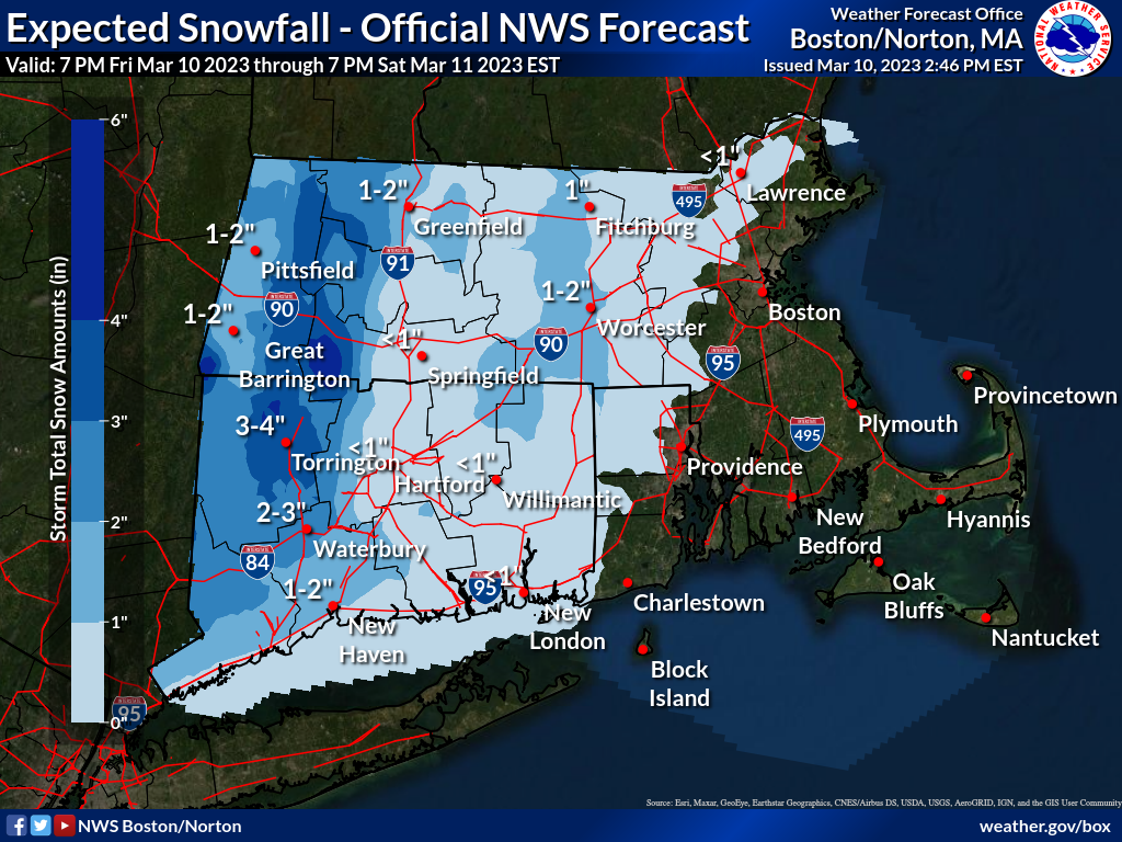
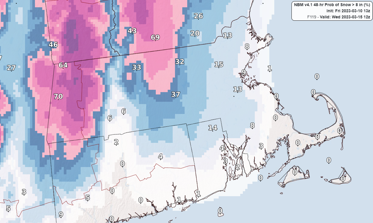
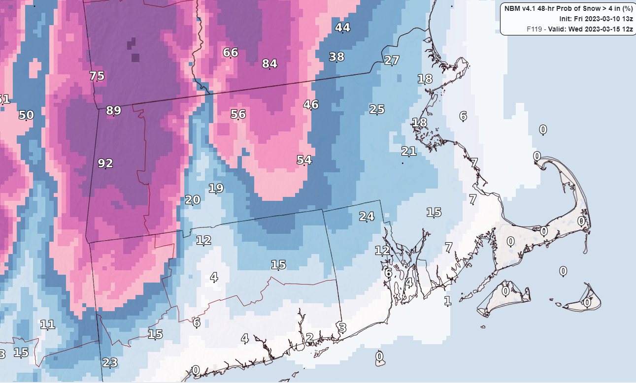
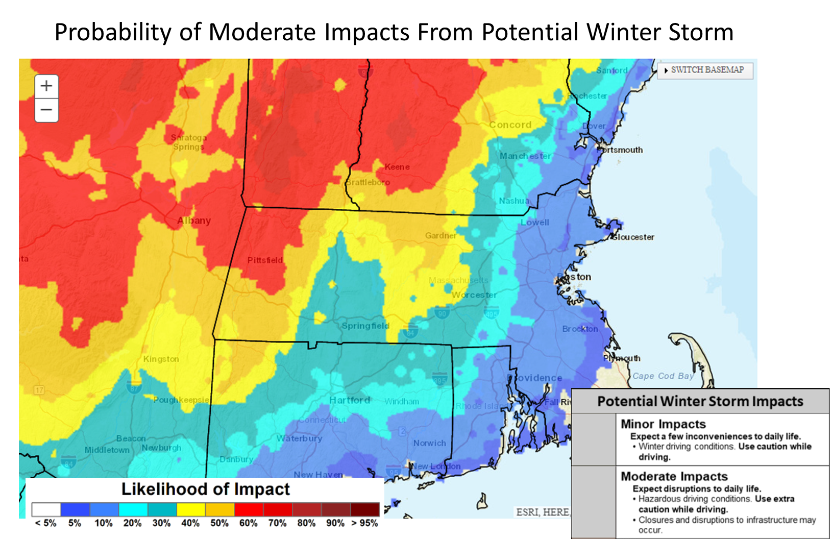
Good afternoon, Attached is a one pager briefing for the snow event tonight across western MA/CT, mainly west of the CT river. We've issued a winter weather advisory for western Hampden county where highest snow amounts are expected, which will extend south through Litchfield county and across the hills of far western Hartford county. We've also included a briefing on the potential winter storm which may impact the region late Mon through Tue night. This has the potential to be a significant storm, but greatest impacts and heaviest snow is expected to be confined to high elevations in northern and western MA. We included graphics for the probability of 4 and 8 inches as well as the probability of moderate impacts from this storm. Unless there are significant changes, expect the next briefing to be issued Saturday afternoon. Thank you. Kevin Cadima, Kristie Smith and Matt Belk If you have any questions or would like more information, don't hesitate to contact us via this email address, on NWSChat <https://nwschat.weather.gov/>, or at the following: National Weather Service Boston/Norton, MA 46 Commerce Way Norton, MA 02766 508.622.3280 Website <http://www.weather.gov/boston> | Facebook <http://www.facebook.com/NWSBoston> | Twitter <http://www.twitter.com/NWSBoston>
participants (1)
-
 BOX Operations - NOAA Service Account