[2020-07-27 AM] NWS Boston EM Briefing: Dangerous Heat Today & Tuesday

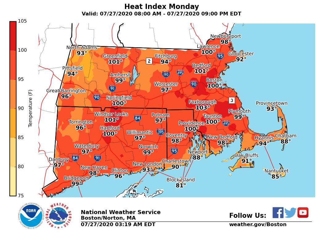
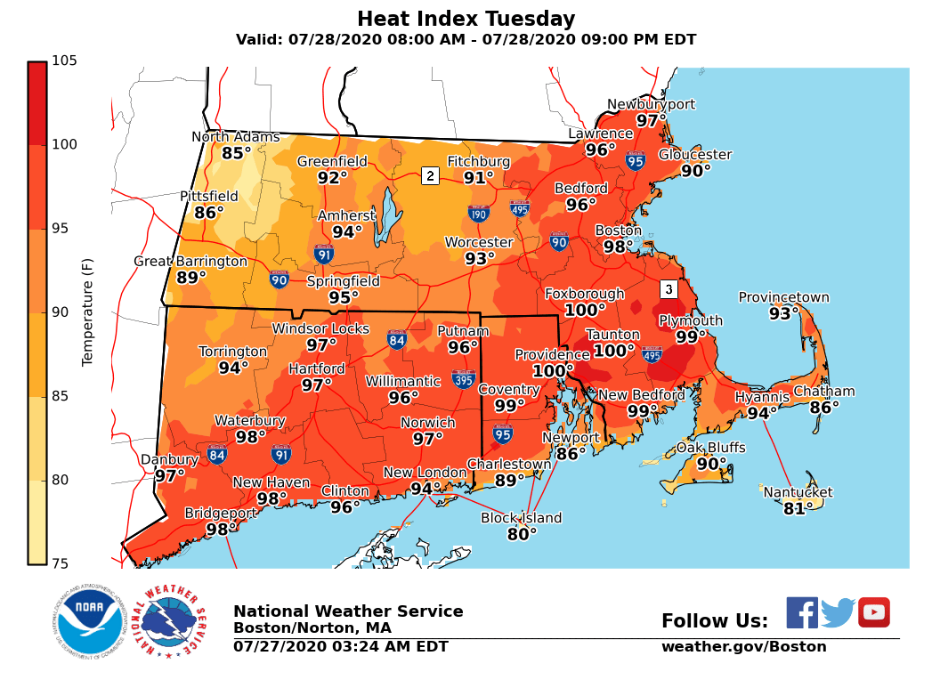
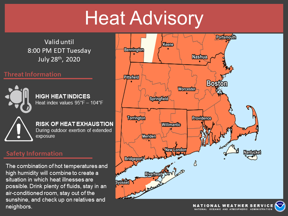
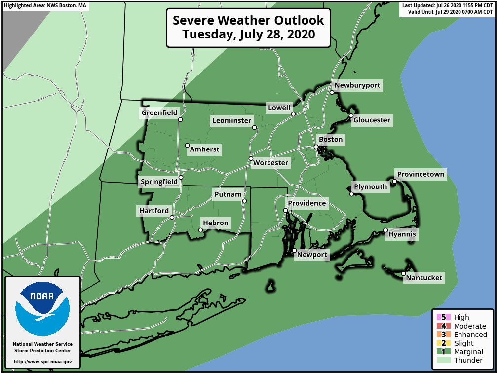
Good morning, Here are the details on the dangerous heat impacting the region today and Tuesday. In addition, isolated severe storms are possible on Tuesday. *What: *Heat Advisory for heat indices of 95 to 104 *Where & When:* - Today - All of southern New England except for Nantucket, Dukes counties along with Block Island - Tuesday - All of southern New England except for the Berkshire, Franklin, western Hampshire, western Hampden, Nantucket and Dukes counties along with Block Island The heat will be exacerbated by the duration of this event with record highs possible today and Tuesday. In addition, record breaking warmth is possible tonight when minimum temperatures may only fall to 75 to 80 degrees in the urban centers including Boston and Hartford. Isolated strong to severe storms are possible across southern New England on Tuesday as a cold front slides in. The main threats with any stronger storms are strong winds and locally heavy downpours. Attached are four graphics, the heat headlines for Today, the heat indices for Today, the heat indices for Tuesday and the severe weather outlook for Tuesday. Frank Nocera & Bryce Williams If you have any questions or would like more information, don't hesitate to contact us via this email address, on NWSChat <https://nwschat.weather.gov/>, or at the following: National Weather Service Boston/Norton, MA 46 Commerce Way Norton, MA 02766 508.622.3280 Website <http://www.weather.gov/boston> | Facebook <http://www.facebook.com/NWSBoston> | Twitter <http://www.twitter.com/NWSBoston>
participants (1)
-
 BOX Operations - NOAA Service Account