NWS Boston Emergency Management Briefing [9/21 AM] - Significant Marine Event Tue

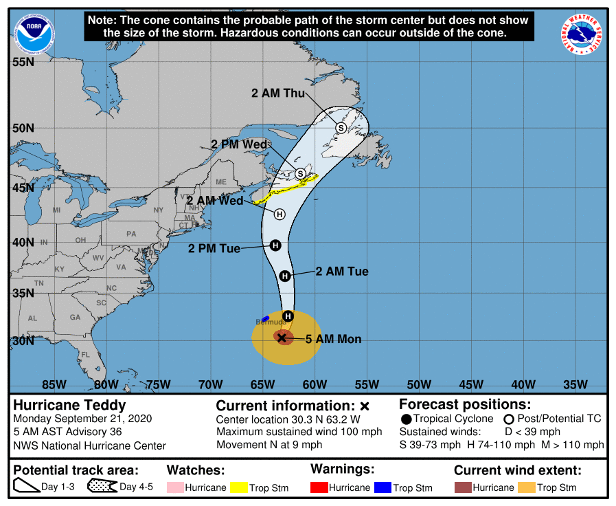
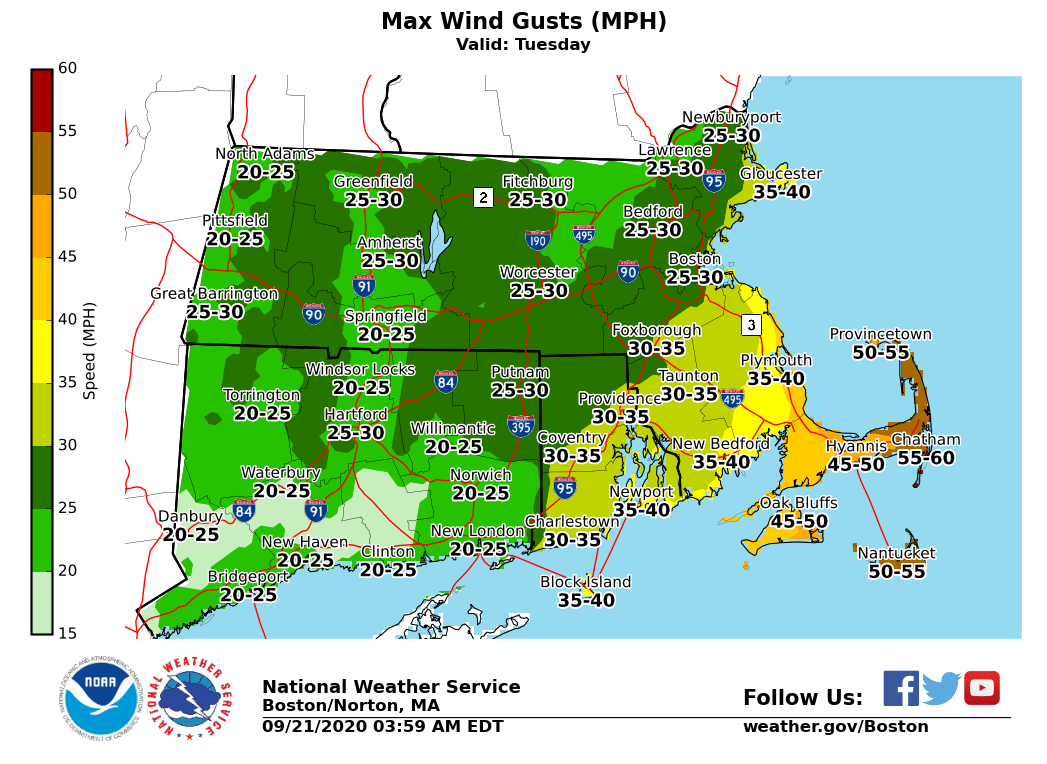
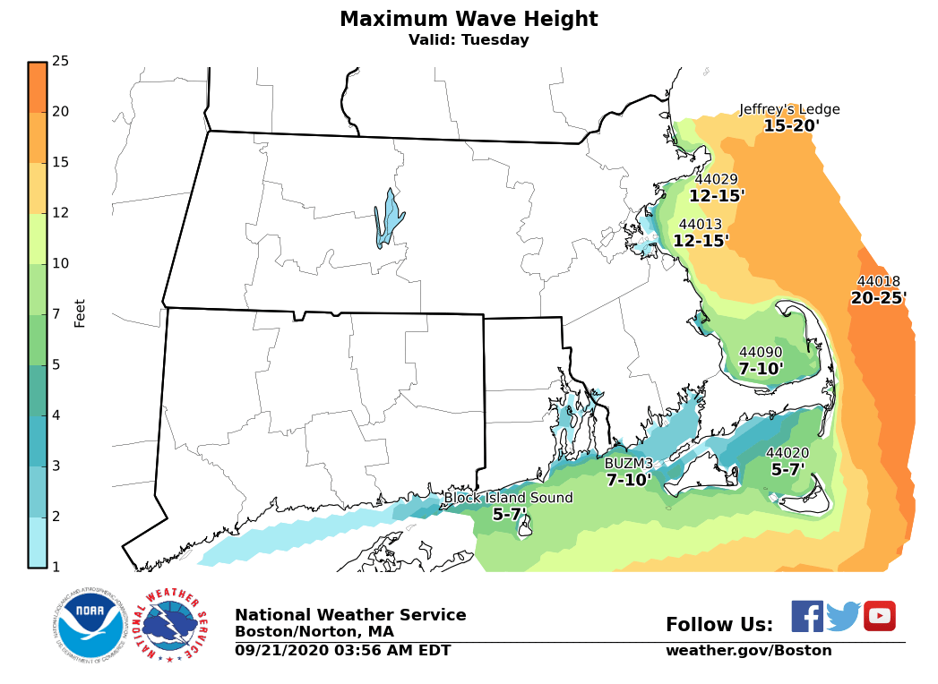
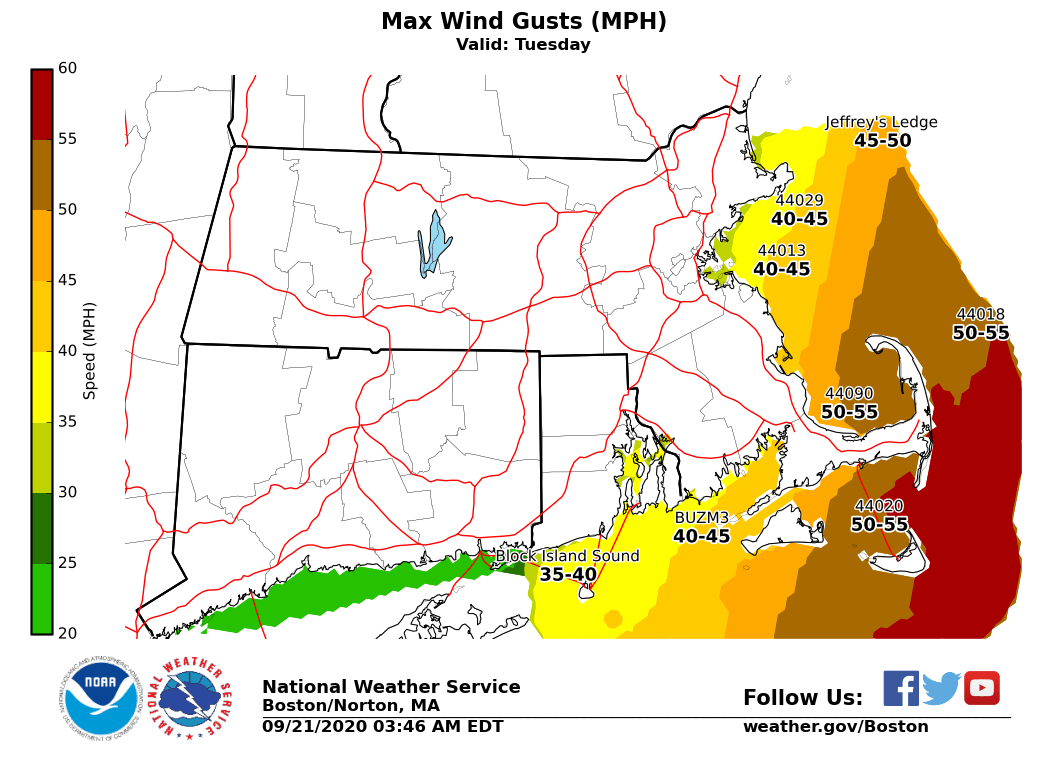
Good morning everyone Still expecting Hurricane Teddy to pass approximately 400 miles east of the Massachusetts coastline Tuesday. The main impact will be for our Marine community. We have high confidence in dangerously high seas of 15 and 25 feet developing across the ocean waters east of Cape Cod and Nantucket, as northerly wind gusts to 40 to 50 knots. Pockets of minor coastal flooding & beach erosion appear likely during the Tuesday afternoon high tide cycle along the eastern MA coast and particularly across the north facing sides of Cape Cod and Nantucket. While some typically vulnerable shoreline roads may become flooded within a few hours of the high tide, significant coastal flooding is not expected. High surf & dangerous rip currents are expected on ocean exposed beaches. In addition, given the large surf, viewing the large waves or fishing from jetties and/or piers can be very dangerous and is strongly discouraged. Northerly wind gusts of 40 to 50 mph are likely across Cape Cod and Nantucket Tuesday, thus a Wind Advisory has been posted. No rain is expected from Hurricane Teddy in southern New England. We have attached the expected track of Hurricane Teddy along with our current wave height and wind gust forecasts. Frank Nocera & Hayden Frank Please let us know if you have any questions. Thank you. If you have any questions or would like more information, don't hesitate to contact us via this email address, on NWSChat <https://nwschat.weather.gov/>, or at the following: National Weather Service Boston/Norton, MA 46 Commerce Way Norton, MA 02766 508.622.3280 Website <http://www.weather.gov/boston> | Facebook <http://www.facebook.com/NWSBoston> | Twitter <http://www.twitter.com/NWSBoston>
participants (1)
-
 BOX Operations - NOAA Service Account