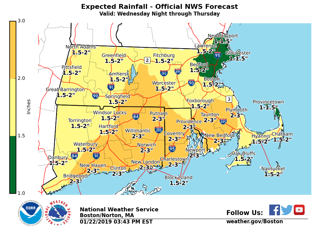
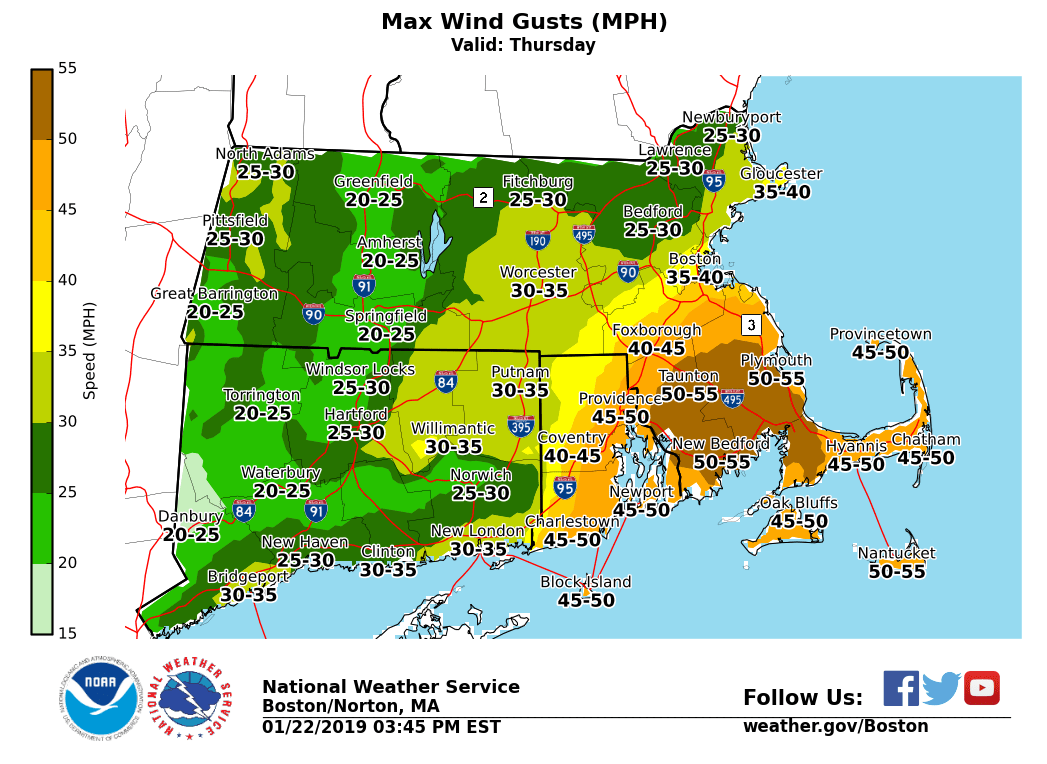
[2019.1.22 PM NWS Briefing] Heavy Rainfall and Strong Wind Potential: Late Wed night/Thu

Good afternoon everyone, We continue to monitor the risk for heavy rain and possible flooding as well as strong winds for late Wednesday night into Thursday. In addition, there is a risk for a bit of sleet or freezing rain Wednesday afternoon over the higher elevations. *What / Where / When ...* - Risk for Light Icing with Sleet or Freezing rain - Main risk over the Berkshires and northern Worcester Hills Wednesday afternoon. - Temperatures should be above freezing but very cold ground temperatures may lead to some light icing and slippery travel on untreated surfaces - Winter Weather Advisory in effect for Berkshire County - Heavy Rainfall and Possible Flooding - Greatest risk across eastern Connecticut, Rhode Island and southeast Massachusetts for late Wednesday night into Thursday - Rainfall of 1-2 inches across southern New England with locally up to 3 inches for eastern CT, RI and SE Massachusetts - Areas of urban and poor drainage flooding possible, as well as some river flooding - Rivers at risk for minor flooding include: - Farmington River at Simsbury, CT - Pawcatuck River at Westerly and Wood River Junction, RI - Wood River at Hope Valley, RI - Taunton River at Bridgewater, MA - Strong Winds - Greatest risk across Rhode Island and SE Massachusetts, including the Cape and Islands, late morning into the afternoon on Thursday - Wind gusts 50-55 mph possible with tree damage and isolated power outages possible If you have any questions or would like more information, don't hesitate to contact us via this email address, on NWSChat <https://nwschat.weather.gov/>, or at the following: National Weather Service Boston/Norton, MA 46 Commerce Way Norton, MA 02766 508.622.3280 Website <http://www.weather.gov/boston> | Facebook <http://www.facebook.com/NWSBoston> | Twitter <http://www.twitter.com/NWSBoston>
participants (1)
-
 BOX Operations - NOAA Service Account