NWS Boston EM Briefing: Light Snow and Strong Winds Late Tonight/Friday Morning

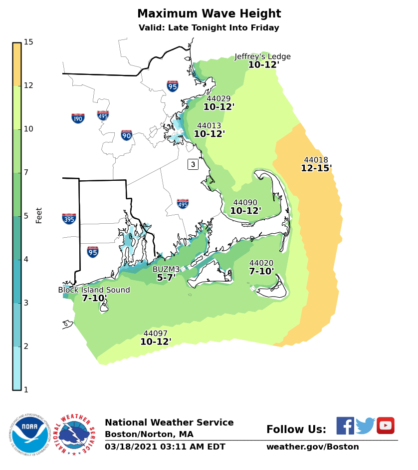
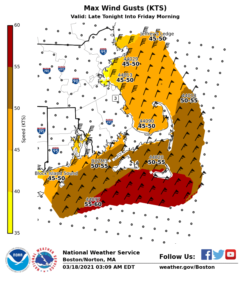
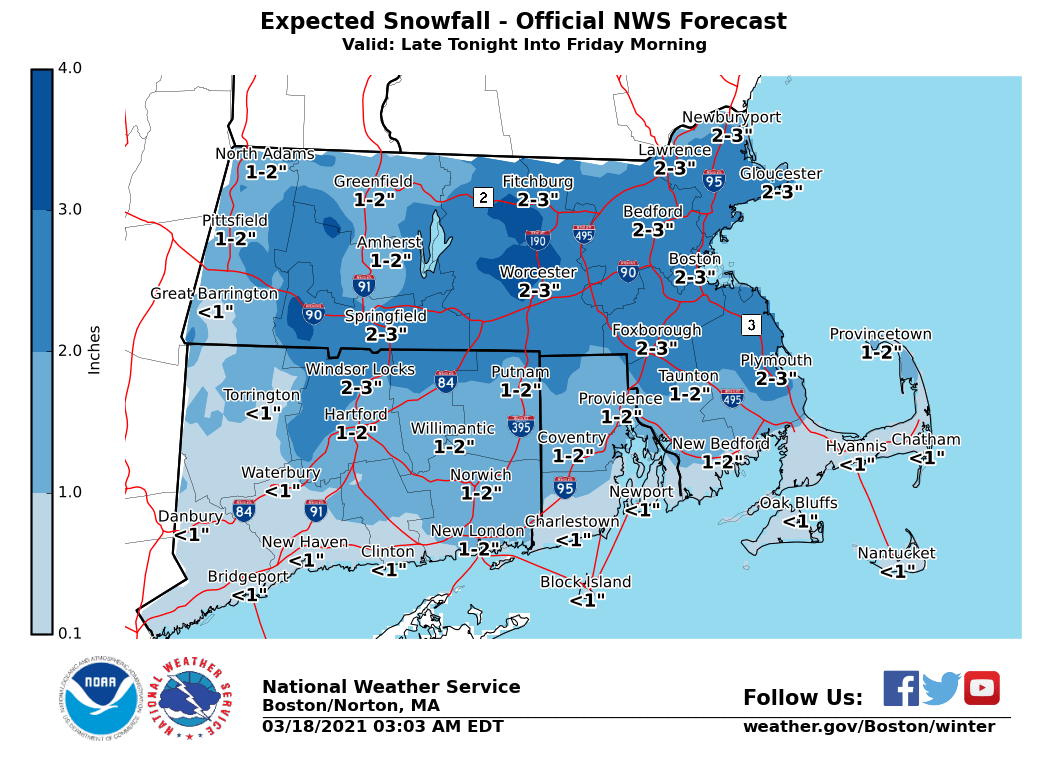
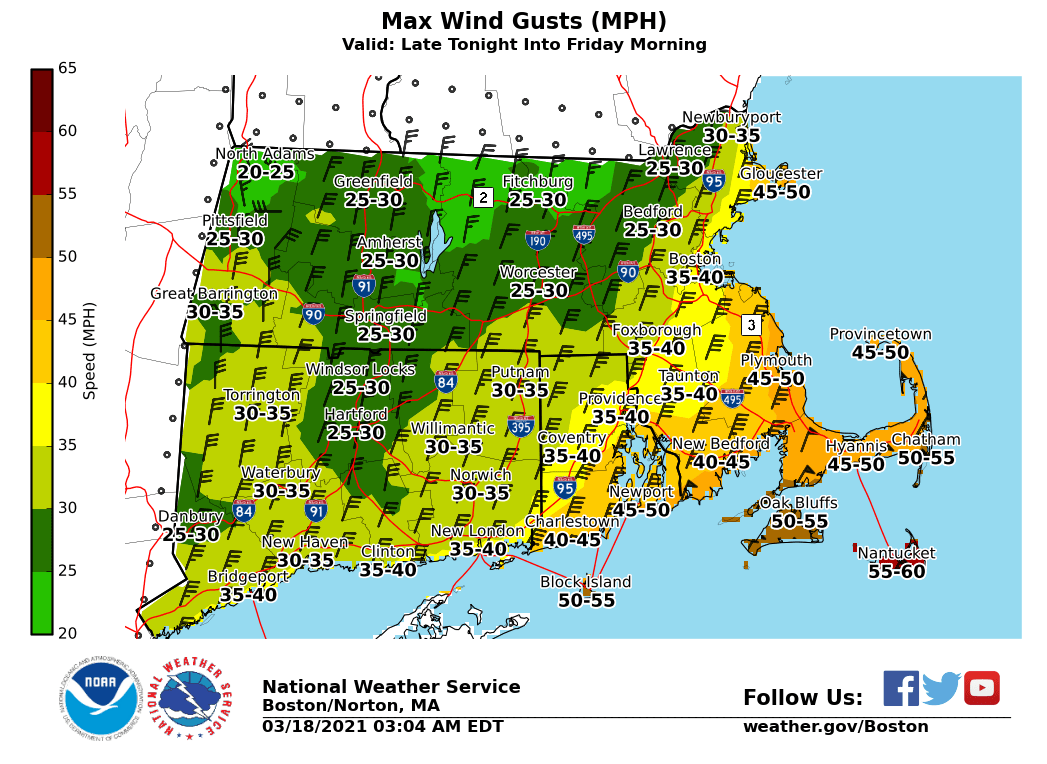
Good Morning, Please see the attached one-page briefing and images which provide information on rain changing to snow and strong winds later tonight into Friday morning. We have not made significant changes since the last briefing, but did increase wind gusts near Nantucket and the adjacent coastal waters, where northeast winds should gust to 60 MPH at times. As a result, a High Wind Warning has been issued for Nantucket and Storm Warnings have been issued for the adjacent coastal waters. Regarding snowfall, we still anticipate totals of 1-3 inches overnight. There is a low risk of one or two places in Massachusetts receiving 4-5 inches, primarily in the Worcester Hills. The snow will be wet in consistency (snow to liquid ratio of around 7:1). Thanks, Kevin Cadima and Joe DelliCarpini If you have any questions or would like more information, don't hesitate to contact us via this email address, on NWSChat <https://nwschat.weather.gov/>, or at the following: National Weather Service Boston/Norton, MA 46 Commerce Way Norton, MA 02766 508.622.3280 Website <http://www.weather.gov/boston> | Facebook <http://www.facebook.com/NWSBoston> | Twitter <http://www.twitter.com/NWSBoston>
participants (1)
-
 BOX Operations - NOAA Service Account