[2019.02.23] Wintry Weather Late Tonight & Sunday Morning, then Damaging winds Monday

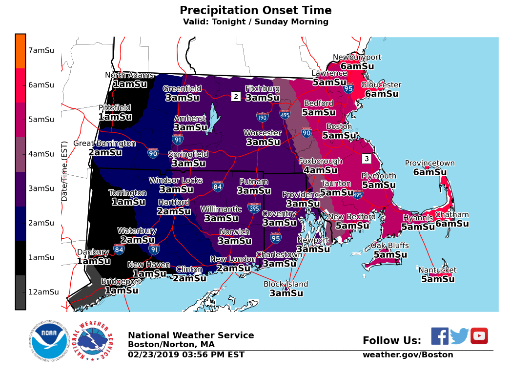
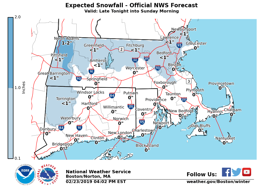
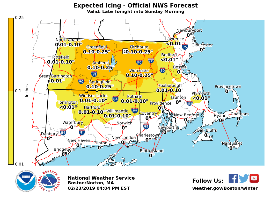
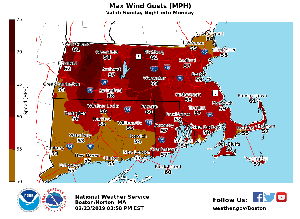
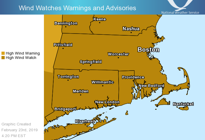
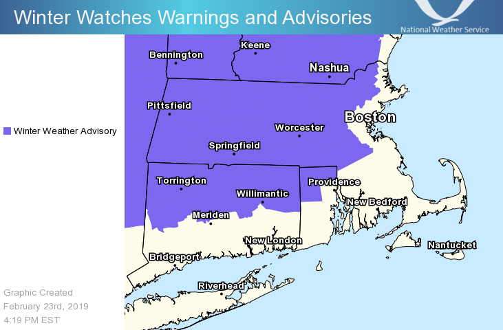
Good afternoon everyone, Wintry weather is expected Saturday night into Sunday, followed by damaging winds Sunday night through Monday night. Details below. *Headlines Changes ... * - *WINTER WEATHER ADVISORY* - Expanded into all of northern CT and northwest RI late tonight & early Sunday - *HIGH WIND WATCH* - Expanded across all of MA, RI & CT for Sunday night into Monday - *STORM WARNING* - All other waters beginning Sunday night into Monday *Winter Weather ...* - *What:* Brief light snow / sleet quickly changes to freezing rain across the interior before changing over to rain; sleet to rain along the coast. Ice accretion of a trace up to two tenths; highest over the Berkshires, Worcester Hills, and Pioneer Valley. - *When:* Beginning after midnight for Hartford / Springfield; 3 am to 5 am Providence/Boston. Changing to rain by mid morning Sunday. - *Impacts:* Low impact given marginal temperatures. Snow / ice covered roadways linger into Sunday morning. *Winds ...* - *What:* Strong to damaging winds are forecast. Wind gusts 55 to 65 mph; potential for gusts as strong as 70 mph. - *When:* Beginning Sunday night, peaking Monday afternoon, gradually diminishing through Tuesday. - *Impacts:* Downed tree limbs / trees as well as power lines. Scattered power outages and blocked roads likely due to tree / power line debris. Meteorologists: Frank Nocera & Matthew Doody If you have any questions or would like more information, don't hesitate to contact us via this email address, on NWSChat <https://nwschat.weather.gov/>, or at the following: National Weather Service Boston/Norton, MA 46 Commerce Way Norton, MA 02766 508.622.3280 Website <http://www.weather.gov/boston> | Facebook <http://www.facebook.com/NWSBoston> | Twitter <http://www.twitter.com/NWSBoston>
participants (1)
-
 BOX Operations - NOAA Service Account