NWS Boston EM Briefing: Wintry Weather Saturday and Saturday Night

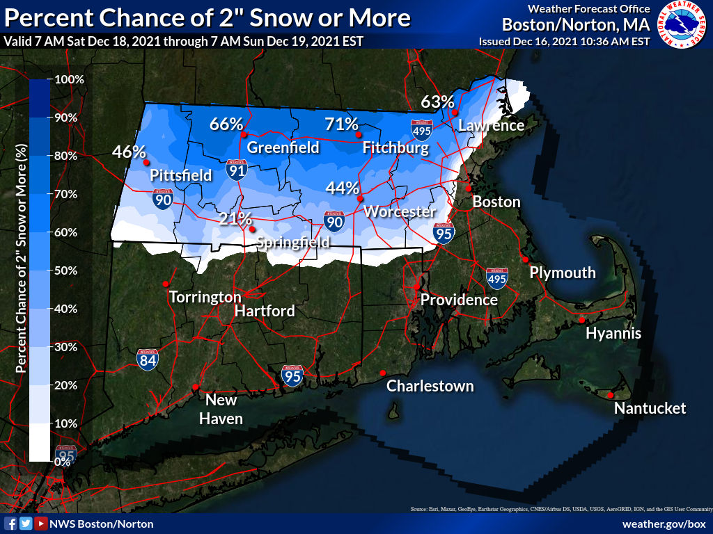
Good Afternoon Everyone, Attached is the latest briefing on the potential for wintry weather Saturday and Saturday night. We are becoming more confident that this will be a minor event with mostly travel impacts. The current expectation is that Winter Weather Advisories could be issued sometime tomorrow. Since there is uncertainty as to how quickly the transition from snow to a wintry mix and eventually rain will occur, which will affect snowfall totals, we attached a map showing the probability of 2 inches or more of snow. Note that it is highest near the Vermont/New Hampshire border where we think as much as 4 inches of snow is possible. Also keep in mind much of the interior could see a light coating of ice during the transition (less than 0.10"). Our Winter Weather page <https://www.weather.gov/box/winter> contains the latest snow and ice forecasts, including probabilistic information. If you have any questions or would like more information, don't hesitate to contact us via this email address, on NWSChat <https://nwschat.weather.gov/>, or at the following: Thanks, Joe DelliCarpini and Andrew Loconto National Weather Service Boston/Norton, MA 46 Commerce Way Norton, MA 02766 508.622.3280 Website <http://www.weather.gov/boston> | Facebook <http://www.facebook.com/NWSBoston> | Twitter <http://www.twitter.com/NWSBoston>
participants (1)
-
 BOX Operations - NOAA Service Account