[01.18.2023 PM] NWS Boston EM Briefing: Snow/Icing Thursday PM into Friday

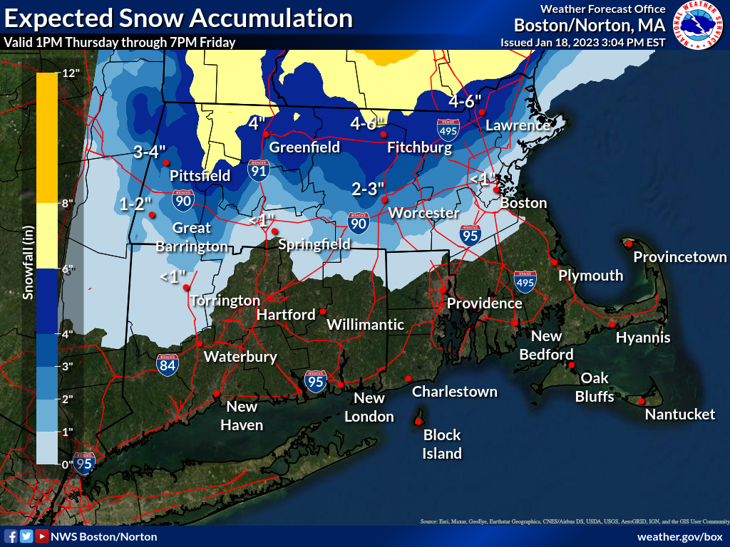
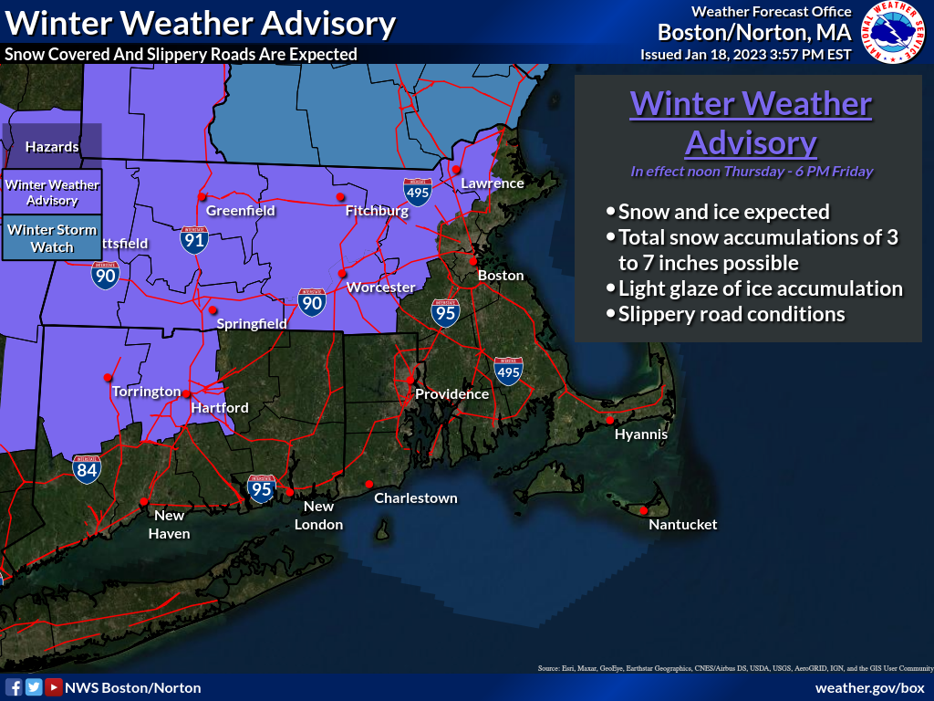
Good afternoon, Attached is an updated one page briefing regarding winter weather that will impact southern New England tomorrow afternoon through Friday. A few changes from our last briefing are listed below. - Winter weather advisory is in effect from noon Thursday through 6 PM Friday for most of north and western southern New England. (See advisory graphic for specific areas). - Snowfall accumulation forecast has been increased slightly, especially along and north of the Route 2 corridor. - We're now monitoring the potential for minor coastal flooding along the east coast during the Friday and Saturday morning high tides. (Boston Harbor forecast uncertainty attached) More details can be found in the attached one pager and supporting graphics. Thank you and have a great afternoon, -Rob Megnia and Kevin Cadima If you have any questions or would like more information, don't hesitate to contact us via this email address, on NWSChat <https://nwschat.weather.gov/>, or at the following: National Weather Service Boston/Norton, MA 46 Commerce Way Norton, MA 02766 508.622.3280 Website <http://www.weather.gov/boston> | Facebook <http://www.facebook.com/NWSBoston> | Twitter <http://www.twitter.com/NWSBoston>
participants (1)
-
 BOX Operations - NOAA Service Account