[2022.04.17 PM] NWS Boston EM Briefing: Strong Storm to Bring Multiple Weather Hazards Monday Night into Tuesday Morning

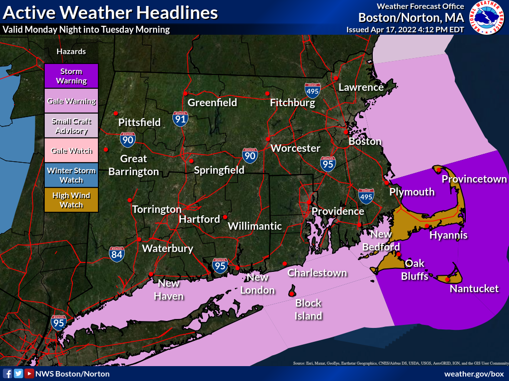
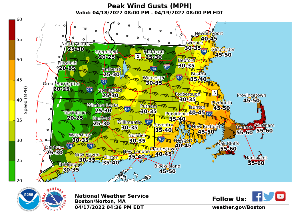
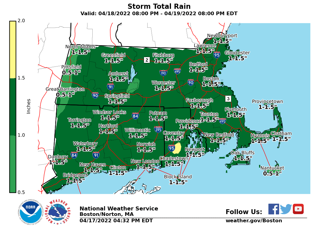
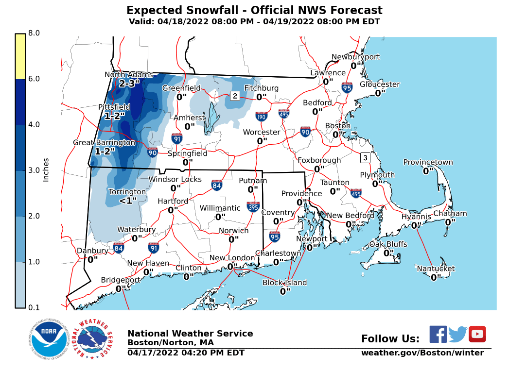
Good afternoon, Attached is an initial briefing and supporting graphics regarding a storm system expected to bring strong to damaging winds, splashover to minor coastal flooding, accumulating snow in the Berkshires, and a period of heavy rain Monday night into Tuesday morning. A *High Wind Watch *is in effect for Barnstable, Dukes and Nantucket Counties in MA from late Monday night into Tuesday morning. The storm's eventual track is still uncertain, and further adjustments to the snow forecast are still possible depending on the track. Regarding coastal flooding: east-southeast wind on Tuesday morning's high tide (1:26 AM) would favor Boston Harbor and the North Shore as the areas most at risk. A 2 ft storm surge is currently expected after this high tide, supporting minor splashover or minor coastal flooding. A greater coastal flooding risk is possible if the peak surge occurs closer to the time of high tide (e.g. sooner than currently anticipated). Supporting graphics attached include: a map of active headlines, expected peak wind gusts, and forecast storm total rain and snow accumulations. Expect the next update to this briefing by 6 AM Monday. Thank You! Meteorologists: Andrew Loconto and Kevin Cadima If you have any questions or would like more information, don't hesitate to contact us via this email address, on NWSChat <https://nwschat.weather.gov/>, or at the following: National Weather Service Boston/Norton, MA 46 Commerce Way Norton, MA 02766 508.622.3280 Website <http://www.weather.gov/boston> | Facebook <http://www.facebook.com/NWSBoston> | Twitter <http://www.twitter.com/NWSBoston>
participants (1)
-
 BOX Operations - NOAA Service Account